 |
|
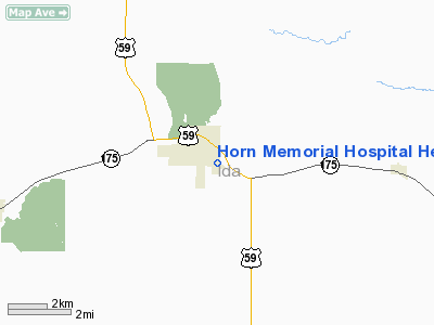
Horn Memorial Hospital Heliport |
Location & QuickFacts
|
FAA Information Effective: |
2007-07-05 |
|
Airport Identifier: |
IA37 |
|
Airport Status: |
Operational |
|
Longitude/Latitude: |
095-27-35.9980W/42-20-19.9530N
-95.459999/42.338876 (Estimated) |
|
Elevation: |
1325 ft / 403.86 m (Estimated) |
|
Land: |
0 acres |
|
From nearest city: |
0 nautical miles N of Ida Grove, IA |
|
Location: |
Ida County, IA |
|
Magnetic Variation: |
05E (1990) |
Owner & Manager
|
Ownership: |
Privately owned |
|
Owner: |
Horn Memorial Hospital |
|
Address: |
701 E 2nd St
Ida Grove, IA 51445 |
|
Phone
number: |
712-364-3311 |
|
Manager: |
Dan Ellis |
|
Address: |
701 E 2nd St
Ida Grove, IA 51445 |
|
Phone number: |
712-364-3311 |
Airport Operations and Facilities
|
Airport
Use: |
Private
MEDICAL USE. |
|
Wind
indicator: |
Yes |
|
Segmented Circle: |
No |
|
Control
Tower: |
No |
|
Sectional chart: |
Omaha |
|
Region: |
ACE - Central |
|
Boundary
ARTCC: |
ZMP - Minneapolis |
|
Tie-in
FSS: |
FOD - Fort Dodge |
|
FSS on
Airport: |
No |
|
FSS
Phone: |
515-955-8114 |
|
FSS Toll
Free: |
1-800-WX-BRIEF |
|
Runway Information
Helipad H1
|
Dimension: |
40 x 40 ft / 12.2 x 12.2 m |
|
Surface: |
CONC, |
|
|
Runway H1
|
Runway
|
|
Traffic
Pattern: |
Left |
Left |
|
Radio Navigation Aids
|
ID |
Type |
Name |
Ch |
Freq |
Var |
Dist |
|
MEY |
NDB |
Mapleton |
|
335.00 |
05E |
17.7 nm |
|
SLB |
NDB |
Storm Lake |
|
434.00 |
04E |
18.4 nm |
|
SKI |
NDB |
Sac City |
|
356.00 |
04E |
21.4 nm |
|
DNS |
NDB |
Denison |
|
350.00 |
04E |
21.6 nm |
|
CKP |
NDB |
Pilot Rock |
|
423.00 |
05E |
24.0 nm |
|
CIN |
NDB |
Carroll |
|
397.00 |
04E |
34.9 nm |
|
SU |
NDB |
Salix |
|
414.00 |
07E |
36.9 nm |
|
GAK |
NDB |
Sioux Gateway |
|
233.00 |
06E |
41.3 nm |
|
POH |
NDB |
Pocahontas |
|
428.00 |
06E |
43.5 nm |
|
OI |
NDB |
Tommi |
|
305.00 |
07E |
45.1 nm |
|
HNR |
NDB |
Harlan |
|
272.00 |
05E |
46.0 nm |
|
ADU |
NDB |
Audubon |
|
266.00 |
04E |
46.1 nm |
|
ORC |
NDB |
Orange City |
|
521.00 |
05E |
47.4 nm |
|
LTU |
NDB |
Little Sioux |
|
326.00 |
05E |
49.5 nm |
|
TQE |
VOR |
Tekamah |
|
108.40 |
07E |
47.3 nm |
|
SUX |
VORTAC |
Sioux City |
112X |
116.50 |
09E |
38.4 nm |
Remarks
-
OWNER DESIRES
ARPT NOT BE CHARTED.
-
PRVDD APCH/DEP
PATHS 8:1 GLIDE SLOPE; TRANSITIONAL SFC FOR A 2:1 SLOPE; THE TREE 050 DEG FROM
CENTER OF PAD BE REMOVED; & WIRES SOUTHWEST & WEST BE MKD; POLES SOUTHWEST &
WEST BE LGTD PRIOR TO ACTIVATION.
Horn Memorial Hospital Heliport
Address:
Ida County, IA
Tel:
712-364-3311
Images
and information placed above are from
http://www.airport-data.com/airport/IA37/
We
thank them for the data!
|
General Info |
| Country |
United
States |
| State |
IOWA
|
| FAA ID |
IA37
|
| Latitude |
42-20-19.953N |
|
Longitude |
095-27-35.998W |
|
Elevation |
1325
feet |
| Near
City |
IDA
GROVE |
We don't guarantee the information is fresh and accurate. The data may
be wrong or outdated.
For more up-to-date information please refer to other sources.
|
|


