 |
|
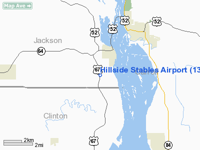
Location &
QuickFacts
|
FAA
Information Effective: |
2007-07-05 |
|
Airport
Identifier: |
13IA |
|
Airport
Status: |
Operational |
|
Longitude/Latitude: |
090-11-27.9617W/42-02-44.5880N
-90.191100/42.045719 (Estimated) |
|
Elevation: |
760 ft / 231.65 m (Estimated) |
|
Land: |
0 acres |
|
From
nearest city: |
2 nautical miles SW of Sabula, IA |
|
Location: |
Jackson County, IA |
|
Magnetic Variation: |
00E (1995) |
Owner & Manager
|
Ownership: |
Privately owned |
|
Owner: |
Volker & Carol Nass |
|
Address: |
1412 Hwy 67
Sabula, IA 52070 |
|
Phone number: |
319-687-2479 |
|
Manager: |
Volker & Carol Nass |
|
Address: |
1412 Hwy 67
Sabula, IA 52070 |
|
Phone number: |
319-687-2479 |
Airport
Operations and Facilities
|
Airport
Use: |
Private |
|
Segmented Circle: |
No |
|
Control
Tower: |
No |
|
Sectional chart: |
Chicago |
|
Region: |
ACE - Central |
|
Boundary
ARTCC: |
ZAU - Chicago |
|
Tie-in
FSS: |
FOD - Fort Dodge |
|
FSS
Phone: |
515-955-8114 |
|
FSS Toll
Free: |
1-800-WX-BRIEF |
|
Runway Information
Runway 09/27
|
Dimension: |
850 x 60 ft / 259.1 x 18.3 m |
|
Surface: |
TURF, |
|
|
Runway 09
|
Runway 27
|
|
Traffic
Pattern: |
Left |
Left |
|
Radio Navigation Aids
|
ID |
Type |
Name |
Ch |
Freq |
Var |
Dist |
|
CWI |
NDB |
Clinton |
|
377.00 |
01E |
14.4 nm |
|
OQW |
NDB |
Maquoketa |
|
386.00 |
02E |
24.5 nm |
|
BOZ |
NDB |
Whiteside |
|
254.00 |
01E |
27.1 nm |
|
FEP |
NDB |
Freeport |
|
335.00 |
00E |
29.5 nm |
|
PVB |
NDB |
Platteville |
|
203.00 |
01E |
40.1 nm |
|
MXO |
NDB |
Monticello |
|
397.00 |
01E |
43.2 nm |
|
PLL |
VOR/DME |
Polo |
049X |
111.20 |
03E |
30.2 nm |
|
RFD |
VOR/DME |
Rockford |
045X |
110.80 |
01E |
45.5 nm |
|
CVA |
VORTAC |
Davenport |
085X |
113.80 |
04E |
24.1 nm |
|
DBQ |
VORTAC |
Dubuque |
105X |
115.80 |
04E |
31.4 nm |
|
MZV |
VORTAC |
Moline |
091X |
114.40 |
05E |
48.0 nm |
|
DVN |
VOT |
Davenport Municipal |
|
111.80 |
|
31.5 nm |
Remarks
-
PRVDD A CLEAR
APCH TO EA RY FOR A 20:1 GLIDE SLOPE AND A CLEAR TRANSITIONAL SFC FOR A 7:1
SLOPE.
Based
Aircraft
|
Aircraft based
on field: |
1 |
|
Single Engine
Airplanes: |
1 |
Hillside Stables Airport
Address:
Jackson County, IA
Tel:
319-687-2479
Images
and information placed above are from
http://www.airport-data.com/airport/13IA/
We
thank them for the data!
|
General Info |
| Country |
United
States |
| State |
IOWA
|
| FAA ID |
13IA
|
| Latitude |
42-02-44.588N |
|
Longitude |
090-11-27.962W |
|
Elevation |
760 feet
|
| Near
City |
SABULA
|
We don't guarantee the information is fresh and accurate. The data may
be wrong or outdated.
For more up-to-date information please refer to other sources.
|
|


