 |
|
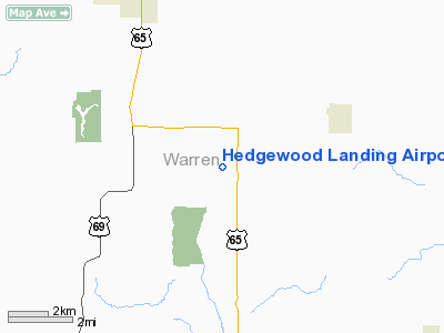
Hedgewood Landing Airport |
Location &
QuickFacts
|
FAA
Information Effective: |
2007-07-05 |
|
Airport
Identifier: |
IA86 |
|
Airport
Status: |
Operational |
|
Longitude/Latitude: |
093-30-33.7700W/41-15-59.9810N
-93.509381/41.266661 (Estimated) |
|
Elevation: |
990 ft / 301.75 m (Estimated) |
|
Land: |
0 acres |
|
From
nearest city: |
5 nautical miles SE of Indianola, IA |
|
Location: |
Warren County, IA |
|
Magnetic Variation: |
03E (1995) |
Owner & Manager
|
Ownership: |
Privately owned |
|
Owner: |
John Michael Sereg |
|
Address: |
1674 140 Th Ave
Indianola Ia50125 |
|
Phone number: |
515-961-4987 |
|
Manager: |
John Michael Sereg |
|
Address: |
1674 140 Th Ave
Indianola, IA 50125 |
|
Phone number: |
515-961-4987 |
Airport
Operations and Facilities
|
Airport
Use: |
Private |
|
Segmented Circle: |
No |
|
Control
Tower: |
No |
|
Sectional chart: |
Omaha |
|
Region: |
ACE - Central |
|
Boundary
ARTCC: |
ZAU - Chicago |
|
Tie-in
FSS: |
FOD - Fort Dodge |
|
FSS on
Airport: |
No |
|
FSS
Phone: |
515-955-8114 |
|
FSS Toll
Free: |
1-800-WX-BRIEF |
|
Runway Information
Runway 10/28
|
Dimension: |
2000 x 60 ft / 609.6 x 18.3 m |
|
Surface: |
TURF, |
|
|
Runway 10
|
Runway 28
|
|
Traffic
Pattern: |
Left |
Left |
|
Obstruction: |
|
50 ft bldg, 50.0 ft from runway |
|
Radio Navigation Aids
|
ID |
Type |
Name |
Ch |
Freq |
Var |
Dist |
|
CNC |
NDB |
Chariton |
|
335.00 |
05E |
16.4 nm |
|
OXV |
NDB |
Knoxville |
|
284.00 |
03E |
17.9 nm |
|
IKV |
NDB |
Ankeny |
|
275.00 |
03E |
26.1 nm |
|
PEA |
NDB |
Pella |
|
257.00 |
02E |
26.9 nm |
|
UNE |
NDB |
Union County |
|
379.00 |
04E |
42.3 nm |
|
GFZ |
NDB |
Greenfield |
|
338.00 |
04E |
42.4 nm |
|
GGI |
NDB |
Grinnell |
|
248.00 |
02E |
44.1 nm |
|
TVK |
NDB |
Centerville |
|
290.00 |
04E |
44.5 nm |
|
PRO |
NDB |
Perry |
|
251.00 |
06E |
44.8 nm |
|
OOA |
NDB |
Oskaloosa |
|
414.00 |
03E |
46.3 nm |
|
GCT |
NDB |
Guthrie Center |
|
518.00 |
05E |
48.5 nm |
|
BNW |
NDB |
Boone |
|
407.00 |
03E |
49.8 nm |
|
TNU |
VOR/DME |
Newton |
072X |
112.50 |
03E |
35.9 nm |
|
DSM |
VORTAC |
Des Moines |
122X |
117.50 |
07E |
12.0 nm |
|
LMN |
VORTAC |
Lamoni |
114X |
116.70 |
07E |
45.3 nm |
|
DSM |
VOT |
Des Moines |
|
109.20 |
|
18.0 nm |
Remarks
-
OWNER DESIRES
ARPT NOT BE CHARTED.
-
PRVDD ACFT REMAIN
S OF RY 10/28; MAINTAIN CLEAR APCH EA RY FOR A 20:1 GS & MAINTAIN CLEAR
TRANSITIONAL SFC FOR A 7:1 SLOPE.
Based
Aircraft
|
Aircraft based
on field: |
1 |
|
Single Engine
Airplanes: |
1 |
Hedgewood Landing Airport
Address:
Warren County, IA
Tel:
515-961-4987
Images
and information placed above are from
http://www.airport-data.com/airport/IA86/
We
thank them for the data!
|
General Info |
| Country |
United
States |
| State |
IOWA
|
| FAA ID |
IA86
|
| Latitude |
41-15-59.981N |
|
Longitude |
093-30-33.770W |
|
Elevation |
990 feet
|
| Near
City |
INDIANOLA |
We don't guarantee the information is fresh and accurate. The data may
be wrong or outdated.
For more up-to-date information please refer to other sources.
|
|


