 |
|
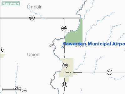
Hawarden Municipal Airport |
|
|
Location &
QuickFacts
|
FAA
Information Effective: |
2007-07-05 |
|
Airport
Identifier: |
2Y2 |
|
Airport
Status: |
Operational |
|
Longitude/Latitude: |
096-29-35.1150W/43-02-12.9540N
-96.493088/43.036932 (Estimated) |
|
Elevation: |
1190 ft / 362.71 m (Estimated) |
|
Land: |
69 acres |
|
From
nearest city: |
2 nautical miles N of Hawarden, IA |
|
Location: |
Sioux County, IA |
|
Magnetic Variation: |
06E (1985) |
Owner & Manager
|
Ownership: |
Publicly owned |
|
Owner: |
City Of Hawarden |
|
Address: |
1150 Central Avenue
Hawarden, IA 51023 |
|
Phone number: |
712-551-2565 |
|
Manager: |
Chris Myres |
|
Address: |
1150 Central Avenue
Hawarden, IA 51023 |
|
Phone number: |
712-551-2565 |
Airport
Operations and Facilities
|
Airport
Use: |
Open to public |
|
Wind
indicator: |
Yes |
|
Segmented Circle: |
No |
|
Control
Tower: |
No |
|
Lighting
Schedule: |
RDO-CTL
ACTVT MIRL RY 16/34 - 122.8. |
|
Landing
fee charge: |
No |
|
Sectional chart: |
Omaha |
|
Region: |
ACE - Central |
|
Boundary
ARTCC: |
ZMP - Minneapolis |
|
Tie-in
FSS: |
FOD - Fort Dodge |
|
FSS on
Airport: |
No |
|
FSS
Phone: |
515-955-8114 |
|
FSS Toll
Free: |
1-800-WX-BRIEF |
|
NOTAMs
Facility: |
FOD (NOTAM-d service avaliable) |
Airport Communications
Airport Services
|
Airframe
Repair: |
NONE |
|
Power
Plant Repair: |
NONE |
|
Bottled
Oxygen: |
NONE |
|
Bulk
Oxygen: |
NONE |
|
Runway Information
Runway 16/34
|
Dimension: |
2030 x 50 ft / 618.7 x 15.2 m |
|
Surface: |
CONC, Good Condition |
|
Weight Limit: |
Single wheel: 24000 lbs.
Dual wheel: 30000 lbs. |
|
Edge Lights: |
Medium |
|
|
Runway 16
|
Runway 34
|
|
Traffic
Pattern: |
Left |
Left |
|
Markings: |
Basic, Good Condition |
Basic, Good Condition |
|
Obstruction: |
9 ft road, 224.0 ft from runway, 2:1 slope to clear |
31 ft tree, 480.0 ft from runway, 95 ft right of
centerline, 9:1 slope to clear |
|
Radio Navigation Aids
|
ID |
Type |
Name |
Ch |
Freq |
Var |
Dist |
|
SOY |
NDB |
Sioux Center |
|
368.00 |
06E |
14.5 nm |
|
ORC |
NDB |
Orange City |
|
521.00 |
05E |
19.2 nm |
|
VMR |
NDB |
Vermillion |
|
375.00 |
06E |
25.5 nm |
|
SHL |
NDB |
Sheldon |
|
338.00 |
05E |
30.8 nm |
|
FS |
NDB |
Rokky |
|
245.00 |
06E |
31.2 nm |
|
OI |
NDB |
Tommi |
|
305.00 |
07E |
34.7 nm |
|
ISB |
NDB |
Sibley |
|
269.00 |
05E |
38.1 nm |
|
GAK |
NDB |
Sioux Gateway |
|
233.00 |
06E |
38.1 nm |
|
SU |
NDB |
Salix |
|
414.00 |
07E |
43.6 nm |
|
CKP |
NDB |
Pilot Rock |
|
423.00 |
05E |
45.3 nm |
|
DDL |
VOR/DME |
Sheldon |
023X |
108.60 |
05E |
30.8 nm |
|
YKN |
VOR/DME |
Yankton |
051X |
111.40 |
07E |
39.9 nm |
|
FSD |
VORTAC |
Sioux Falls |
097X |
115.00 |
09E |
38.9 nm |
|
SUX |
VORTAC |
Sioux City |
112X |
116.50 |
09E |
42.3 nm |
Remarks
-
PRVDD OLD MUNI
ARPT IS ABNDD; THE APCH TO EACH RWY IS MAINTD FOR A 20:1 GLIDE SLOPE & THE
TRSNL SFC BE MAINTD FOR A 7:1 SLOPE.
Based
Aircraft
|
Aircraft based
on field: |
5 |
|
Single Engine
Airplanes: |
5 |
Operational Statistics
Time Period:
2005-07-28 -
2006-07-27
|
Aircraft
Operations: |
38/Week |
|
General
Aviation Local: |
43.2% |
|
General
Aviation Itinerant: |
56.8% |
Hawarden Municipal Airport
Address:
Sioux County, IA
Tel:
712-551-2565
Images
and information placed above are from
http://www.airport-data.com/airport/2Y2/
We
thank them for the data!
|
General Info |
| Country |
United
States |
| State |
IOWA
|
| FAA ID |
2Y2
|
| Latitude |
43-02-12.954N |
|
Longitude |
096-29-35.115W |
|
Elevation |
1190
feet |
| Near
City |
HAWARDEN
|
We don't guarantee the information is fresh and accurate. The data may
be wrong or outdated.
For more up-to-date information please refer to other sources.
|
|


