 |
|
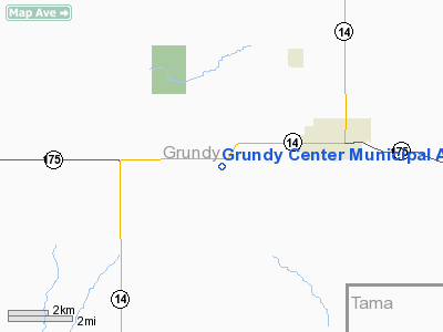
Grundy Center Municipal Airport |
|
|
Location &
QuickFacts
|
FAA
Information Effective: |
2007-07-05 |
|
Airport
Identifier: |
6K7 |
|
Airport
Status: |
Operational |
|
Longitude/Latitude: |
092-50-36.7190W/42-21-02.9390N
-92.843533/42.350816 (Estimated) |
|
Elevation: |
1075 ft / 327.66 m (Surveyed) |
|
Land: |
14 acres |
|
From
nearest city: |
3 nautical miles W of Grundy Center, IA |
|
Location: |
Grundy County, IA |
|
Magnetic Variation: |
03E (1985) |
Owner & Manager
|
Ownership: |
Publicly owned |
|
Owner: |
City Of Grundy Center |
|
Address: |
703 "f" Avenue, Suite 2
Grundy Center, IA 50638 |
|
Phone
number: |
319-825-6118 |
|
Manager: |
Jim Copeman |
|
Address: |
703 "f" Avenue, Suite 2
Grundy Center, IA 50638 |
|
Phone number: |
319-825-6118 |
Airport Operations and Facilities
|
Airport
Use: |
Open to public |
|
Wind
indicator: |
Yes |
|
Segmented Circle: |
No |
|
Control
Tower: |
No |
|
Landing
fee charge: |
No |
|
Sectional chart: |
Chicago |
|
Region: |
ACE - Central |
|
Boundary
ARTCC: |
ZAU - Chicago |
|
Tie-in
FSS: |
FOD - Fort Dodge |
|
FSS on
Airport: |
No |
|
FSS
Phone: |
515-955-8114 |
|
FSS Toll
Free: |
1-800-WX-BRIEF |
|
NOTAMs
Facility: |
FOD (NOTAM-d service avaliable) |
Airport Communications
Airport Services
|
Airframe
Repair: |
NONE |
|
Power
Plant Repair: |
NONE |
|
Bottled
Oxygen: |
NONE |
|
Bulk
Oxygen: |
NONE |
|
Runway Information
Runway 17/35
|
Dimension: |
2250 x 60 ft / 685.8 x 18.3 m |
|
Surface: |
TURF, Fair Condition |
|
|
Runway 17
|
Runway 35
|
|
Traffic
Pattern: |
Left |
Left |
|
Displaced
threshold: |
640.00 ft
DSPLCD THLD MARKED WITH THREE YELLOW CONES EACH SIDE OF RY. |
0.00 ft |
|
Obstruction: |
10 ft road, 200.0 ft from runway, 20:1 slope to clear
APCH RATIO 50:1 AT DSPLCD THLD. |
7 ft fence, 115.0 ft from runway, 16:1 slope to clear |
|
Radio Navigation Aids
|
ID |
Type |
Name |
Ch |
Freq |
Var |
Dist |
|
MIW |
NDB |
Marshalltown |
|
239.00 |
03E |
14.8 nm |
|
IFA |
NDB |
Iowa Falls |
|
368.00 |
03E |
20.2 nm |
|
HPT |
NDB |
Hampton |
|
230.00 |
03E |
28.2 nm |
|
VTI |
NDB |
Garrison |
|
338.00 |
03E |
37.4 nm |
|
TZT |
NDB |
Belle Plaine |
|
371.00 |
02E |
37.5 nm |
|
GGI |
NDB |
Grinnell |
|
248.00 |
02E |
38.9 nm |
|
IIB |
NDB |
Wapsie |
|
206.00 |
02E |
40.1 nm |
|
OLZ |
NDB |
Oelwein |
|
260.00 |
02E |
43.3 nm |
|
CCY |
NDB |
Charles City |
|
375.00 |
03E |
44.4 nm |
|
EBS |
NDB |
Webster City |
|
323.00 |
03E |
45.9 nm |
|
CAV |
NDB |
Clarion |
|
387.00 |
03E |
47.0 nm |
|
IY |
NDB |
Chukk |
|
417.00 |
03E |
47.3 nm |
|
BNW |
NDB |
Boone |
|
407.00 |
03E |
48.4 nm |
|
JWJ |
VOR/DME |
Elmwood |
031X |
109.40 |
03E |
14.7 nm |
|
TNU |
VOR/DME |
Newton |
072X |
112.50 |
03E |
36.1 nm |
|
ALO |
VORTAC |
Waterloo |
059X |
112.20 |
06E |
23.3 nm |
|
MCW |
VORTAC |
Mason City |
096X |
114.90 |
06E |
49.6 nm |
Remarks
-
ARPT CLSD WINTER MONTHS.
-
RADIO CONTROL
ACFT ON AND AROUND ARPT.
-
RY 17 +29 FT LGTD
POLE 495 T FM DSPLCD THLD 155 FT R.
Based
Aircraft
|
Aircraft based
on field: |
1 |
|
Ultralights: |
1 |
Operational Statistics
Time Period:
2005-09-12 -
2006-09-11
|
Aircraft
Operations: |
17/Month |
|
General
Aviation Local: |
40.0% |
|
General
Aviation Itinerant: |
60.0% |
Grundy Center Municipal Airport
Address:
Grundy County, IA
Tel:
319-825-6118
Images
and information placed above are from
http://www.airport-data.com/airport/6K7/
We
thank them for the data!
|
General Info |
| Country |
United
States |
| State |
IOWA
|
| FAA ID |
6K7
|
| Latitude |
42-21-02.939N |
|
Longitude |
092-50-36.719W |
|
Elevation |
1075
feet |
| Near
City |
GRUNDY
CENTER |
We don't guarantee the information is fresh and accurate. The data may
be wrong or outdated.
For more up-to-date information please refer to other sources.
|
|


