 |
|
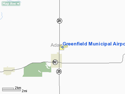
Greenfield Municipal Airport |
|
|
Location &
QuickFacts
|
FAA
Information Effective: |
2007-07-05 |
|
Airport
Identifier: |
GFZ |
|
Airport
Status: |
Operational |
|
Longitude/Latitude: |
094-26-44.6000W/41-19-37.3000N
-94.445722/41.327028 (Estimated) |
|
Elevation: |
1361 ft / 414.83 m (Surveyed) |
|
Land: |
38 acres |
|
From
nearest city: |
2 nautical miles NE of Greenfield, IA |
|
Location: |
Adair County, IA |
|
Magnetic Variation: |
04E (1995) |
Owner & Manager
|
Ownership: |
Publicly owned |
|
Owner: |
City Of Greenfield |
|
Address: |
Box 95
Greenfield, IA 50849 |
|
Phone number: |
641-743-2183 |
|
Manager: |
Chuck Campbell |
|
Address: |
Box 95
Greenfield, IA 50849 |
|
Phone number: |
641-743-6384 |
Airport
Operations and Facilities
|
Airport
Use: |
Open to public |
|
Wind
indicator: |
Yes
WIND INDICATOR LIGHTS ACTIVATED VIA 122.9. |
|
Segmented Circle: |
No |
|
Control
Tower: |
No |
|
Lighting
Schedule: |
DUSK-DAWN
ACTVT MIRL RY 14/32; VASI & REIL RYS 14 & 32 - CTAF. MIRL RY 07/25
PRESET ON LOW INTST; TO INCR INTST - CTAF. |
|
Beacon
Color: |
Clear-Green (lighted land airport) |
|
Landing
fee charge: |
No |
|
Sectional chart: |
Omaha |
|
Region: |
ACE - Central |
|
Boundary
ARTCC: |
ZMP - Minneapolis |
|
Tie-in
FSS: |
FOD - Fort Dodge |
|
FSS on
Airport: |
No |
|
FSS
Phone: |
515-955-8114 |
|
FSS Toll
Free: |
1-800-WX-BRIEF |
|
NOTAMs
Facility: |
FOD (NOTAM-d service avaliable) |
|
Federal Agreements: |
NY1 |
Airport Communications
Airport Services
|
Fuel
available: |
100LL
FOR FUEL DURING DALGT CALL (641) 743-2183; NIGHTS CALL (641) 743-2323
(POLICE DEPT). |
|
Bottled
Oxygen: |
NONE |
|
Bulk
Oxygen: |
NONE |
|
Runway Information
Runway 07/25
|
Dimension: |
3400 x 60 ft / 1036.3 x 18.3 m |
|
Surface: |
CONC, Good Condition |
|
Edge Lights: |
Medium |
|
|
Runway 07
|
Runway 25
|
|
Longitude: |
094-27-01.2000W |
094-26-17.4000W |
|
Latitude: |
41-19-34.0000N |
41-19-41.0000N |
|
Elevation: |
1358.00 ft |
1361.00 ft |
|
Alignment: |
78 |
127 |
|
Traffic
Pattern: |
Left |
Left |
|
Markings: |
Non-precision instrument, Good Condition |
Non-precision instrument, Good Condition |
|
Runway 14/32
|
Dimension: |
2500 x 50 ft / 762.0 x 15.2 m |
|
Surface: |
CONC, Good Condition |
|
Weight Limit: |
Single wheel: 7000 lbs. |
|
Edge Lights: |
Medium |
|
|
Runway 14
|
Runway 32
|
|
Longitude: |
094-27-02.0800W |
094-26-42.0500W |
|
Latitude: |
41-19-46.8280N |
41-19-27.2800N |
|
Elevation: |
1356.00 ft |
1361.00 ft |
|
Alignment: |
127 |
127 |
|
Traffic
Pattern: |
Left |
Left |
|
Markings: |
Non-precision instrument, Good Condition |
Non-precision instrument, Good Condition |
|
Crossing
Height: |
26.00 ft |
26.00 ft |
|
VASI: |
2-box on left side
VASI OTS INDEFLY. |
2-box on left side
VASI OTS INDEFLY. |
|
Visual
Glide Angle: |
3.00° |
3.00° |
|
Runway End
Identifier: |
Yes
REIL OTS INDEFLY. |
Yes
REIL OTS INDEFLY. |
|
Obstruction: |
, 50:1 slope to clear |
16 ft road, 320.0 ft from runway, 250 ft right of
centerline, 7:1 slope to clear
18' HANGAR 50' FROM RWY END AND 250' RIGHT |
|
Radio Navigation Aids
|
ID |
Type |
Name |
Ch |
Freq |
Var |
Dist |
|
GFZ |
NDB |
Greenfield |
|
338.00 |
04E |
0.1 nm |
|
GCT |
NDB |
Guthrie Center |
|
518.00 |
05E |
21.3 nm |
|
UNE |
NDB |
Union County |
|
379.00 |
04E |
22.7 nm |
|
CRZ |
NDB |
Corning |
|
278.00 |
04E |
24.4 nm |
|
AIO |
NDB |
Atlantic |
|
365.00 |
04E |
27.5 nm |
|
ADU |
NDB |
Audubon |
|
266.00 |
04E |
30.2 nm |
|
PRO |
NDB |
Perry |
|
251.00 |
06E |
32.9 nm |
|
RDK |
NDB |
Red Oak |
|
230.00 |
04E |
41.0 nm |
|
EFW |
NDB |
Jefferson |
|
391.00 |
03E |
41.5 nm |
|
HNR |
NDB |
Harlan |
|
272.00 |
05E |
43.1 nm |
|
ICL |
NDB |
Clarinda |
|
353.00 |
04E |
44.7 nm |
|
IKV |
NDB |
Ankeny |
|
275.00 |
03E |
45.6 nm |
|
CIN |
NDB |
Carroll |
|
397.00 |
04E |
45.8 nm |
|
DSM |
VORTAC |
Des Moines |
122X |
117.50 |
07E |
36.5 nm |
|
LMN |
VORTAC |
Lamoni |
114X |
116.70 |
07E |
49.0 nm |
|
DSM |
VOT |
Des Moines |
|
109.20 |
|
37.1 nm |
Remarks
-
PHONE ON ARPT.
-
INADQT CLNC FOR
HLDG ON TURNAROUND AT THLD OF RY 14.
-
RY 25 IS CALM
WIND RY.
Based
Aircraft
|
Aircraft based
on field: |
18 |
|
Single Engine
Airplanes: |
15 |
|
Multi Engine
Airplanes: |
1 |
|
Gliders: |
1 |
|
Ultralights: |
1 |
Operational Statistics
Time Period:
2005-07-25 -
2006-07-24
|
Aircraft
Operations: |
197/Week |
|
General
Aviation Local: |
43.2% |
|
General
Aviation Itinerant: |
56.8% |
Greenfield Municipal Airport
Address:
Adair County, IA
Tel:
641-743-2183, 641-743-6384
Images
and information placed above are from
http://www.airport-data.com/airport/GFZ/
We
thank them for the data!
|
General Info |
| Country |
United
States |
| State |
IOWA
|
| FAA ID |
GFZ
|
| Latitude |
41-19-37.300N |
|
Longitude |
094-26-44.600W |
|
Elevation |
1361
feet |
| Near
City |
GREENFIELD |
We don't guarantee the information is fresh and accurate. The data may
be wrong or outdated.
For more up-to-date information please refer to other sources.
|
|


