 |
|
|
|
|
|
Location &
QuickFacts
|
FAA
Information Effective: |
2007-07-05 |
|
Airport
Identifier: |
IA24 |
|
Airport
Status: |
Operational |
|
Longitude/Latitude: |
091-43-39.6270W/41-45-18.0410N
-91.727674/41.755011 (Estimated) |
|
Elevation: |
750 ft / 228.60 m (Estimated) |
|
Land: |
0 acres |
|
From
nearest city: |
4 nautical miles NE of Oxford, IA |
|
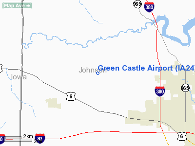
Location: |
Johnson County, IA |
|
Magnetic Variation: |
02E (1985) |
Owner & Manager
|
Ownership: |
Privately owned |
|
Owner: |
Don & Jacqueline Nelson |
|
Address: |
2154 250th St. N.w.
Oxford, IA 52322 |
|
Phone
number: |
319-645-2101 |
|
Manager: |
Green Castle Aero Club, Ltd |
|
Address: |
2154 250th St. N.w.
Oxford, IA 52322 |
|
Phone number: |
319-645-2101 |
Airport Operations and Facilities
|
Airport Use: |
Private |
|
Wind indicator: |
Yes |
|
Segmented Circle: |
No |
|
Control Tower: |
No |
|
Lighting Schedule: |
DUSK-DAWN |
|
Landing fee charge: |
No |
|
Sectional chart: |
Chicago |
|
Region: |
ACE - Central |
|
Boundary ARTCC: |
ZAU - Chicago |
|
Tie-in FSS: |
FOD - Fort Dodge |
|
FSS on Airport: |
No |
|
FSS Phone: |
515-955-8114 |
|
FSS Toll Free: |
1-800-WX-BRIEF |
Airport Services
|
Fuel
available: |
100LL |
|
Airframe
Repair: |
MAJOR |
|
Power
Plant Repair: |
MAJOR |
|
Runway
Information
Runway NW/SE
|
Dimension: |
4000 x 60 ft / 1219.2 x 18.3 m |
|
Surface: |
ASPH-TURF, |
|
Edge Lights: |
Low |
|
|
Runway NW
|
Runway SE
|
|
Traffic
Pattern: |
Left |
Left |
|
Radio Navigation Aids
|
ID |
Type |
Name |
Ch |
Freq |
Var |
Dist |
|
TZT |
NDB |
Belle Plaine |
|
371.00 |
02E |
26.1 nm |
|
AWG |
NDB |
Washington |
|
219.00 |
02E |
28.7 nm |
|
VTI |
NDB |
Garrison |
|
338.00 |
03E |
30.9 nm |
|
MXO |
NDB |
Monticello |
|
397.00 |
01E |
37.6 nm |
|
IIB |
NDB |
Wapsie |
|
206.00 |
02E |
43.1 nm |
|
GGI |
NDB |
Grinnell |
|
248.00 |
02E |
45.0 nm |
|
FFL |
NDB |
Fairfield |
|
332.00 |
03E |
46.2 nm |
|
OOA |
NDB |
Oskaloosa |
|
414.00 |
03E |
46.7 nm |
|
OQW |
NDB |
Maquoketa |
|
386.00 |
02E |
47.6 nm |
|
MPZ |
NDB |
Mount Pleasant |
|
212.00 |
02E |
49.8 nm |
|
CID |
VOR/DME |
Cedar Rapids |
088X |
114.10 |
05E |
8.4 nm |
|
DDD |
VOR/DME |
Port City |
112X |
116.50 |
01E |
35.0 nm |
|
IOW |
VORTAC |
Iowa City |
109X |
116.20 |
05E |
15.1 nm |
Remarks
-
RWY NW/SE - 1400'
TURF STOPWAY ON NW END.
Based
Aircraft
|
Aircraft based
on field: |
26 |
|
Single Engine
Airplanes: |
25 |
|
Ultralights: |
1 |
Green Castle Airport
Address:
Johnson County, IA
Tel:
319-645-2101
Images
and information placed above are from
http://www.airport-data.com/airport/IA24/
We
thank them for the data!
|
General Info |
| Country |
United
States |
| State |
IOWA
|
| FAA ID |
IA24
|
| Latitude |
41-45-18.041N |
|
Longitude |
091-43-39.627W |
|
Elevation |
750 feet
|
| Near
City |
OXFORD
|
We don't guarantee the information is fresh and accurate. The data may
be wrong or outdated.
For more up-to-date information please refer to other sources.
|
|


