 |
|
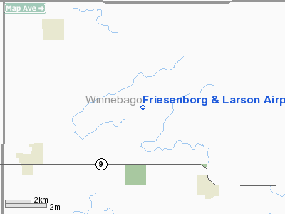
Friesenborg and Larson Airport |
Location &
QuickFacts
|
FAA
Information Effective: |
2007-07-05 |
|
Airport
Identifier: |
IA70 |
|
Airport
Status: |
Operational |
|
Longitude/Latitude: |
093-50-08.8130W/43-25-32.8390N
-93.835781/43.425789 (Estimated) |
|
Elevation: |
1220 ft / 371.86 m (Estimated) |
|
Land: |
0 acres |
|
From
nearest city: |
5 nautical miles NE of Buffalo Center, IA |
|
Location: |
Winnebago County, IA |
|
Magnetic Variation: |
04E (1985) |
Owner & Manager
|
Ownership: |
Privately owned |
|
Owner: |
Friesenborg & Larson, Inc. |
|
Address: |
Box 120
Buffalo Center, IA 50424 |
|
Phone number: |
515-584-2379 |
|
Manager: |
Gary Friesenborg |
|
Address: |
Box 120
Buffalo Center, IA 50424 |
|
Phone number: |
515-584-2379 |
Airport
Operations and Facilities
|
Airport
Use: |
Private |
|
Wind
indicator: |
Yes |
|
Segmented Circle: |
No |
|
Control
Tower: |
No |
|
Landing
fee charge: |
No |
|
Sectional chart: |
Omaha |
|
Region: |
ACE - Central |
|
Boundary
ARTCC: |
ZMP - Minneapolis |
|
Tie-in
FSS: |
FOD - Fort Dodge |
|
FSS on
Airport: |
No |
|
FSS
Phone: |
515-955-8114 |
|
FSS Toll
Free: |
1-800-WX-BRIEF |
|
Runway Information
Runway 17/35
|
Dimension: |
2900 x 100 ft / 883.9 x 30.5 m |
|
Surface: |
TURF, |
|
|
Runway 17
|
Runway 35
|
|
Traffic
Pattern: |
Left |
Left |
|
Radio Navigation Aids
|
ID |
Type |
Name |
Ch |
Freq |
Var |
Dist |
|
FXY |
NDB |
Forest City |
|
359.00 |
05E |
14.8 nm |
|
SBU |
NDB |
Blue Earth |
|
332.00 |
04E |
15.3 nm |
|
AXA |
NDB |
Algona |
|
403.00 |
03E |
28.2 nm |
|
PUF |
NDB |
Puff |
|
345.00 |
04E |
39.7 nm |
|
ACQ |
NDB |
Waseca |
|
371.00 |
02E |
40.6 nm |
|
CAV |
NDB |
Clarion |
|
387.00 |
03E |
41.0 nm |
|
EGQ |
NDB |
Emmetsburg |
|
410.00 |
04E |
42.8 nm |
|
EAG |
NDB |
Eagle Grove |
|
302.00 |
03E |
43.2 nm |
|
JYG |
NDB |
St James |
|
260.00 |
04E |
45.8 nm |
|
HPT |
NDB |
Hampton |
|
230.00 |
03E |
49.9 nm |
|
EST |
VOR |
Estherville |
|
110.40 |
07E |
39.7 nm |
|
AEL |
VOR/DME |
Albert Lea |
035X |
109.80 |
05E |
25.4 nm |
|
FRM |
VOR/DME |
Fairmont |
039X |
110.20 |
07E |
28.8 nm |
|
JAY |
VOR/DME |
Austin |
019X |
108.20 |
03E |
41.0 nm |
|
MKT |
VOR/DME |
Mankato |
045X |
110.80 |
07E |
47.8 nm |
|
MCW |
VORTAC |
Mason City |
096X |
114.90 |
06E |
29.8 nm |
Remarks
-
PRVDD THE APCH TO
EA RWY IS MAINTAINED FOR A MIN 20:1 GLIDE SLOPE AND THE TRANSITIONAL SFC BE
MAINTAINED FOR A 7:1 SLOPE.
Based
Aircraft
|
Aircraft based
on field: |
1 |
|
Single Engine
Airplanes: |
1 |
Friesenborg and Larson Airport
Address:
Winnebago County, IA
Tel:
515-584-2379
Images
and information placed above are from
http://www.airport-data.com/airport/IA70/
We
thank them for the data!
|
General Info |
| Country |
United
States |
| State |
IOWA
|
| FAA ID |
IA70
|
| Latitude |
43-25-32.839N |
|
Longitude |
093-50-08.813W |
|
Elevation |
1220
feet |
| Near
City |
BUFFALO
CENTER |
We don't guarantee the information is fresh and accurate. The data may
be wrong or outdated.
For more up-to-date information please refer to other sources.
|
|


