 |
|
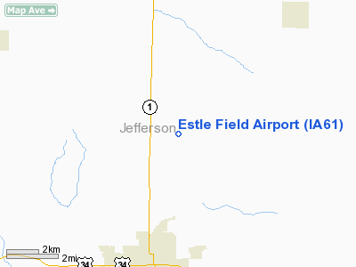
Location &
QuickFacts
|
FAA
Information Effective: |
2007-07-05 |
|
Airport
Identifier: |
IA61 |
|
Airport
Status: |
Operational |
|
Longitude/Latitude: |
091-56-47.6220W/41-04-49.0660N
-91.946562/41.080296 (Estimated) |
|
Elevation: |
800 ft / 243.84 m (Estimated) |
|
Land: |
0 acres |
|
From
nearest city: |
5 nautical miles N of Fairfield, IA |
|
Location: |
Jefferson County, IA |
|
Magnetic Variation: |
02E (1995) |
Owner & Manager
|
Ownership: |
Privately owned |
|
Owner: |
John & Connie Estle |
|
Address: |
Rr 4 Box 162
Fairfield, IA 52556 |
|
Phone number: |
515-472-2733 |
|
Manager: |
John & Connie Estele |
|
Address: |
Rr Box 162
Fairfield, IA 52556 |
|
Phone number: |
515-472-2733 |
Airport
Operations and Facilities
|
Airport
Use: |
Private |
|
Wind
indicator: |
Yes |
|
Segmented Circle: |
No |
|
Control
Tower: |
No |
|
Sectional chart: |
Chicago |
|
Region: |
ACE - Central |
|
Boundary
ARTCC: |
ZAU - Chicago |
|
Tie-in
FSS: |
FOD - Fort Dodge |
|
FSS on
Airport: |
No |
|
FSS
Phone: |
515-955-8114 |
|
FSS Toll
Free: |
1-800-WX-BRIEF |
|
Runway Information
Runway 04/22
|
Dimension: |
2100 x 60 ft / 640.1 x 18.3 m |
|
Surface: |
TURF, |
|
|
Runway 04
|
Runway 22
|
|
Traffic
Pattern: |
Left |
Left |
|
Runway 09/27
|
Dimension: |
1100 x 60 ft / 335.3 x 18.3 m |
|
Surface: |
TURF, |
|
|
Runway 09
|
Runway 27
|
|
Traffic
Pattern: |
Left |
Left |
|
Obstruction: |
129 ft tower, 200.0 ft from runway |
|
|
Radio Navigation Aids
|
ID |
Type |
Name |
Ch |
Freq |
Var |
Dist |
|
FFL |
NDB |
Fairfield |
|
332.00 |
03E |
4.6 nm |
|
AWG |
NDB |
Washington |
|
219.00 |
02E |
17.2 nm |
|
MPZ |
NDB |
Mount Pleasant |
|
212.00 |
02E |
21.5 nm |
|
OOA |
NDB |
Oskaloosa |
|
414.00 |
03E |
26.0 nm |
|
BEX |
NDB |
Bloomfield |
|
269.00 |
02E |
29.8 nm |
|
EOK |
NDB |
Keokuk |
|
366.00 |
02E |
43.8 nm |
|
PEA |
NDB |
Pella |
|
257.00 |
02E |
49.1 nm |
|
TVK |
NDB |
Centerville |
|
290.00 |
04E |
49.4 nm |
|
OTM |
VOR/DME |
Ottumwa |
053X |
111.60 |
06E |
17.5 nm |
|
DDD |
VOR/DME |
Port City |
112X |
116.50 |
01E |
39.9 nm |
|
CID |
VOR/DME |
Cedar Rapids |
088X |
114.10 |
05E |
49.1 nm |
|
IOW |
VORTAC |
Iowa City |
109X |
116.20 |
05E |
30.4 nm |
Based Aircraft
|
Aircraft based
on field: |
3 |
|
Single Engine
Airplanes: |
1 |
|
Ultralights: |
2 |
Estle Field Airport
Address:
Jefferson County, IA
Tel:
515-472-2733
Images
and information placed above are from
http://www.airport-data.com/airport/IA61/
We
thank them for the data!
|
General Info |
| Country |
United
States |
| State |
IOWA
|
| FAA ID |
IA61
|
| Latitude |
41-04-49.066N |
|
Longitude |
091-56-47.622W |
|
Elevation |
800 feet
|
| Near
City |
FAIRFIELD |
We don't guarantee the information is fresh and accurate. The data may
be wrong or outdated.
For more up-to-date information please refer to other sources.
|
|


