 |
|
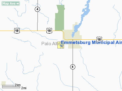
Emmetsburg Municipal Airport |
|
|
Location &
QuickFacts
|
FAA
Information Effective: |
2007-07-05 |
|
Airport
Identifier: |
EGQ |
|
Airport
Status: |
Operational |
|
Longitude/Latitude: |
094-42-16.8300W/43-06-07.2740N
-94.704675/43.102021 (Estimated) |
|
Elevation: |
1205 ft / 367.28 m (Surveyed) |
|
Land: |
179 acres |
|
From
nearest city: |
1 nautical miles SW of Emmetsburg, IA |
|
Location: |
Palo Alto County, IA |
|
Magnetic Variation: |
04E (2000) |
Owner & Manager
|
Ownership: |
Publicly owned |
|
Owner: |
City Of Emmetsburg |
|
Address: |
2021 Main
Emmetsburg, IA 50536 |
|
Phone number: |
712-852-4030 |
|
Manager: |
Drew Albright |
|
Address: |
3775 450th Street
Emmetsburg, IA 50536 |
|
Phone number: |
712-852-3810 |
Airport
Operations and Facilities
|
Airport
Use: |
Open to public |
|
Wind
indicator: |
Yes |
|
Segmented Circle: |
No |
|
Control
Tower: |
No |
|
Lighting
Schedule: |
DUSK-DAWN
ACTVT MIRL RY 13/31 & SAVASI RY 13 & 31 - CTAF. |
|
Beacon
Color: |
Clear-Green (lighted land airport) |
|
Landing
fee charge: |
No |
|
Sectional chart: |
Omaha |
|
Region: |
ACE - Central |
|
Boundary
ARTCC: |
ZMP - Minneapolis |
|
Tie-in
FSS: |
FOD - Fort Dodge |
|
FSS on
Airport: |
No |
|
FSS
Phone: |
515-955-8114 |
|
FSS Toll
Free: |
1-800-WX-BRIEF |
|
NOTAMs
Facility: |
FOD (NOTAM-d service avaliable) |
|
Federal Agreements: |
NY1 |
Airport Communications
|
CTAF: |
122.800 |
|
Unicom: |
122.800 |
Airport Services
|
Fuel
available: |
100LLMOGAS
MOGAS UNAVBL INDEFLY. |
|
Airframe
Repair: |
MINOR |
|
Power
Plant Repair: |
MINOR |
|
Bottled
Oxygen: |
NONE |
|
Bulk
Oxygen: |
NONE |
|
Runway Information
Runway 04/22
|
Dimension: |
2545 x 120 ft / 775.7 x 36.6 m |
|
Surface: |
TURF, Fair Condition |
|
|
Runway 04
|
Runway 22
|
|
Longitude: |
094-42-25.9300W |
094-42-01.4290W |
|
Latitude: |
43-05-52.3750N |
43-06-09.6740N |
|
Alignment: |
46 |
127 |
|
Traffic
Pattern: |
Left |
Left |
|
Obstruction: |
11 ft road, 230.0 ft from runway, 20:1 slope to clear |
17 ft road, 340.0 ft from runway, 20:1 slope to clear |
|
Runway 13/31
|
Dimension: |
3401 x 60 ft / 1036.6 x 18.3 m |
|
Surface: |
CONC, Good Condition |
|
Weight Limit: |
Single wheel: 29000 lbs. |
|
Edge Lights: |
Medium |
|
|
Runway 13
|
Runway 31
|
|
Longitude: |
094-42-42.1180W |
094-42-10.5810W |
|
Latitude: |
43-06-25.6700N |
43-06-01.2870N |
|
Elevation: |
1205.00 ft |
1205.00 ft |
|
Alignment: |
127 |
127 |
|
Traffic
Pattern: |
Left |
Left |
|
Markings: |
Non-precision instrument, Good Condition |
Non-precision instrument, Good Condition |
|
Crossing
Height: |
21.00 ft |
21.00 ft |
|
VASI: |
2-box SAVASI on left side
VASI OTS INDEFLY. |
2-box SAVASI on right side
VASI OTS INDEFLY. |
|
Visual
Glide Angle: |
3.00° |
3.50° |
|
Obstruction: |
51 ft trees, 1028.0 ft from runway, 50 ft right of
centerline, 16:1 slope to clear |
53 ft tree, 1340.0 ft from runway, 165 ft left of
centerline, 21:1 slope to clear |
|
Runway 17/35
|
Dimension: |
2177 x 150 ft / 663.5 x 45.7 m |
|
Surface: |
TURF, Fair Condition |
|
|
Runway 17
|
Runway 35
|
|
Longitude: |
094-42-06.9300W |
094-42-06.9300W |
|
Latitude: |
43-06-14.3100N |
43-05-52.8800N |
|
Alignment: |
127 |
0 |
|
Traffic
Pattern: |
Left |
Left |
|
Obstruction: |
46 ft trees, 627.0 ft from runway, 93 ft right of
centerline, 13:1 slope to clear |
12 ft berm, 291.0 ft from runway, 24:1 slope to clear |
|
Radio Navigation Aids
|
ID |
Type |
Name |
Ch |
Freq |
Var |
Dist |
|
EGQ |
NDB |
Emmetsburg |
|
410.00 |
04E |
0.1 nm |
|
PUF |
NDB |
Puff |
|
345.00 |
04E |
15.1 nm |
|
LTU |
NDB |
Little Sioux |
|
326.00 |
05E |
18.8 nm |
|
AXA |
NDB |
Algona |
|
403.00 |
03E |
19.0 nm |
|
POH |
NDB |
Pocahontas |
|
428.00 |
06E |
21.5 nm |
|
MJQ |
NDB |
Jackson |
|
353.00 |
04E |
35.0 nm |
|
SLB |
NDB |
Storm Lake |
|
434.00 |
04E |
38.4 nm |
|
SBU |
NDB |
Blue Earth |
|
332.00 |
04E |
39.9 nm |
|
EAG |
NDB |
Eagle Grove |
|
302.00 |
03E |
42.2 nm |
|
CKP |
NDB |
Pilot Rock |
|
423.00 |
05E |
43.5 nm |
|
SKI |
NDB |
Sac City |
|
356.00 |
04E |
45.1 nm |
|
CAV |
NDB |
Clarion |
|
387.00 |
03E |
46.8 nm |
|
FXY |
NDB |
Forest City |
|
359.00 |
05E |
48.2 nm |
|
ISB |
NDB |
Sibley |
|
269.00 |
05E |
48.6 nm |
|
SHL |
NDB |
Sheldon |
|
338.00 |
05E |
50.0 nm |
|
EST |
VOR |
Estherville |
|
110.40 |
07E |
18.6 nm |
|
SPW |
VOR/DME |
Spencer |
037X |
110.00 |
05E |
22.1 nm |
|
FRM |
VOR/DME |
Fairmont |
039X |
110.20 |
07E |
34.9 nm |
|
DDL |
VOR/DME |
Sheldon |
023X |
108.60 |
05E |
50.0 nm |
|
FOD |
VORTAC |
Fort Dodge |
082X |
113.50 |
07E |
34.6 nm |
Based Aircraft
|
Aircraft based
on field: |
8 |
|
Single Engine
Airplanes: |
7 |
|
Ultralights: |
1 |
Operational Statistics
Time Period:
2004-11-29 -
2005-11-28
|
Aircraft
Operations: |
145/Week |
|
General
Aviation Local: |
90.2% |
|
General
Aviation Itinerant: |
9.8% |
Emmetsburg Municipal Airport
Address:
Palo Alto County, IA
Tel:
712-852-4030, 712-852-3810
Images
and information placed above are from
http://www.airport-data.com/airport/EGQ/
We
thank them for the data!
|
General Info |
| Country |
United
States |
| State |
IOWA
|
| FAA ID |
EGQ
|
| Latitude |
43-06-07.274N |
|
Longitude |
094-42-16.830W |
|
Elevation |
1205
feet |
| Near
City |
EMMETSBURG |
We don't guarantee the information is fresh and accurate. The data may
be wrong or outdated.
For more up-to-date information please refer to other sources.
|
|


