 |
|
|
|
|
|
Location & QuickFacts
|
FAA Information Effective: |
2007-07-05 |
|
Airport Identifier: |
2Y1 |
|
Airport Status: |
Operational |
|
Longitude/Latitude: |
093-25-00.7500W/42-18-59.9400N
-93.416875/42.316650 (Estimated) |
|
Elevation: |
1179 ft / 359.36 m (Surveyed) |
|
Land: |
12
acres |
|
From nearest city: |
1 nautical miles E of Radcliffe, IA |
|
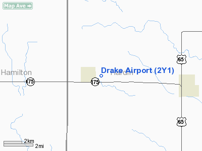
Location: |
Hardin County, IA |
|
Magnetic Variation: |
04E (1985) |
Owner & Manager
|
Ownership: |
Privately owned |
|
Owner: |
R. Drake |
|
Address: |
303 East St.
Radcliffe, IA 50230 |
|
Phone number: |
515-899-2121 |
|
Manager: |
R. R. Drake |
|
Address: |
303 East St.
Radcliffe, IA 50230 |
|
Phone number: |
515-899-2169 |
Airport Operations and Facilities
|
Airport Use: |
Open to public |
|
Wind indicator: |
Yes |
|
Segmented Circle: |
No |
|
Control Tower: |
No |
|
Lighting Schedule: |
RDO-CTL
ACTVT LIRL RWY 08/26 - 122.8. |
|
Landing fee charge: |
No |
|
Sectional chart: |
Omaha |
|
Region: |
ACE - Central |
|
Boundary ARTCC: |
ZMP - Minneapolis |
|
Tie-in FSS: |
FOD - Fort Dodge |
|
FSS on Airport: |
No |
|
FSS Phone: |
515-955-8114 |
|
FSS Toll Free: |
1-800-WX-BRIEF |
|
NOTAMs Facility: |
FOD (NOTAM-d service avaliable) |
Airport Communications
|
CTAF: |
122.800 |
|
Unicom: |
122.800 |
Airport Services
|
Airframe Repair: |
NONE |
|
Power Plant Repair: |
NONE |
|
Bottled Oxygen: |
NONE |
|
Bulk Oxygen: |
NONE |
|
Runway Information
Runway 08/26
|
Dimension: |
2480 x 90 ft / 755.9 x 27.4
m |
|
Surface: |
TURF, Fair Condition |
|
Edge Lights: |
Non-standard lighting system
NSTD LIRL; SOLID CLEAR; THLD LGTS SOLID GREEN. |
|
|
Runway 08
|
Runway 26
|
|
Elevation: |
0.00 ft |
1179.00 ft |
|
Traffic
Pattern: |
Left |
Left |
|
Obstruction: |
46 ft trees, 285.0 ft from runway, 80 ft right of centerline, 6:1 slope
to clear |
, 50:1 slope to clear |
|
Radio Navigation Aids
|
ID |
Type |
Name |
Ch |
Freq |
Var |
Dist |
|
IFA |
NDB |
Iowa Falls |
|
368.00 |
03E |
11.7 nm |
|
EBS |
NDB |
Webster City |
|
323.00 |
03E |
21.4 nm |
|
BNW |
NDB |
Boone |
|
407.00 |
03E |
25.0 nm |
|
MIW |
NDB |
Marshalltown |
|
239.00 |
03E |
25.5 nm |
|
HPT |
NDB |
Hampton |
|
230.00 |
03E |
26.0 nm |
|
CAV |
NDB |
Clarion |
|
387.00 |
03E |
29.9 nm |
|
EAG |
NDB |
Eagle Grove |
|
302.00 |
03E |
32.1 nm |
|
IKV |
NDB |
Ankeny |
|
275.00 |
03E |
37.7 nm |
|
PRO |
NDB |
Perry |
|
251.00 |
06E |
44.2 nm |
|
EFW |
NDB |
Jefferson |
|
391.00 |
03E |
45.1 nm |
|
GGI |
NDB |
Grinnell |
|
248.00 |
02E |
47.7 nm |
|
JWJ |
VOR/DME |
Elmwood |
031X |
109.40 |
03E |
25.8 nm |
|
TNU |
VOR/DME |
Newton |
072X |
112.50 |
03E |
34.9 nm |
|
FOD |
VORTAC |
Fort Dodge |
082X |
113.50 |
07E |
42.8 nm |
|
MCW |
VORTAC |
Mason City |
096X |
114.90 |
06E |
46.9 nm |
|
ALO |
VORTAC |
Waterloo |
059X |
112.20 |
06E |
47.4 nm |
|
DSM |
VOT |
Des Moines |
|
109.20 |
|
48.1 nm |
Remarks
-
WINTER
MONTHS CALL 515-899-2169 FOR ARPT CONDITIONS.
-
PROVIDED
APCH TO EACH RWY IS MAINTAINED FOR A MIN 20:1 GLIDE SLOPE AND THE TRANSITIONAL
SURFACE BE MAINTAINED FOR A 7:1 SLOPE.
Based Aircraft
|
Aircraft based
on field: |
1 |
|
Single Engine
Airplanes: |
1 |
Operational Statistics
Time
Period:
2006-05-09 - 2007-05-08
|
Aircraft
Operations: |
17/Month |
|
General
Aviation Local: |
100.0% |
Drake Airport
Address:
Hardin County, IA
Tel:
515-899-2121,
515-899-2169
Images
and information placed above are from
http://www.airport-data.com/airport/2Y1/
We
thank them for the data!
| General Info
|
| Country |
United States
|
| State |
IOWA
|
| FAA ID |
2Y1
|
| Latitude |
42-18-59.940N
|
| Longitude |
093-25-00.750W
|
| Elevation |
1179 feet
|
| Near City |
RADCLIFFE
|
We don't guarantee the information is fresh and accurate. The data may
be wrong or outdated.
For more up-to-date information please refer to other sources.
|
|


