 |
|
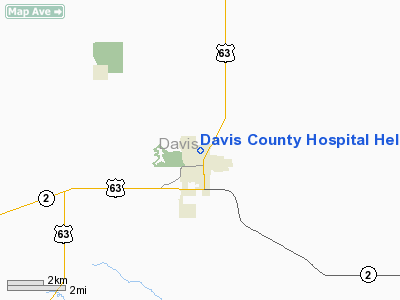
Davis County Hospital Heliport |
Location & QuickFacts
|
FAA Information Effective: |
2007-07-05 |
|
Airport Identifier: |
63IA |
|
Airport Status: |
Operational |
|
Longitude/Latitude: |
092-24-55.6600W/40-45-33.5700N
-92.415461/40.759325 (Estimated) |
|
Elevation: |
890 ft / 271.27 m (Estimated) |
|
Land: |
0
acres |
|
From nearest city: |
2 nautical miles N of Bloomfield, IA |
|
Location: |
Davis County, IA |
|
Magnetic Variation: |
02E (2000) |
Owner & Manager
|
Ownership: |
Privately owned |
|
Owner: |
Davis County Hospital |
|
Address: |
507-509 N Madison
Bloomfield, IA 52537 |
|
Phone number: |
641-664-2145 |
|
Manager: |
John Monnahan |
|
Address: |
507-509 N Madison
Bloomfield, IA 52537 |
|
Phone number: |
641-664-2145 |
Airport Operations and Facilities
|
Airport Use: |
Private |
|
Wind indicator: |
Yes |
|
Segmented Circle: |
No |
|
Control Tower: |
No |
|
Lighting Schedule: |
PHONE REQ
FOR PERIMETER LGTS CALL 641-664-2145. |
|
Region: |
ACE - Central |
|
Boundary ARTCC: |
ZAU - Chicago |
|
Tie-in FSS: |
FOD - Fort Dodge |
|
FSS Phone: |
515-955-8114 |
|
FSS Toll Free: |
1-800-WX-BRIEF |
|
Runway Information
Helipad H1
|
Dimension: |
40 x 40 ft / 12.2 x 12.2
m |
|
Surface: |
CONC, |
|
|
Runway H1
|
Runway
|
|
Traffic
Pattern: |
Left |
Left |
|
Radio Navigation Aids
|
ID |
Type |
Name |
Ch |
Freq |
Var |
Dist |
|
BEX |
NDB |
Bloomfield |
|
269.00 |
02E |
1.1 nm |
|
TVK |
NDB |
Centerville |
|
290.00 |
04E |
22.5 nm |
|
FFL |
NDB |
Fairfield |
|
332.00 |
03E |
24.6 nm |
|
OOA |
NDB |
Oskaloosa |
|
414.00 |
03E |
28.2 nm |
|
MPZ |
NDB |
Mount Pleasant |
|
212.00 |
02E |
42.6 nm |
|
OXV |
NDB |
Knoxville |
|
284.00 |
03E |
45.2 nm |
|
PEA |
NDB |
Pella |
|
257.00 |
02E |
45.6 nm |
|
CNC |
NDB |
Chariton |
|
335.00 |
05E |
45.7 nm |
|
AWG |
NDB |
Washington |
|
219.00 |
02E |
46.0 nm |
|
EOK |
NDB |
Keokuk |
|
366.00 |
02E |
48.2 nm |
|
OTM |
VOR/DME |
Ottumwa |
053X |
111.60 |
06E |
16.7 nm |
|
IRK |
VORTAC |
Kirksville |
093X |
114.60 |
06E |
38.4 nm |
Remarks
-
OWNER
DESIRES HELIPORT NOT BE CHARTED.
-
MEDICAL USE.
-
PRVDD
MAINTAIN CLEAR OF OBSTRUCTIONS; INGRESS/EGRESS ROUTES ARE FM 290 DEGS
CLOCKWISE THRU 030 DEGS & 170 DEGS CLOCKWISE THRU 200 DEGS CLOCKWISE;
OBSTRUCTIONS NEED TO BE MKD, LIGHTED OR REMOVED; CONTROL OF PUBLIC ACCESS; AND
ADEQUACY OF FIRE EQUIPMENT.
Davis County Hospital Heliport
Address:
Davis County, IA
Tel:
641-664-2145
Images
and information placed above are from
http://www.airport-data.com/airport/63IA/
We
thank them for the data!
| General Info
|
| Country |
United States
|
| State |
IOWA
|
| FAA ID |
63IA
|
| Latitude |
40-45-33.570N
|
| Longitude |
092-24-55.660W
|
| Elevation |
890 feet
|
| Near City |
BLOOMFIELD
|
We don't guarantee the information is fresh and accurate. The data may
be wrong or outdated.
For more up-to-date information please refer to other sources.
|
|


