 |
|
|
|
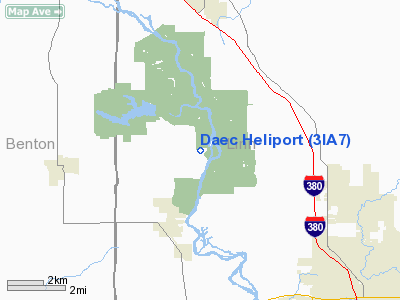
Location &
QuickFacts
|
FAA
Information Effective: |
2007-07-05 |
|
Airport
Identifier: |
3IA7 |
|
Airport
Status: |
Operational |
|
Longitude/Latitude: |
091-46-37.6450W/42-06-06.9840N
-91.777124/42.101940 (Estimated) |
|
Elevation: |
753 ft / 229.51 m (Estimated) |
|
Land: |
0 acres |
|
From
nearest city: |
2 nautical miles NE of Palo, IA |
|
Location: |
Linn County, IA |
|
Magnetic Variation: |
02E (1985) |
Owner & Manager
|
Ownership: |
Privately owned |
|
Owner: |
Alliant/ies Utilities
OWNER DESIRES HELIPORT NOT BE CHARTED. |
|
Address: |
P O Box 351
Cedar Rapids, IA 52406 |
|
Phone
number: |
319-398-4411
CORP. HDGRS PHONE 319-851-7611 DAEC. |
|
Manager: |
J. F. Franz Vp-nuclear
NUCLEAR GENERATION. |
|
Address: |
P O Box 351
Cedar Rapids, IA 52406 |
|
Phone number: |
319-398-8162 |
Airport Operations and Facilities
|
Airport
Use: |
Private |
|
Segmented Circle: |
No |
|
Control
Tower: |
No |
|
Landing
fee charge: |
No |
|
Sectional chart: |
Chicago |
|
Region: |
ACE - Central |
|
Boundary
ARTCC: |
ZAU - Chicago |
|
Tie-in
FSS: |
FOD - Fort Dodge |
|
FSS on
Airport: |
No |
|
FSS
Phone: |
515-955-8114 |
|
FSS Toll
Free: |
1-800-WX-BRIEF |
|
Runway Information
Helipad H1
|
Dimension: |
100 x 100 ft / 30.5 x 30.5 m |
|
Surface: |
TURF, |
|
|
Runway H1
|
Runway
|
|
Traffic
Pattern: |
Left |
Left |
|
Radio Navigation Aids
|
ID |
Type |
Name |
Ch |
Freq |
Var |
Dist |
|
VTI |
NDB |
Garrison |
|
338.00 |
03E |
13.0 nm |
|
IIB |
NDB |
Wapsie |
|
206.00 |
02E |
22.4 nm |
|
TZT |
NDB |
Belle Plaine |
|
371.00 |
02E |
26.1 nm |
|
MXO |
NDB |
Monticello |
|
397.00 |
01E |
29.1 nm |
|
OLZ |
NDB |
Oelwein |
|
260.00 |
02E |
36.1 nm |
|
OQW |
NDB |
Maquoketa |
|
386.00 |
02E |
46.3 nm |
|
GGI |
NDB |
Grinnell |
|
248.00 |
02E |
48.7 nm |
|
AWG |
NDB |
Washington |
|
219.00 |
02E |
49.6 nm |
|
CID |
VOR/DME |
Cedar Rapids |
088X |
114.10 |
05E |
12.9 nm |
|
IOW |
VORTAC |
Iowa City |
109X |
116.20 |
05E |
35.8 nm |
|
ALO |
VORTAC |
Waterloo |
059X |
112.20 |
06E |
38.9 nm |
Remarks
-
PROVIDED
APPROACHES ARE MAINTAINED FOR A 8:1 GLIDE SLOPE AND TRANSITIONAL SFCS FOR A
2:1 SLOPE.
Daec Heliport
Address:
Linn County, IA
Tel:
319-398-4411,
319-398-8162
Images
and information placed above are from
http://www.airport-data.com/airport/3IA7/
We
thank them for the data!
|
General Info |
| Country |
United
States |
| State |
IOWA
|
| FAA ID |
3IA7
|
| Latitude |
42-06-06.984N |
|
Longitude |
091-46-37.645W |
|
Elevation |
753 feet
|
| Near
City |
PALO
|
We don't guarantee the information is fresh and accurate. The data may
be wrong or outdated.
For more up-to-date information please refer to other sources.
|
|


