 |
|
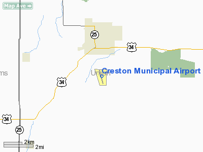
Creston Municipal Airport |
|
|
Location &
QuickFacts
|
FAA
Information Effective: |
2007-07-05 |
|
Airport
Identifier: |
CSQ |
|
Airport
Status: |
Operational |
|
Longitude/Latitude: |
094-21-47.9000W/41-01-17.2000N
-94.363306/41.021444 (Estimated) |
|
Elevation: |
1300 ft / 396.24 m (Surveyed) |
|
Land: |
360 acres |
|
From
nearest city: |
3 nautical miles S of Creston, IA |
|
Location: |
Union County, IA |
|
Magnetic Variation: |
04E (1995) |
Owner & Manager
|
Ownership: |
Publicly owned |
|
Owner: |
City Of Creston
KEVIN GLICK - COMM CHMN. |
|
Address: |
116 W. Adams
Creston, IA 50801 |
|
Phone
number: |
641-782-2000 |
|
Manager: |
Larry West |
|
Address: |
1945 Cherry Street Road
Creston, IA 50801 |
|
Phone number: |
641-782-2383
ADDNL PHONE 641-782-4841. |
Airport Operations and Facilities
|
Airport
Use: |
Open to public |
|
Wind
indicator: |
Yes |
|
Segmented Circle: |
No |
|
Control
Tower: |
No |
|
Lighting
Schedule: |
DUSK-DAWN
MIRL RY 16/34 PRESET LOW INTST; ACTVT HIGHER INTST & VASI & REIL RYS
16 & 34 - CTAF. |
|
Beacon
Color: |
Clear-Green (lighted land airport) |
|
Landing
fee charge: |
No |
|
Sectional chart: |
Omaha |
|
Region: |
ACE - Central |
|
Boundary
ARTCC: |
ZMP - Minneapolis |
|
Tie-in
FSS: |
FOD - Fort Dodge |
|
FSS on
Airport: |
No |
|
FSS
Phone: |
515-955-8114 |
|
FSS Toll
Free: |
1-800-WX-BRIEF |
|
NOTAMs
Facility: |
CSQ (NOTAM-d service avaliable) |
|
Federal Agreements: |
NGY |
Airport Communications
|
CTAF: |
122.800 |
|
Unicom: |
122.800 |
Airport Services
|
Fuel
available: |
100LLA
FOR FUEL AFT HRS & WKENDS CALL (641) 782-8402 (LAW ENFORCEMENT CENTER). |
|
Airframe
Repair: |
MINOR |
|
Power
Plant Repair: |
MINOR |
|
Bottled
Oxygen: |
NONE |
|
Bulk
Oxygen: |
NONE |
|
Runway Information
Runway 04/22
|
Dimension: |
1692 x 100 ft / 515.7 x 30.5 m |
|
Surface: |
TURF, Good Condition |
|
|
Runway 04
|
Runway 22
|
|
Longitude: |
094-21-50.4498W |
094-21-34.8883W |
|
Latitude: |
41-01-14.3956N |
41-01-26.2573N |
|
Elevation: |
0.00 ft |
1299.00 ft |
|
Alignment: |
45 |
127 |
|
Traffic
Pattern: |
Left |
Left |
|
Obstruction: |
, 50:1 slope to clear |
20 ft road, 865.0 ft from runway, 43:1 slope to clear |
|
Runway 16/34
|
Dimension: |
4901 x 75 ft / 1493.8 x 22.9 m |
|
Surface: |
ASPH, Good Condition |
|
Weight Limit: |
Single wheel: 15000 lbs. |
|
Edge Lights: |
Medium |
|
|
Runway 16
|
Runway 34
|
|
Longitude: |
094-21-58.0531W |
094-21-41.3407W |
|
Latitude: |
41-01-39.4263N |
41-00-52.6892N |
|
Elevation: |
1289.00 ft |
1295.00 ft |
|
Alignment: |
127 |
127 |
|
Traffic
Pattern: |
Left |
Left |
|
Markings: |
Non-precision instrument, Poor Condition
MARKINGS FADED. |
Non-precision instrument, Fair Condition |
|
Crossing
Height: |
46.00 ft |
46.00 ft |
|
Displaced
threshold: |
0.00 ft |
100.00 ft |
|
VASI: |
2-box on left side |
2-box on left side |
|
Visual
Glide Angle: |
3.00° |
3.00° |
|
Runway End
Identifier: |
Yes |
Yes |
|
Obstruction: |
13 ft fence, 520.0 ft from runway, 24:1 slope to clear |
41 ft tree, 944.0 ft from runway, 185 ft right of
centerline, 18:1 slope to clear
APCH SLOPE 20:1 TO DSPLCD THLD. |
|
Radio Navigation Aids
|
ID |
Type |
Name |
Ch |
Freq |
Var |
Dist |
|
UNE |
NDB |
Union County |
|
379.00 |
04E |
3.9 nm |
|
CRZ |
NDB |
Corning |
|
278.00 |
04E |
17.9 nm |
|
GFZ |
NDB |
Greenfield |
|
338.00 |
04E |
18.6 nm |
|
ICL |
NDB |
Clarinda |
|
353.00 |
04E |
35.0 nm |
|
AIO |
NDB |
Atlantic |
|
365.00 |
04E |
38.5 nm |
|
GCT |
NDB |
Guthrie Center |
|
518.00 |
05E |
39.8 nm |
|
RDK |
NDB |
Red Oak |
|
230.00 |
04E |
40.4 nm |
|
CNC |
NDB |
Chariton |
|
335.00 |
05E |
45.4 nm |
|
ADU |
NDB |
Audubon |
|
266.00 |
04E |
47.2 nm |
|
EVU |
NDB |
Emville |
|
317.00 |
05E |
47.7 nm |
|
PRO |
NDB |
Perry |
|
251.00 |
06E |
49.5 nm |
|
LMN |
VORTAC |
Lamoni |
114X |
116.70 |
07E |
31.2 nm |
|
DSM |
VORTAC |
Des Moines |
122X |
117.50 |
07E |
40.8 nm |
|
DSM |
VOT |
Des Moines |
|
109.20 |
|
44.0 nm |
Based Aircraft
|
Aircraft based
on field: |
15 |
|
Single Engine
Airplanes: |
11 |
|
Ultralights: |
4 |
Operational Statistics
Time Period:
2003-06-03 -
2004-06-01
|
Aircraft
Operations: |
95/Week |
|
General
Aviation Local: |
51.6% |
|
General
Aviation Itinerant: |
48.4% |
Creston Municipal Airport
Address:
Union County, IA
Tel:
641-782-2000,
641-782-2383
Images
and information placed above are from
http://www.airport-data.com/airport/CSQ/
We
thank them for the data!
|
General Info |
| Country |
United
States |
| State |
IOWA
|
| FAA ID |
CSQ
|
| Latitude |
41-01-17.261N |
|
Longitude |
094-21-47.949W |
|
Elevation |
1294
feet |
| Near
City |
CRESTON
|
We don't guarantee the information is fresh and accurate. The data may
be wrong or outdated.
For more up-to-date information please refer to other sources.
|
|


