 |
|
Burgess Memorial Hospital Heliport |
|
|
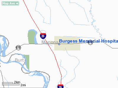
Location
& QuickFacts
|
FAA Information Effective: |
2007-07-05 |
|
Airport
Identifier: |
2IA8 |
|
Airport
Status: |
Operational |
|
Longitude/Latitude: |
096-06-23.0560W/42-01-34.9570N
-96.106404/42.026377 (Estimated) |
|
Elevation: |
1049 ft / 319.74 m (Estimated) |
|
Land: |
8
acres |
|
From
nearest city: |
0 nautical miles N of Onawa, IA |
|
Location: |
Monona County, IA |
|
Magnetic Variation: |
06E (1985) |
Owner
& Manager
|
Ownership: |
Privately owned |
|
Owner: |
Burgess Memorial Hospital |
|
Address: |
1600 Diamond St
Onawa, IA 51040 |
|
Phone number: |
712-423-2311 |
|
Manager: |
Karmon T. Bjella |
|
Address: |
1600 Diamond St
Onawa, IA 51040 |
|
Phone number: |
712-423-2311 |
Airport
Operations and Facilities
|
Airport Use: |
Private
MEDICAL. |
|
Wind
indicator: |
Yes |
|
Segmented
Circle: |
No |
|
Control
Tower: |
No |
|
Lighting
Schedule: |
PHONE REQ
FOR PERIMETER LIGHTS CALL 712-423-2311. |
|
Landing
fee charge: |
No |
|
Sectional
chart: |
Omaha |
|
Region: |
ACE - Central |
|
Boundary
ARTCC: |
ZMP - Minneapolis |
|
Tie-in
FSS: |
FOD - Fort Dodge |
|
FSS
on Airport: |
No |
|
FSS
Phone: |
515-955-8114 |
|
FSS
Toll Free: |
1-800-WX-BRIEF |
|
Runway Information
Helipad H1
|
Dimension: |
25
x 25 ft / 7.6 x 7.6 m
HELIPAD LCTD WITHIN 100 X 100' LNDG/TKOF AREA. |
|
Surface: |
CONC, |
|
|
Runway H1 |
Runway |
|
Traffic
Pattern: |
Left |
Left |
|
Radio Navigation
Aids
|
ID |
Type |
Name |
Ch |
Freq |
Var |
Dist |
|
MEY |
NDB |
Mapleton |
|
335.00 |
05E |
16.7 nm |
|
SU |
NDB |
Salix |
|
414.00 |
07E |
19.9 nm |
|
GAK |
NDB |
Sioux Gateway |
|
233.00 |
06E |
26.1 nm |
|
OI |
NDB |
Tommi |
|
305.00 |
07E |
30.5 nm |
|
DNS |
NDB |
Denison |
|
350.00 |
04E |
32.6 nm |
|
FET |
NDB |
Fremont |
|
311.00 |
06E |
39.2 nm |
|
OM |
NDB |
Gerfi |
|
320.00 |
05E |
40.2 nm |
|
LCG |
NDB |
Wayne |
|
389.00 |
06E |
41.2 nm |
|
HNR |
NDB |
Harlan |
|
272.00 |
05E |
43.6 nm |
|
CKP |
NDB |
Pilot Rock |
|
423.00 |
05E |
49.0 nm |
|
MLE |
NDB |
Millard |
|
371.00 |
06E |
50.0 nm |
|
TQE |
VOR |
Tekamah |
|
108.40 |
07E |
16.4 nm |
|
SCB |
VOR/DME |
Scribner |
47X |
111.00 |
06E |
34.5 nm |
|
SUX |
VORTAC |
Sioux City |
112X |
116.50 |
09E |
21.4 nm |
|
OMA |
VOT |
Omaha |
|
109.00 |
|
45.0 nm |
Remarks
- CONDL-PROVIDED
APPROACH/DEPARTURE PATHS ARE MAINTAINED FOR A MIN 8:1 GLIDE SLOPE AND
THE TRANSITIONAL SURFACE BE MAINTAINED FOR A MIN 2:1 SLOPE.
Burgess Memorial Hospital Heliport
Address:
Monona County, IA
Tel:
712-423-2311
Images
and information placed above are from
http://www.airport-data.com/airport/2IA8/
We
thank them for the data!
| General
Info |
| Country |
United
States |
| State |
IOWA
|
| FAA ID |
2IA8
|
| Latitude |
42-01-34.957N
|
| Longitude |
096-06-23.056W
|
| Elevation |
1049 feet
|
| Near City |
ONAWA
|
We don't guarantee the information is fresh and accurate. The data may
be wrong or outdated.
For more up-to-date information please refer to other sources.
|
|


