 |
|
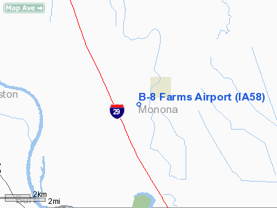
Location
& QuickFacts
|
FAA Information Effective: |
2007-07-05 |
|
Airport
Identifier: |
IA58 |
|
Airport
Status: |
Operational |
|
Longitude/Latitude: |
096-10-19.0700W/42-06-53.9610N
-96.171964/42.114989 (Estimated) |
|
Elevation: |
1063 ft / 324.00 m (Estimated) |
|
Land: |
0
acres |
|
From
nearest city: |
1 nautical miles W of Whiting, IA |
|
Location: |
Monona County, IA |
|
Magnetic Variation: |
06E (1985) |
Owner
& Manager
|
Ownership: |
Privately owned |
|
Owner: |
J L Garred |
|
Address: |
Whiting, IA 51063 |
|
Phone number: |
712-458-2431 |
|
Address: |
|
|
Phone number: |
712-458-2534 |
Airport
Operations and Facilities
|
Airport Use: |
Private |
|
Wind
indicator: |
Yes |
|
Segmented
Circle: |
No |
|
Control
Tower: |
No |
|
Lighting
Schedule: |
PHONE REQ
FOR RWY LGTS CALL 712-458-2431. |
|
Landing
fee charge: |
No |
|
Sectional
chart: |
Omaha |
|
Region: |
ACE - Central |
|
Boundary
ARTCC: |
ZMP - Minneapolis |
|
Tie-in
FSS: |
FOD - Fort Dodge |
|
FSS
on Airport: |
No |
|
FSS
Phone: |
515-955-8114 |
|
FSS
Toll Free: |
1-800-WX-BRIEF |
|
Runway
Information
Runway N/S
|
Dimension: |
2400 x 100 ft / 731.5 x 30.5 m |
|
Surface: |
TURF, |
|
Edge
Lights: |
Low |
|
|
Runway N |
Runway S |
|
Traffic
Pattern: |
Left |
Left |
|
Radio Navigation
Aids
|
ID |
Type |
Name |
Ch |
Freq |
Var |
Dist |
|
SU |
NDB |
Salix |
|
414.00 |
07E |
13.8 nm |
|
MEY |
NDB |
Mapleton |
|
335.00 |
05E |
17.3 nm |
|
GAK |
NDB |
Sioux Gateway |
|
233.00 |
06E |
20.0 nm |
|
OI |
NDB |
Tommi |
|
305.00 |
07E |
24.4 nm |
|
DNS |
NDB |
Denison |
|
350.00 |
04E |
36.2 nm |
|
LCG |
NDB |
Wayne |
|
389.00 |
06E |
37.0 nm |
|
FET |
NDB |
Fremont |
|
311.00 |
06E |
42.9 nm |
|
OM |
NDB |
Gerfi |
|
320.00 |
05E |
46.0 nm |
|
CKP |
NDB |
Pilot Rock |
|
423.00 |
05E |
46.2 nm |
|
HNR |
NDB |
Harlan |
|
272.00 |
05E |
49.2 nm |
|
TQE |
VOR |
Tekamah |
|
108.40 |
07E |
21.4 nm |
|
SCB |
VOR/DME |
Scribner |
47X |
111.00 |
06E |
36.8 nm |
|
SUX |
VORTAC |
Sioux City |
112X |
116.50 |
09E |
15.4 nm |
Based
Aircraft
|
Aircraft
based on field: |
3 |
|
Single
Engine Airplanes: |
2 |
|
Multi
Engine Airplanes: |
1 |
B-8 Farms Airport
Address:
Monona County, IA
Tel:
712-458-2431, 712-458-2534
Images
and information placed above are from
http://www.airport-data.com/airport/IA58/
We
thank them for the data!
| General
Info |
| Country |
United
States |
| State |
IOWA
|
| FAA ID |
IA58
|
| Latitude |
42-06-53.961N
|
| Longitude |
096-10-19.070W
|
| Elevation |
1063 feet
|
| Near City |
WHITING
|
We don't guarantee the information is fresh and accurate. The data may
be wrong or outdated.
For more up-to-date information please refer to other sources.
|
|


