 |
|
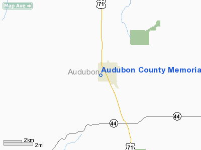
Audubon County Memorial Hospital Heliport |
Location
& QuickFacts
|
FAA Information Effective: |
2007-07-05 |
|
Airport
Identifier: |
0IA2 |
|
Airport
Status: |
Operational |
|
Longitude/Latitude: |
094-56-18.9530W/41-42-55.9510N
-94.938598/41.715542 (Estimated) |
|
Elevation: |
1320 ft / 402.34 m (Estimated) |
|
Land: |
0
acres |
|
From
nearest city: |
0 nautical miles N of Audubon, IA |
|
Location: |
Audubon County, IA |
|
Magnetic Variation: |
05E (1985) |
Owner
& Manager
|
Ownership: |
Publicly owned |
|
Owner: |
Audubon County |
|
Address: |
515 Pacific St
Audubon, IA 50025 |
|
Phone
number: |
712-563-2611 |
|
Manager: |
David G Couser Admin
RICK ENSLEY, BLDG SUPERINTENDENT. |
|
Address: |
515 Pacific St
Audubon, IA 50025 |
|
Phone number: |
712-563-2611 |
Airport
Operations and Facilities
|
Airport Use: |
Private
MEDICAL. |
|
Wind
indicator: |
Yes |
|
Segmented
Circle: |
No |
|
Control
Tower: |
No |
|
Sectional
chart: |
Omaha |
|
Region: |
ACE - Central |
|
Boundary
ARTCC: |
ZMP - Minneapolis |
|
Tie-in
FSS: |
FOD - Fort Dodge |
|
FSS
Phone: |
515-955-8114 |
|
FSS
Toll Free: |
1-800-WX-BRIEF |
|
Runway Information
Helipad H1
|
Dimension: |
60 x 50 ft / 18.3 x 15.2 m |
|
Surface: |
CONC, |
|
|
Runway H1 |
Runway |
|
Traffic
Pattern: |
Left |
Left |
|
Radio Navigation
Aids
|
ID |
Type |
Name |
Ch |
Freq |
Var |
Dist |
|
ADU |
NDB |
Audubon |
|
266.00 |
04E |
2.0 nm |
|
AIO |
NDB |
Atlantic |
|
365.00 |
04E |
19.3 nm |
|
HNR |
NDB |
Harlan |
|
272.00 |
05E |
19.8 nm |
|
CIN |
NDB |
Carroll |
|
397.00 |
04E |
21.0 nm |
|
GCT |
NDB |
Guthrie Center |
|
518.00 |
05E |
22.8 nm |
|
DNS |
NDB |
Denison |
|
350.00 |
04E |
25.5 nm |
|
EFW |
NDB |
Jefferson |
|
391.00 |
03E |
32.1 nm |
|
GFZ |
NDB |
Greenfield |
|
338.00 |
04E |
32.3 nm |
|
PRO |
NDB |
Perry |
|
251.00 |
06E |
35.6 nm |
|
SKI |
NDB |
Sac City |
|
356.00 |
04E |
40.0 nm |
|
CRZ |
NDB |
Corning |
|
278.00 |
04E |
44.0 nm |
|
RDK |
NDB |
Red Oak |
|
230.00 |
04E |
44.4 nm |
|
MEY |
NDB |
Mapleton |
|
335.00 |
05E |
47.4 nm |
|
OVR |
VORTAC |
Omaha |
110X |
116.30 |
08E |
48.8 nm |
|
OMA |
VOT |
Omaha |
|
109.00 |
|
49.6 nm |
Remarks
- PRVDD
CLEAR 8:1 APCH/DEP PATHS & CLEAR 2:1 TRANSITIONAL SFCS.
Audubon County Memorial Hospital Heliport
Address:
Audubon County, IA
Tel:
712-563-2611
Images
and information placed above are from
http://www.airport-data.com/airport/0IA2/
We
thank them for the data!
| General
Info |
| Country |
United
States |
| State |
IOWA
|
| FAA ID |
0IA2
|
| Latitude |
41-42-55.951N
|
| Longitude |
094-56-18.953W
|
| Elevation |
1320 feet
|
| Near City |
AUDUBON
|
We don't guarantee the information is fresh and accurate. The data may
be wrong or outdated.
For more up-to-date information please refer to other sources.
|
|


