 |
|
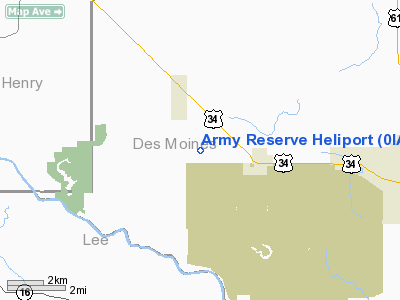
Location
& QuickFacts
|
FAA Information Effective: |
2007-07-05 |
|
Airport
Identifier: |
0IA9 |
|
Airport
Status: |
Operational |
|
Longitude/Latitude: |
091-18-00.5430W/40-50-00.1330N
-91.300151/40.833370 (Estimated) |
|
Elevation: |
725 ft / 220.98 m (Estimated) |
|
Land: |
0
acres |
|
From
nearest city: |
1 nautical miles W of Middleton, IA |
|
Location: |
Des Moines County, IA |
|
Magnetic Variation: |
02E (1985) |
Owner
& Manager
|
Ownership: |
Army owned |
|
Owner: |
Co C 389th Engr Bn |
|
Address: |
Usarc Highway 79 West
Middletown, IA 52638 |
|
Phone
number: |
319-392-4296 |
|
Manager: |
Mr. Hill |
|
Address: |
Usarc Highway 79 West
Middletown, IA 52638 |
|
Phone number: |
319-392-4296 |
Airport
Operations and Facilities
|
Airport Use: |
Private |
|
Wind
indicator: |
No |
|
Segmented
Circle: |
No |
|
Control
Tower: |
No |
|
Landing
fee charge: |
No |
|
Sectional
chart: |
Chicago |
|
Region: |
ACE - Central |
|
Boundary
ARTCC: |
ZAU - Chicago |
|
Tie-in
FSS: |
FOD - Fort Dodge |
|
FSS
on Airport: |
No |
|
FSS
Phone: |
515-955-8114 |
|
FSS
Toll Free: |
1-800-WX-BRIEF |
|
Runway Information
Helipad H1
|
Dimension: |
50 x 50 ft / 15.2 x 15.2 m |
|
Surface: |
TURF, |
|
|
Runway H1 |
Runway |
|
Traffic
Pattern: |
Left |
Left |
|
Radio Navigation
Aids
|
ID |
Type |
Name |
Ch |
Freq |
Var |
Dist |
|
MPZ |
NDB |
Mount Pleasant |
|
212.00 |
02E |
11.6 nm |
|
EOK |
NDB |
Keokuk |
|
366.00 |
02E |
23.0 nm |
|
AWG |
NDB |
Washington |
|
219.00 |
02E |
31.7 nm |
|
FFL |
NDB |
Fairfield |
|
332.00 |
03E |
33.0 nm |
|
JZY |
NDB |
Macomb |
|
251.00 |
01E |
38.7 nm |
|
DDD |
VOR/DME |
Port City |
112X |
116.50 |
01E |
32.8 nm |
|
GBG |
VOR/DME |
Galesburg |
035X |
109.80 |
03E |
39.8 nm |
|
OTM |
VOR/DME |
Ottumwa |
053X |
111.60 |
06E |
48.0 nm |
|
BRL |
VORTAC |
Burlington |
051X |
111.40 |
05E |
18.3 nm |
|
MZV |
VORTAC |
Moline |
091X |
114.40 |
05E |
41.9 nm |
|
IOW |
VORTAC |
Iowa City |
109X |
116.20 |
05E |
43.6 nm |
Remarks
- OWNER
DESIRES ARPT NOT TO BE CHARTED.
Army Reserve Heliport
Address:
Des Moines County, IA
Tel:
319-392-4296
Images
and information placed above are from
http://www.airport-data.com/airport/0IA9/
We
thank them for the data!
| General
Info |
| Country |
United
States |
| State |
IOWA
|
| FAA ID |
0IA9
|
| Latitude |
40-50-00.133N
|
| Longitude |
091-18-00.543W
|
| Elevation |
725 feet
|
| Near City |
MIDDLETON
|
We don't guarantee the information is fresh and accurate. The data may
be wrong or outdated.
For more up-to-date information please refer to other sources.
|
|


