 |
|
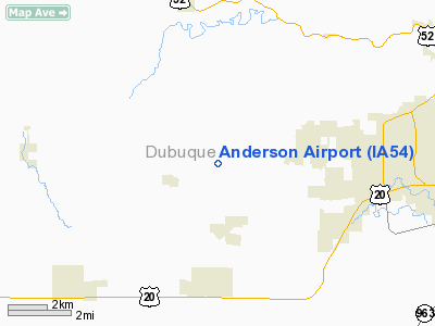
Location
& QuickFacts
|
FAA Information Effective: |
2007-07-05 |
|
Airport
Identifier: |
IA54 |
|
Airport
Status: |
Operational |
|
Longitude/Latitude: |
090-50-35.4600W/42-30-08.0000N
-90.843183/42.502222 (Estimated) |
|
Elevation: |
1135 ft / 345.95 m () |
|
Land: |
0
acres |
|
From
nearest city: |
8 nautical miles W of Dubuque, IA |
|
Location: |
Adair County, IA |
|
Magnetic Variation: |
00E (2000) |
Owner
& Manager
|
Ownership: |
Privately owned |
|
Owner: |
Richard A Anderson |
|
Address: |
18225 Kaunc Lan
Durango, IA 52039 |
|
Phone number: |
319-557-7152 |
|
Manager: |
Richard A Anderson |
|
Address: |
18225 Knaunc
Durango, IA 52038 |
|
Phone number: |
319-557-7152 |
Airport
Operations and Facilities
|
Airport Use: |
Private |
|
Segmented
Circle: |
No |
|
Control
Tower: |
No |
|
Sectional
chart: |
Chicago |
|
Region: |
ACE - Central |
|
Boundary
ARTCC: |
ZAU - Chicago |
|
Tie-in
FSS: |
FOD - Fort Dodge |
|
FSS
Phone: |
515-955-8114 |
|
FSS
Toll Free: |
1-800-WX-BRIEF |
|
Runway Information
Runway 10/28
|
Dimension: |
2000 x 100 ft / 609.6 x 30.5 m |
|
Surface: |
TURF, |
|
|
Runway 10 |
Runway 28 |
|
Traffic
Pattern: |
Left |
Left |
|
Radio Navigation
Aids
|
ID |
Type |
Name |
Ch |
Freq |
Var |
Dist |
|
PVB |
NDB |
Platteville |
|
203.00 |
01E |
21.2 nm |
|
MXO |
NDB |
Monticello |
|
397.00 |
01E |
22.3 nm |
|
OQW |
NDB |
Maquoketa |
|
386.00 |
02E |
27.5 nm |
|
MRJ |
NDB |
Mineral Point |
|
365.00 |
00W |
35.8 nm |
|
CWI |
NDB |
Clinton |
|
377.00 |
01E |
46.5 nm |
|
IIB |
NDB |
Wapsie |
|
206.00 |
02E |
49.2 nm |
|
XWY |
NDB |
West Union |
|
278.00 |
02E |
49.2 nm |
|
DBQ |
VORTAC |
Dubuque |
105X |
115.80 |
04E |
8.5 nm |
Based
Aircraft
|
Aircraft
based on field: |
1 |
|
Single
Engine Airplanes: |
1 |
Anderson Airport
Address:
Adair County, IA
Tel:
319-557-7152
Images
and information placed above are from
http://www.airport-data.com/airport/IA54/
We
thank them for the data!
| General
Info |
| Country |
United
States |
| State |
IOWA
|
| FAA ID |
IA54
|
| Latitude |
42-30-08.000N
|
| Longitude |
090-50-35.460W
|
| Elevation |
1135 feet
|
| Near City |
DUBUQUE |
We don't guarantee the information is fresh and accurate. The data may
be wrong or outdated.
For more up-to-date information please refer to other sources.
|
|


