 |
|
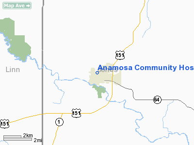
Anamosa Community Hospital Heliport |
Location
& QuickFacts
|
FAA Information Effective: |
2007-07-05 |
|
Airport
Identifier: |
IA39 |
|
Airport
Status: |
Operational |
|
Longitude/Latitude: |
091-17-17.5740W/42-06-46.0120N
-91.288215/42.112781 (Estimated) |
|
Elevation: |
880 ft / 268.22 m (Estimated) |
|
Land: |
0
acres |
|
From
nearest city: |
0 nautical miles N of Anamosa, IA |
|
Location: |
Jones County, IA |
|
Magnetic Variation: |
02E (1990) |
Owner
& Manager
|
Ownership: |
Privately owned |
|
Owner: |
Anamosa Community Hospital |
|
Address: |
104 Broadway Place
Anamosa, IA 52205 |
|
Phone number: |
319-462-6131 |
|
Manager: |
Margaret Robinson, Admin |
|
Address: |
104 Broadway Place
Anamosa, IA 52205 |
|
Phone number: |
319-462-6131 |
Airport
Operations and Facilities
|
Airport Use: |
Private
MEDICAL USE. |
|
Wind
indicator: |
Yes |
|
Segmented
Circle: |
No |
|
Control
Tower: |
No |
|
Sectional
chart: |
Chicago |
|
Region: |
ACE - Central |
|
Boundary
ARTCC: |
ZAU - Chicago |
|
Tie-in
FSS: |
FOD - Fort Dodge |
|
FSS
on Airport: |
No |
|
FSS
Phone: |
515-955-8114 |
|
FSS
Toll Free: |
1-800-WX-BRIEF |
|
Runway Information
Helipad H1
|
Dimension: |
174 x 117 ft / 53.0 x 35.7 m |
|
Surface: |
CONC, |
|
|
Runway H1 |
Runway |
|
Traffic
Pattern: |
Left |
Left |
|
Radio Navigation
Aids
|
ID |
Type |
Name |
Ch |
Freq |
Var |
Dist |
|
MXO |
NDB |
Monticello |
|
397.00 |
01E |
8.6 nm |
|
OQW |
NDB |
Maquoketa |
|
386.00 |
02E |
24.7 nm |
|
VTI |
NDB |
Garrison |
|
338.00 |
03E |
33.3 nm |
|
IIB |
NDB |
Wapsie |
|
206.00 |
02E |
35.8 nm |
|
OLZ |
NDB |
Oelwein |
|
260.00 |
02E |
46.0 nm |
|
CWI |
NDB |
Clinton |
|
377.00 |
01E |
46.2 nm |
|
TZT |
NDB |
Belle Plaine |
|
371.00 |
02E |
46.5 nm |
|
CID |
VOR/DME |
Cedar Rapids |
088X |
114.10 |
05E |
26.0 nm |
|
DDD |
VOR/DME |
Port City |
112X |
116.50 |
01E |
45.3 nm |
|
DBQ |
VORTAC |
Dubuque |
105X |
115.80 |
04E |
31.1 nm |
|
IOW |
VORTAC |
Iowa City |
109X |
116.20 |
05E |
38.5 nm |
|
CVA |
VORTAC |
Davenport |
085X |
113.80 |
04E |
43.4 nm |
|
DVN |
VOT |
Davenport Municipal |
|
111.80 |
|
43.6 nm |
Remarks
- OBSTRUCTIONS
CAUSE INADQUATE INGRESS/EGRESS ROUTES; THERE ARE NO FORCED LNDG AREAS
AVAILABLE.
Anamosa Community Hospital Heliport
Address:
Jones County, IA
Tel:
319-462-6131
Images
and information placed above are from
http://www.airport-data.com/airport/IA39/
We
thank them for the data!
| General
Info |
| Country |
United
States |
| State |
IOWA
|
| FAA ID |
IA39
|
| Latitude |
42-06-46.012N
|
| Longitude |
091-17-17.574W
|
| Elevation |
880 feet
|
| Near City |
ANAMOSA
|
We don't guarantee the information is fresh and accurate. The data may
be wrong or outdated.
For more up-to-date information please refer to other sources.
|
|


