 |
|
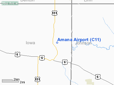
Location
& QuickFacts
|
FAA Information Effective: |
2007-07-05 |
|
Airport
Identifier: |
C11 |
|
Airport
Status: |
Operational |
|
Longitude/Latitude: |
091-51-53.1800W/41-47-36.9000N
-91.864772/41.793583 (Estimated) |
|
Elevation: |
712 ft / 217.02 m (Surveyed) |
|
Land: |
10
acres |
|
From
nearest city: |
0 nautical miles SE of Amana, IA |
|
Location: |
Iowa County, IA |
|
Magnetic Variation: |
03E (1985) |
Owner
& Manager
|
Ownership: |
Privately owned |
|
Owner: |
Thompson Aero, Inc |
|
Address: |
950 48 Th Ave
Amana, IA 52203 |
|
Phone number: |
319-622-3251 |
|
Manager: |
John D. Thompson |
|
Address: |
950 48 Th Ave
Amana, IA 52203 |
|
Phone number: |
319-622-3251 |
Airport
Operations and Facilities
|
Airport Use: |
Open to public |
|
Wind
indicator: |
Yes |
|
Segmented
Circle: |
No |
|
Control
Tower: |
No |
|
Landing
fee charge: |
No |
|
Sectional
chart: |
Chicago |
|
Region: |
ACE - Central |
|
Boundary
ARTCC: |
ZAU - Chicago |
|
Tie-in
FSS: |
FOD - Fort Dodge |
|
FSS
on Airport: |
No |
|
FSS
Phone: |
515-955-8114 |
|
FSS
Toll Free: |
1-800-WX-BRIEF |
|
NOTAMs
Facility: |
FOD (NOTAM-d service avaliable) |
Airport
Communications
|
Runway Information
Runway 08/26
|
Dimension: |
2600 x 95 ft / 792.5 x 29.0 m |
|
Surface: |
TURF, Good Condition |
|
|
Runway 08 |
Runway 26 |
|
Traffic
Pattern: |
Left |
Left |
|
Obstruction: |
34 ft pline, 1575.0 ft from runway, 46:1 slope
to clear |
22 ft tree, 825.0 ft from runway, 85 ft left
of centerline, 37:1 slope to clear |
|
Radio Navigation
Aids
|
ID |
Type |
Name |
Ch |
Freq |
Var |
Dist |
|
TZT |
NDB |
Belle Plaine |
|
371.00 |
02E |
19.5 nm |
|
VTI |
NDB |
Garrison |
|
338.00 |
03E |
26.7 nm |
|
AWG |
NDB |
Washington |
|
219.00 |
02E |
32.1 nm |
|
GGI |
NDB |
Grinnell |
|
248.00 |
02E |
39.1 nm |
|
IIB |
NDB |
Wapsie |
|
206.00 |
02E |
39.8 nm |
|
MXO |
NDB |
Monticello |
|
397.00 |
01E |
40.7 nm |
|
OOA |
NDB |
Oskaloosa |
|
414.00 |
03E |
44.2 nm |
|
FFL |
NDB |
Fairfield |
|
332.00 |
03E |
47.4 nm |
|
CID |
VOR/DME |
Cedar Rapids |
088X |
114.10 |
05E |
6.7 nm |
|
DDD |
VOR/DME |
Port City |
112X |
116.50 |
01E |
41.2 nm |
|
IOW |
VORTAC |
Iowa City |
109X |
116.20 |
05E |
20.0 nm |
Remarks
- DITCHES
AT RY EDGES.
- TREES
BOTH SIDES OF APPROACH TO RY 26 END PENETRATE THE TRANSITIONAL SFC.
TREE
GROVES NORTH OF RY 08/26 PENETRATE THE TRANSITIONAL SFC.
- ARPT
CLSD FM FIRST SNOW FALL TO EARLY SPRING.
- LNDG
FEE.
- PRVDD
APCHS MAINTD FOR A MINIMUM 20:1 GLIDE SLOPE; TRSNL SFC MAINTD FOR A
7:1 SLOPE; AND GRVL ROAD WHICH CROSSES RWY IS CLSD AND BARRICADED TO
PROHIBIT UNAUTHORIZED CROSSING AND ACCESS TO RWY.
Based
Aircraft
|
Aircraft
based on field: |
3 |
|
Single
Engine Airplanes: |
3 |
Operational Statistics
Time Period: 2003-07-23
- 2004-07-21
|
Aircraft
Operations: |
32/Week |
|
General
Aviation Local: |
73.6% |
|
General
Aviation Itinerant: |
24.5% |
|
Military: |
1.8% |
Amana Airport
Address:
Iowa County, IA
Tel:
319-622-3251
Images
and information placed above are from
http://www.airport-data.com/airport/C11/
We
thank them for the data!
| General
Info |
| Country |
United
States |
| State |
IOWA
|
| FAA ID |
C11
|
| Latitude |
41-47-45.025N
|
| Longitude |
091-52-15.640W
|
| Elevation |
712 feet
|
| Near City |
AMANA
|
We don't guarantee the information is fresh and accurate. The data may
be wrong or outdated.
For more up-to-date information please refer to other sources.
|
|


