 |
|
|
|
|
|
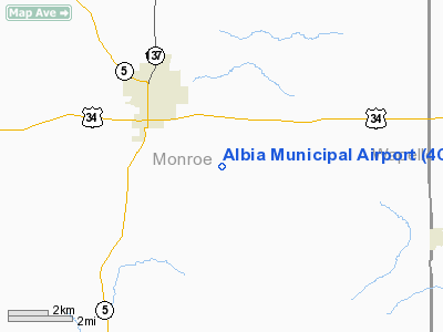
Location
& QuickFacts
|
FAA Information Effective: |
2007-07-05 |
|
Airport
Identifier: |
4C8 |
|
Airport
Status: |
Operational |
|
Longitude/Latitude: |
092-45-46.6990W/40-59-40.0330N
-92.762972/40.994454 (Estimated) |
|
Elevation: |
963 ft / 293.52 m (Surveyed) |
|
Land: |
63
acres |
|
From
nearest city: |
3 nautical miles SE of Albia, IA |
|
Location: |
Monroe County, IA |
|
Magnetic Variation: |
02E (2000) |
Owner
& Manager
|
Ownership: |
Publicly owned |
|
Owner: |
City Of Albia |
|
Address: |
City Hall 120 South A St
Albia, IA 52531 |
|
Phone
number: |
641-932-2129 |
|
Manager: |
Linda Roarda |
|
Address: |
City Hall 120 South A St
Albia, IA 52531 |
|
Phone number: |
641-932-2129 |
Airport
Operations and Facilities
|
Airport Use: |
Open to public |
|
Wind
indicator: |
Yes |
|
Segmented
Circle: |
No |
|
Control
Tower: |
No |
|
Lighting
Schedule: |
DUSK-DAWN |
|
Beacon
Color: |
Clear-Green (lighted land airport) |
|
Landing
fee charge: |
No |
|
Sectional
chart: |
Chicago |
|
Region: |
ACE - Central |
|
Boundary
ARTCC: |
ZAU - Chicago |
|
Tie-in
FSS: |
FOD - Fort Dodge |
|
FSS
on Airport: |
No |
|
FSS
Phone: |
515-955-8114 |
|
FSS
Toll Free: |
1-800-WX-BRIEF |
|
NOTAMs
Facility: |
FOD (NOTAM-d service avaliable) |
|
Federal Agreements: |
NY1 |
Airport
Communications
|
CTAF: |
122.800 |
|
Unicom: |
122.800 |
Airport
Services
|
Fuel available: |
100LL |
|
Bottled
Oxygen: |
NONE |
|
Runway Information
Runway 13/31
|
Dimension: |
3400 x 60 ft / 1036.3 x 18.3 m |
|
Surface: |
ASPH, Fair Condition |
|
Weight
Limit: |
Single wheel: 15000 lbs. |
|
Edge
Lights: |
Medium |
|
|
Runway 13 |
Runway 31 |
|
Longitude: |
092-46-13.7646W |
092-45-39.2105W |
|
Latitude: |
40-59-57.0792N |
40-59-36.0392N |
|
Elevation: |
958.00
ft |
964.00
ft |
|
Alignment: |
127 |
127 |
|
Traffic
Pattern: |
Left |
Left |
|
Markings: |
Non-precision instrument, Fair Condition |
Non-precision instrument, Fair Condition |
|
Obstruction: |
30 ft pline, 1317.0 ft from runway, 199 ft
left of centerline, 37:1 slope to clear |
70 ft tree, 1900.0 ft from runway, 210 ft right
of centerline, 20:1 slope to clear |
|
Radio Navigation
Aids
|
ID |
Type |
Name |
Ch |
Freq |
Var |
Dist |
|
OOA |
NDB |
Oskaloosa |
|
414.00 |
03E |
18.7 nm |
|
TVK |
NDB |
Centerville |
|
290.00 |
04E |
19.5 nm |
|
BEX |
NDB |
Bloomfield |
|
269.00 |
02E |
21.3 nm |
|
OXV |
NDB |
Knoxville |
|
284.00 |
03E |
24.1 nm |
|
PEA |
NDB |
Pella |
|
257.00 |
02E |
26.0 nm |
|
CNC |
NDB |
Chariton |
|
335.00 |
05E |
27.2 nm |
|
FFL |
NDB |
Fairfield |
|
332.00 |
03E |
35.1 nm |
|
GGI |
NDB |
Grinnell |
|
248.00 |
02E |
43.0 nm |
|
OTM |
VOR/DME |
Ottumwa |
053X |
111.60 |
06E |
19.9 nm |
|
TNU |
VOR/DME |
Newton |
072X |
112.50 |
03E |
49.9 nm |
|
DSM |
VORTAC |
Des Moines |
122X |
117.50 |
07E |
48.1 nm |
Remarks
Based
Aircraft
|
Aircraft
based on field: |
10 |
|
Single
Engine Airplanes: |
8 |
|
Multi
Engine Airplanes: |
2 |
Operational Statistics
Time Period: 2005-05-19
- 2006-05-18
|
Aircraft
Operations: |
85/Week |
|
General
Aviation Local: |
43.2% |
|
General
Aviation Itinerant: |
56.8% |
Albia Municipal Airport
Address:
Monroe County, IA
Tel:
641-932-2129
Images
and information placed above are from
http://www.airport-data.com/airport/4C8/
We
thank them for the data!
| General
Info |
| Country |
United
States |
| State |
IOWA
|
| FAA ID |
4C8
|
| Latitude |
40-59-40.033N
|
| Longitude |
092-45-46.699W
|
| Elevation |
963 feet
|
| Near City |
ALBIA
|
We don't guarantee the information is fresh and accurate. The data may
be wrong or outdated.
For more up-to-date information please refer to other sources.
|
|


