 |
|
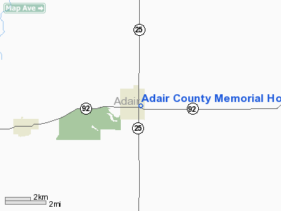
Adair County Memorial Hospital Heliport |
Location
& QuickFacts
|
FAA Information Effective: |
2007-07-05 |
|
Airport Identifier: |
75IA |
|
Airport Status: |
Operational |
|
Longitude/Latitude: |
094-27-03.6000W/41-18-14.3000N
-94.451000/41.303972 (Estimated) |
|
Elevation: |
1310 ft / 399.29 m (Estimated) |
|
Land: |
0 acres |
|
From nearest city: |
0 nautical miles N of Greenfield, IA |
|
Location: |
Adair County, IA |
|
Magnetic Variation: |
() |
Owner
& Manager
|
Ownership: |
Privately owned |
|
Owner: |
Adair County Memorial Hospital |
|
Address: |
609 Se Kent
Greenfield, IA 50849 |
|
Manager: |
Adair County Memorial Hospital |
|
Address: |
609 Se Kent
Greenfield, IA 50849 |
Airport
Operations and Facilities
|
Airport Use: |
Private
MEDICAL USE. |
|
Control
Tower: |
No |
|
Region: |
ACE - Central |
|
Boundary
ARTCC: |
ZMP - Minneapolis |
|
Tie-in
FSS: |
FOD - Fort Dodge |
|
FSS
Phone: |
515-955-8114 |
|
FSS
Toll Free: |
1-800-WX-BRIEF |
|
Runway Information
Helipad H1
|
Dimension: |
40 x 40 ft / 12.2 x 12.2 m |
|
Surface: |
CONC, |
|
|
Runway H1 |
Runway |
|
Traffic
Pattern: |
Left |
Left |
|
Radio Navigation
Aids
|
ID |
Type |
Name |
Ch |
Freq |
Var |
Dist |
|
GFZ |
NDB |
Greenfield |
|
338.00 |
04E |
1.3 nm |
|
UNE |
NDB |
Union County |
|
379.00 |
04E |
21.4 nm |
|
GCT |
NDB |
Guthrie Center |
|
518.00 |
05E |
22.7 nm |
|
CRZ |
NDB |
Corning |
|
278.00 |
04E |
23.1 nm |
|
AIO |
NDB |
Atlantic |
|
365.00 |
04E |
27.5 nm |
|
ADU |
NDB |
Audubon |
|
266.00 |
04E |
31.1 nm |
|
PRO |
NDB |
Perry |
|
251.00 |
06E |
34.2 nm |
|
RDK |
NDB |
Red Oak |
|
230.00 |
04E |
40.2 nm |
|
EFW |
NDB |
Jefferson |
|
391.00 |
03E |
42.9 nm |
|
HNR |
NDB |
Harlan |
|
272.00 |
05E |
43.4 nm |
|
ICL |
NDB |
Clarinda |
|
353.00 |
04E |
43.4 nm |
|
IKV |
NDB |
Ankeny |
|
275.00 |
03E |
46.5 nm |
|
CIN |
NDB |
Carroll |
|
397.00 |
04E |
47.0 nm |
|
DSM |
VORTAC |
Des Moines |
122X |
117.50 |
07E |
37.1 nm |
|
LMN |
VORTAC |
Lamoni |
114X |
116.70 |
07E |
47.8 nm |
|
DSM |
VOT |
Des Moines |
|
109.20 |
|
37.8 nm |
Remarks
- OWNERS
DESIRE HELIPORT NOT BE CHARTED.
Adair County Memorial Hospital Heliport
Address:
Adair County, IA
Tel:
Images
and information placed above are from
http://www.airport-data.com/airport/75IA/
We
thank them for the data!
We don't guarantee the information is fresh and accurate. The data may
be wrong or outdated.
For more up-to-date information please refer to other sources.
|
|


