 |
|
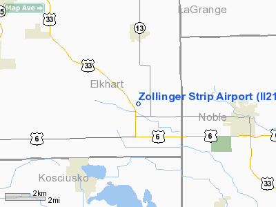
Location & QuickFacts
|
FAA
Information Effective: |
2008-06-05 |
|
Airport
Identifier: |
II21 |
| Airport
Status: |
Operational |
|
Longitude/Latitude: |
085-41-40.9570W/41-28-31.1760N
-85.694710/41.475327 (Estimated) |
|
Elevation: |
860
ft / 262.13 m (Estimated) |
|
Land: |
4 acres |
| From
nearest city: |
5
nautical miles W of Ligonier, IN |
|
Location: |
Elkhart County, IN |
|
Magnetic Variation: |
03W
(1985) |
Owner
& Manager
|
Ownership: |
Privately
owned |
|
Owner: |
Adrian
G. Zollinger |
|
Address: |
Cr 148 Nr. 12030
Ligonier, IN 46767 |
|
Phone number: |
219-894-3450 |
|
Manager: |
Adrian G. Zollinger |
|
Address: |
Cr
148 Nr. 12030
Ligonier, IN 46767 |
|
Phone
number: |
219-894-3450 |
Airport Operations and Facilities
|
Airport
Use: |
Private |
|
Wind indicator: |
Yes |
|
Segmented Circle: |
No |
|
Control
Tower: |
No |
| Landing
fee charge: |
No |
|
Sectional
chart: |
Chicago |
| Region: |
AGL
- Great Lakes |
|
Boundary
ARTCC: |
ZAU - Chicago |
| Tie-in
FSS: |
HUF
- Terre Haute |
|
FSS on Airport: |
No |
| FSS
Toll Free: |
1-800-WX-BRIEF |
|
Runway Information
Runway 09/27
|
Dimension: |
2000 x 75 ft
/ 609.6 x 22.9 m |
| Surface: |
TURF,
|
|
|
Runway 09 |
Runway 27 |
|
Traffic Pattern: |
Left |
Left |
|
Obstruction: |
18
ft pline |
|
|
Radio Navigation Aids
|
ID |
Type |
Name |
Ch |
Freq |
Var |
Dist |
| IRS |
NDB |
Sturgis |
|
382.00 |
04W |
23.4
nm |
|
ANQ |
NDB |
Angola |
|
347.00 |
05W |
29.1 nm |
| HAI |
NDB |
Three
Rivers |
|
407.00 |
02W |
29.4
nm |
|
RCR |
NDB |
Rochester |
|
216.00 |
03W |
33.3 nm |
| CPB |
NDB |
Culver |
|
391.00 |
01W |
34.8
nm |
|
HHG |
NDB |
Huntington |
|
417.00 |
03W |
38.7 nm |
| IWH |
NDB |
Wabash |
|
329.00 |
03W |
43.0
nm |
|
RWN |
NDB |
Winamac/dcmsnd |
|
335.00 |
00W |
47.1 nm |
| IUL |
NDB |
La
Porte |
|
356.00 |
03W |
48.5
nm |
|
OLK |
VOR |
Wolf Lake |
|
110.40 |
03W |
16.4 nm |
| OXI |
VOR/DME |
Knox |
103X |
115.60 |
00E |
44.0
nm |
|
ELX |
VOR/DME |
Keeler |
113X |
116.60 |
00E |
44.6 nm |
| AZO |
VOR/DME |
Kalamazoo |
027X |
109.00 |
01W |
46.2
nm |
|
GSH |
VORTAC |
Goshen |
084X |
113.70 |
00E |
15.3 nm |
| GIJ |
VORTAC |
Gipper |
101X |
115.40 |
00E |
33.1
nm |
|
FWA |
VORTAC |
Fort Wayne |
125X |
117.80 |
00E |
37.6 nm |
| FWA |
VOT |
Fort
Wayne Baer |
|
111.00 |
|
37.6
nm |
Based Aircraft
|
Aircraft
based on field: |
10 |
|
Single Engine Airplanes: |
7 |
| Ultralights: |
3 |
Zollinger Strip Airport
Address:
Elkhart County, IN
Tel:
219-894-3450
Images
and information placed above are from
http://www.airport-data.com/airport/II21/
We
thank them for the data!
| General
Info |
| Country |
United
States |
| State |
INDIANA
|
| FAA ID |
II21 |
| Latitude |
41-28-31.176N
|
| Longitude |
085-41-40.957W
|
| Elevation |
860 feet
|
| Near City |
LIGONIER
|
We don't guarantee the information is fresh and accurate. The data may
be wrong or outdated.
For more up-to-date information please refer to other sources.
|
|


