 |
|
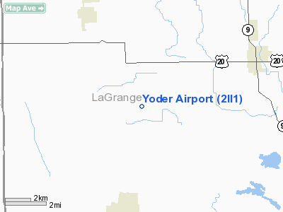
Location & QuickFacts
|
FAA
Information Effective: |
2008-06-05 |
|
Airport
Identifier: |
2II1 |
| Airport
Status: |
Operational |
|
Longitude/Latitude: |
085-31-31.9400W/41-36-35.1800N
-85.525539/41.609772 (Estimated) |
|
Elevation: |
905
ft / 275.84 m (Estimated) |
|
Land: |
0 acres |
| From
nearest city: |
1
nautical miles E of Emma, IN |
|
Location: |
Lagrange County, IN |
|
Magnetic Variation: |
03W
(1990) |
Owner
& Manager
|
Ownership: |
Privately
owned |
|
Owner: |
Tim
Yoder |
|
Address: |
5130 W 200 St
Topeka, IN 46571 |
|
Phone number: |
219-593-2963 |
|
Address: |
|
Airport Operations and Facilities
|
Airport
Use: |
Private |
|
Wind indicator: |
Yes |
|
Segmented Circle: |
No |
|
Control
Tower: |
No |
|
Sectional chart: |
Chicago |
|
Region: |
AGL - Great Lakes |
| Boundary
ARTCC: |
ZAU
- Chicago |
|
Tie-in FSS: |
HUF - Terre Haute |
| FSS
Toll Free: |
1-800-WX-BRIEF |
|
Runway Information
Runway 09/27
|
Dimension: |
1000 x 30 ft
/ 304.8 x 9.1 m |
| Surface: |
TURF,
|
|
|
Runway 09 |
Runway 27 |
|
Traffic Pattern: |
Right |
Right |
|
Obstruction: |
|
64
ft bldgs |
|
Radio Navigation Aids
|
ID |
Type |
Name |
Ch |
Freq |
Var |
Dist |
| IRS |
NDB |
Sturgis |
|
382.00 |
04W |
12.9
nm |
|
ANQ |
NDB |
Angola |
|
347.00 |
05W |
19.8 nm |
| HAI |
NDB |
Three
Rivers |
|
407.00 |
02W |
21.2
nm |
|
RCR |
NDB |
Rochester |
|
216.00 |
03W |
44.4 nm |
| CPB |
NDB |
Culver |
|
391.00 |
01W |
45.4
nm |
|
HHG |
NDB |
Huntington |
|
417.00 |
03W |
45.4 nm |
| BT |
NDB |
Batol |
|
272.00 |
04W |
47.7
nm |
|
BYN |
NDB |
Bryan |
|
260.00 |
04W |
48.3 nm |
| OLK |
VOR |
Wolf
Lake |
|
110.40 |
03W |
21.8
nm |
|
AZO |
VOR/DME |
Kalamazoo |
027X |
109.00 |
01W |
37.7 nm |
| ELX |
VOR/DME |
Keeler |
113X |
116.60 |
00E |
41.8
nm |
|
LFD |
VOR/DME |
Litchfield |
049X |
111.20 |
05W |
43.6 nm |
| GSH |
VORTAC |
Goshen |
084X |
113.70 |
00E |
23.2
nm |
|
GIJ |
VORTAC |
Gipper |
101X |
115.40 |
00E |
36.8 nm |
| FWA |
VORTAC |
Fort
Wayne |
125X |
117.80 |
00E |
40.9
nm |
|
BTL |
VORTAC |
Battle Creek |
031X |
109.40 |
02W |
43.8 nm |
| FWA |
VOT |
Fort
Wayne Baer |
|
111.00 |
|
40.9
nm |
Remarks
- OBS
REMOVED/LOWERED OR THRS DSPLCD TO PRVD 20:1 SLOPES; AREA 125' EITHER
SIDE OF CNTRLN & 200' EITHER END BE CLEAR OF OBS.
Based Aircraft
|
Aircraft
based on field: |
2 |
|
Single Engine Airplanes: |
1 |
| Ultralights: |
1 |
Yoder Airport
Address:
Lagrange County, IN
Tel:
219-593-2963
Images
and information placed above are from
http://www.airport-data.com/airport/2II1/
We
thank them for the data!
| General
Info |
| Country |
United
States |
| State |
INDIANA
|
| FAA ID |
2II1 |
| Latitude |
41-36-35.180N
|
| Longitude |
085-31-31.940W
|
| Elevation |
905 feet
|
| Near City |
EMMA |
We don't guarantee the information is fresh and accurate. The data may
be wrong or outdated.
For more up-to-date information please refer to other sources.
|
|


