 |
|
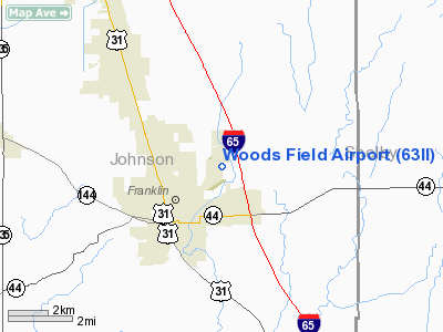
Location & QuickFacts
|
FAA
Information Effective: |
2008-06-05 |
|
Airport
Identifier: |
63II |
| Airport
Status: |
Operational |
|
Longitude/Latitude: |
086-01-48.9450W/39-30-18.1800N
-86.030263/39.505050 (Estimated) |
|
Elevation: |
750
ft / 228.60 m (Estimated) |
|
Land: |
0 acres |
| From
nearest city: |
1
nautical miles NE of Franklin, IN |
|
Location: |
Johnson County, IN |
|
Magnetic Variation: |
02W
(1990) |
Owner
& Manager
|
Ownership: |
Privately
owned |
|
Owner: |
William
G. Woods |
|
Address: |
Rr 2 Box 165
Franklin, IN 46131 |
|
Phone number: |
317-738-2520 |
|
Manager: |
William G. Woods |
|
Address: |
Rr
2 Box 165
Franklin, IN 46131 |
|
Phone
number: |
317-738-2520 |
Airport Operations and Facilities
|
Airport
Use: |
Private |
|
Wind indicator: |
Yes |
|
Segmented Circle: |
No |
|
Control
Tower: |
No |
|
Sectional chart: |
St
Louis |
|
Region: |
AGL - Great Lakes |
| Boundary
ARTCC: |
ZID
- Indianapolis |
|
Tie-in FSS: |
HUF - Terre Haute |
| FSS
Toll Free: |
1-800-WX-BRIEF |
|
Runway Information
Runway 18/36
|
Dimension: |
1650 x 75 ft
/ 502.9 x 22.9 m |
| Surface: |
TURF,
|
|
|
Runway 18 |
Runway 36 |
|
Traffic Pattern: |
Left |
Left |
|
Radio Navigation Aids
|
ID |
Type |
Name |
Ch |
Freq |
Var |
Dist |
| HFY |
NDB |
Greenwood |
|
398.00 |
02W |
8.2
nm |
|
BA |
NDB |
Clifs |
|
410.00 |
03W |
14.8 nm |
| UMP |
NDB |
Metropolitan |
|
338.00 |
03W |
26.0
nm |
|
HZP |
NDB |
Zionsville |
|
248.00 |
03W |
28.0 nm |
| OVO |
NDB |
North
Vernon |
|
374.00 |
02W |
33.9
nm |
|
HLB |
NDB |
Batesville |
|
254.00 |
02W |
37.1 nm |
| BM |
NDB |
Claye |
|
382.00 |
02W |
37.8
nm |
|
TVX |
NDB |
Greencastle |
|
521.00 |
03W |
38.1 nm |
| EQZ |
NDB |
Captain |
|
308.00 |
02W |
38.4
nm |
|
UWL |
NDB |
New Castle |
|
385.00 |
02W |
39.9 nm |
| AI |
NDB |
Video |
|
371.00 |
03W |
41.6
nm |
|
BFR |
NDB |
Bedford |
|
344.00 |
02W |
44.3 nm |
| CFJ |
NDB |
Crawfordsville |
|
388.00 |
02W |
49.9
nm |
|
SHB |
VORTAC |
Shelbyville |
057X |
112.00 |
01E |
12.2 nm |
| VHP |
VORTAC |
Brickyard |
110X |
116.30 |
01E |
24.3
nm |
|
OOM |
VORTAC |
Hoosier |
039X |
110.20 |
02W |
34.7 nm |
| IND |
VOT |
Indianapolis
Intl |
|
109.60 |
|
17.6
nm |
Remarks
- PRVDD
ANY OBSTN IN RY APCH SLOPE ARE REMOVED/LOWERED OR RY THR IS DSPLCD &
CLEARLY MKD TO PRVD A 20:1 APCH CLNC OVER OBSTN OR ELSE OPERATE PER
YOUR LTR OF 9/13/90 REGARDING OBSTNS & THE AREA 125 FT EITHER SIDE
OF RY CNTRLN BE CLEAR OF ANY OBSTNS.
Based Aircraft
|
Aircraft
based on field: |
1 |
|
Single Engine Airplanes: |
1 |
Woods Field Airport
Address:
Johnson County, IN
Tel:
317-738-2520
Images
and information placed above are from
http://www.airport-data.com/airport/63II/
We
thank them for the data!
| General
Info |
| Country |
United
States |
| State |
INDIANA
|
| FAA ID |
63II |
| Latitude |
39-30-18.180N
|
| Longitude |
086-01-48.945W
|
| Elevation |
750 feet
|
| Near City |
FRANKLIN
|
We don't guarantee the information is fresh and accurate. The data may
be wrong or outdated.
For more up-to-date information please refer to other sources.
|
|


