 |
|
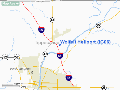
Location & QuickFacts
|
FAA
Information Effective: |
2008-06-05 |
|
Airport
Identifier: |
IG06 |
| Airport
Status: |
Operational |
|
Longitude/Latitude: |
086-51-07.0000W/40-29-17.0000N
-86.851944/40.488056 (Estimated) |
|
Elevation: |
560
ft / 170.69 m (Estimated) |
|
Land: |
0 acres |
| From
nearest city: |
3
nautical miles N of Lafayette, IN |
|
Location: |
Tippecanoe County, IN |
|
Magnetic Variation: |
02W
(1995) |
Owner & Manager
|
Ownership: |
Privately
owned |
| Owner: |
Gary
H. Wolfelt |
|
Address: |
5009 Swisher Road
West Lafayette, IN 47906 |
| Phone
number: |
317-423-1382 |
|
Manager: |
Gary H. Wolfelt |
| Address: |
5009
Swisher Road
West Lafayette, IN 47906 |
|
Phone
number: |
317-423-1382 |
Airport
Operations and Facilities
|
Airport
Use: |
Private |
|
Wind indicator: |
Yes |
|
Segmented Circle: |
No |
|
Control
Tower: |
No |
|
Sectional chart: |
Chicago |
|
Region: |
AGL - Great Lakes |
| Boundary
ARTCC: |
ZAU
- Chicago |
|
Tie-in FSS: |
HUF - Terre Haute |
| FSS
on Airport: |
No |
|
FSS Toll
Free: |
1-800-WX-BRIEF |
|
Runway Information
Helipad H1
|
Dimension: |
130 x 130 ft
/ 39.6 x 39.6 m |
|
Surface: |
TURF, |
|
|
Runway H1 |
Runway |
| Traffic
Pattern: |
Left |
Left |
|
Radio Navigation Aids
|
ID |
Type |
Name |
Ch |
Freq |
Var |
Dist |
| MCX |
NDB |
White
County |
|
377.00 |
03W |
14.0
nm |
|
FKR |
NDB |
Frankfort |
|
278.00 |
02W |
18.6 nm |
| GGP |
NDB |
Logansport |
|
263.00 |
01W |
25.6
nm |
|
CFJ |
NDB |
Crawfordsville |
|
388.00 |
02W |
30.6 nm |
| RZL |
NDB |
Rensselaer |
|
362.00 |
02W |
31.5
nm |
|
RWN |
NDB |
Winamac/dcmsnd |
|
335.00 |
00W |
38.1 nm |
| HZP |
NDB |
Zionsville |
|
248.00 |
03W |
43.0
nm |
|
RCR |
NDB |
Rochester |
|
216.00 |
03W |
45.9 nm |
| TVX |
NDB |
Greencastle |
|
521.00 |
03W |
46.6
nm |
|
CPB |
NDB |
Culver |
|
391.00 |
01W |
48.7 nm |
| UMP |
NDB |
Metropolitan |
|
338.00 |
03W |
49.5
nm |
|
BVT |
VORTAC |
Boiler |
098X |
115.10 |
01E |
10.7 nm |
| GUS |
VORTAC |
Grissom |
21Y |
108.45 |
02W |
33.3
nm |
|
DNV |
VORTAC |
Danville |
047X |
111.00 |
02E |
34.3 nm |
| OKK |
VORTAC |
Kokomo |
082X |
113.50 |
00E |
36.4
nm |
|
VHP |
VORTAC |
Brickyard |
110X |
116.30 |
01E |
46.2 nm |
Based Aircraft
|
Aircraft
based on field: |
1 |
|
Helicopters: |
1 |
Wolfelt Heliport
Address:
Tippecanoe County, IN
Tel:
317-423-1382
Images
and information placed above are from
http://www.airport-data.com/airport/IG06/
We
thank them for the data!
| General
Info |
| Country |
United
States |
| State |
INDIANA
|
| FAA ID |
IG06 |
| Latitude |
40-29-17.000N
|
| Longitude |
086-51-07.000W
|
| Elevation |
560 feet
|
| Near City |
LAFAYETTE
|
We don't guarantee the information is fresh and accurate. The data may
be wrong or outdated.
For more up-to-date information please refer to other sources.
|
|


