 |
|
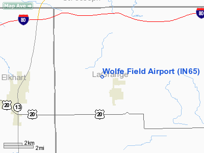
Location & QuickFacts
|
FAA
Information Effective: |
2008-06-05 |
|
Airport
Identifier: |
IN65 |
| Airport
Status: |
Operational |
|
Longitude/Latitude: |
085-35-43.9500W/41-41-29.1810N
-85.595542/41.691439 (Estimated) |
|
Elevation: |
896
ft / 273.10 m (Surveyed) |
|
Land: |
12 acres |
| From
nearest city: |
1
nautical miles NW of Shipshewana, IN |
|
Location: |
Lagrange County, IN |
|
Magnetic Variation: |
03W
(1985) |
Owner
& Manager
|
Ownership: |
Privately
owned |
|
Owner: |
Shipshewana
Air Assoc |
|
Address: |
Shipshewana, IN 46565 |
|
Manager: |
Ralph
Lutes |
|
Address: |
8845w 350n
Shipshewana, IN 46565 |
|
Phone number: |
219-768-4058 |
Airport
Operations and Facilities
|
Airport Use: |
Private |
|
Wind indicator: |
Yes |
|
Segmented
Circle: |
No |
|
Control Tower: |
No |
|
Landing
fee charge: |
No |
|
Sectional chart: |
Chicago |
|
Region: |
AGL - Great Lakes |
|
Boundary ARTCC: |
ZAU
- Chicago |
|
Tie-in
FSS: |
HUF - Terre Haute |
|
FSS on Airport: |
No |
|
FSS Toll
Free: |
1-800-WX-BRIEF |
Airport
Services
|
Airframe
Repair: |
NONE |
|
Power
Plant Repair: |
NONE |
| Bottled
Oxygen: |
NONE |
|
Bulk Oxygen: |
NONE |
|
Runway Information
Runway 09/27
|
Dimension: |
2600 x 200 ft
/ 792.5 x 61.0 m |
|
Surface: |
TURF, |
|
|
Runway 09 |
Runway 27 |
| Traffic
Pattern: |
Left |
Left |
|
Radio Navigation Aids
|
ID |
Type |
Name |
Ch |
Freq |
Var |
Dist |
| IRS |
NDB |
Sturgis |
|
382.00 |
04W |
10.3
nm |
|
HAI |
NDB |
Three Rivers |
|
407.00 |
02W |
16.0 nm |
| ANQ |
NDB |
Angola |
|
347.00 |
05W |
23.0
nm |
|
BT |
NDB |
Batol |
|
272.00 |
04W |
44.3 nm |
| CPB |
NDB |
Culver |
|
391.00 |
01W |
45.6
nm |
|
RCR |
NDB |
Rochester |
|
216.00 |
03W |
46.2 nm |
| OLK |
VOR |
Wolf
Lake |
|
110.40 |
03W |
27.1
nm |
|
AZO |
VOR/DME |
Kalamazoo |
027X |
109.00 |
01W |
32.8 nm |
| ELX |
VOR/DME |
Keeler |
113X |
116.60 |
00E |
36.0
nm |
|
LFD |
VOR/DME |
Litchfield |
049X |
111.20 |
05W |
43.3 nm |
| GSH |
VORTAC |
Goshen |
084X |
113.70 |
00E |
21.9
nm |
|
GIJ |
VORTAC |
Gipper |
101X |
115.40 |
00E |
32.8 nm |
| BTL |
VORTAC |
Battle
Creek |
031X |
109.40 |
02W |
40.2
nm |
|
FWA |
VORTAC |
Fort Wayne |
125X |
117.80 |
00E |
46.6 nm |
| FWA |
VOT |
Fort
Wayne Baer |
|
111.00 |
|
46.6
nm |
Remarks
- HEAVY
AGRICULTUREAL AIRCRAFT ACTIVITY MAY THROUGH OCTOBER.
Based Aircraft
|
Aircraft
based on field: |
5 |
|
Single Engine Airplanes: |
5 |
Operational Statistics
|
Aircraft
Operations: |
30/Week |
|
General Aviation
Local: |
96.8% |
| General
Aviation Itinerant: |
3.2% |
Wolfe Field Airport
Address:
Lagrange County, IN
Tel:
219-768-4058
Images
and information placed above are from
http://www.airport-data.com/airport/IN65/
We
thank them for the data!
| General
Info |
| Country |
United
States |
| State |
INDIANA
|
| FAA ID |
IN65 |
| Latitude |
41-41-29.181N
|
| Longitude |
085-35-43.950W
|
| Elevation |
896 feet
|
| Near City |
SHIPSHEWANA
|
We don't guarantee the information is fresh and accurate. The data may
be wrong or outdated.
For more up-to-date information please refer to other sources.
|
|


