 |
|
Location & QuickFacts
|
FAA
Information Effective: |
2008-06-05 |
|
Airport
Identifier: |
34IN |
| Airport
Status: |
Operational |
|
Longitude/Latitude: |
085-01-04.8850W/40-20-25.1590N
-85.018024/40.340322 (Estimated) |
|
Elevation: |
1035
ft / 315.47 m (Estimated) |
|
Land: |
0 acres |
| From
nearest city: |
6
nautical miles S of Portland, IN |
|
Location: |
Jay County, IN |
|
Magnetic Variation: |
03W
(1985) |
Owner
& Manager
|
Ownership: |
Privately
owned |
|
Owner: |
David
G. Hamilton |
|
Address: |
2111 West 650 South
Portland, IN 47371 |
|
Phone number: |
219-726-2402 |
|
Manager: |
David G. Hamilton |
|
Address: |
2111
West 650 South
Portland, IN 47371 |
|
Phone
number: |
219-726-2402 |
Airport Operations and Facilities
|
Airport
Use: |
Private |
|
Wind indicator: |
Yes |
|
Segmented Circle: |
No |
|
Control
Tower: |
No |
| Landing
fee charge: |
No |
|
Sectional
chart: |
Chicago |
| Region: |
AGL
- Great Lakes |
|
Boundary
ARTCC: |
ZID - Indianapolis |
|
Responsible ARTCC: |
ZAU
- Chicago |
|
Tie-in FSS: |
HUF - Terre Haute |
| FSS
on Airport: |
No |
|
FSS Toll
Free: |
1-800-WX-BRIEF |
|
Runway Information
Runway 18/36
|
Dimension: |
2600 x 100 ft
/ 792.5 x 30.5 m |
|
Surface: |
TURF, |
|
|
Runway 18 |
Runway 36 |
| Traffic
Pattern: |
Left |
Left |
|
Radio Navigation Aids
|
ID |
Type |
Name |
Ch |
Freq |
Var |
Dist |
| PLD |
NDB |
Portland |
|
257.00 |
03W |
7.0
nm |
|
CQA |
NDB |
Lakefield |
|
205.00 |
04W |
22.4 nm |
| VES |
NDB |
Versailles |
|
356.00 |
04W |
24.1
nm |
|
AI |
NDB |
Video |
|
371.00 |
03W |
27.9 nm |
| UWL |
NDB |
New
Castle |
|
385.00 |
02W |
30.9
nm |
|
VFU |
NDB |
Stanley |
|
411.00 |
05W |
36.4 nm |
| HHG |
NDB |
Huntington |
|
417.00 |
03W |
37.1
nm |
|
IWH |
NDB |
Wabash |
|
329.00 |
03W |
43.8 nm |
| MIE |
VOR/DME |
Muncie |
091X |
114.40 |
03W |
18.3
nm |
|
MZZ |
VOR/DME |
Marion |
023X |
108.60 |
03W |
31.6 nm |
| DQN |
VOR/DME |
Dayton |
092X |
114.50 |
01W |
34.5
nm |
|
RID |
VORTAC |
Richmond |
043X |
110.60 |
03W |
36.1 nm |
| FWA |
VORTAC |
Fort
Wayne |
125X |
117.80 |
00E |
39.2
nm |
|
ROD |
VORTAC |
Rosewood |
122X |
117.50 |
05W |
44.8 nm |
| OKK |
VORTAC |
Kokomo |
082X |
113.50 |
00E |
48.9
nm |
|
FWA |
VOT |
Fort Wayne Baer |
|
111.00 |
|
39.1 nm |
| DAY |
VOT |
Dayton J M Cox-day |
|
111.00 |
|
45.2
nm |
Based Aircraft
|
Aircraft
based on field: |
1 |
|
Single Engine Airplanes: |
1 |
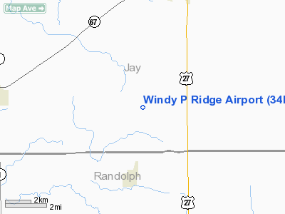
Windy P Ridge Airport
Address:
Jay County, IN
Tel:
219-726-2402
Images
and information placed above are from
http://www.airport-data.com/airport/34IN/
We
thank them for the data!
| General
Info |
| Country |
United
States |
| State |
INDIANA
|
| FAA ID |
34IN |
| Latitude |
40-20-25.159N
|
| Longitude |
085-01-04.885W
|
| Elevation |
1035 feet
|
| Near City |
PORTLAND
|
We don't guarantee the information is fresh and accurate. The data may
be wrong or outdated.
For more up-to-date information please refer to other sources.
|
|


