 |
|
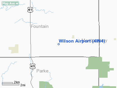
Location & QuickFacts
|
FAA
Information Effective: |
2008-06-05 |
|
Airport
Identifier: |
4IN4 |
| Airport
Status: |
Operational |
|
Longitude/Latitude: |
087-10-49.0000W/39-58-31.0000N
-87.180278/39.975278 (Estimated) |
|
Elevation: |
710
ft / 216.41 m (Estimated) |
|
Land: |
155 acres |
| From
nearest city: |
4
nautical miles E of Wallace, IN |
|
Location: |
Fountain County, IN |
|
Magnetic Variation: |
02W
(1995) |
Owner & Manager
|
Ownership: |
Privately
owned |
| Owner: |
David
S. Wilson |
|
Address: |
4264 S 430 E Rd
Kingman, IN 47952 |
| Phone
number: |
765-397-3155 |
|
Manager: |
David S. Wilson |
| Address: |
4264
S 430 E Rd
Kingman, IN 47952 |
|
Phone
number: |
765-397-3155 |
Airport
Operations and Facilities
|
Airport
Use: |
Private |
|
Wind indicator: |
Yes |
|
Segmented Circle: |
No |
|
Control
Tower: |
No |
| Lighting
Schedule: |
DUSK-DAWN |
|
Sectional
chart: |
St Louis |
| Region: |
AGL
- Great Lakes |
|
Boundary
ARTCC: |
ZAU - Chicago |
| Tie-in
FSS: |
HUF
- Terre Haute |
|
FSS Toll
Free: |
1-800-WX-BRIEF |
|
Runway Information
Runway 18/36
|
Dimension: |
2300 x 75 ft
/ 701.0 x 22.9 m |
|
Surface: |
TURF, Good Condition |
| Edge
Lights: |
Low |
|
|
Runway 18 |
Runway 36 |
|
Traffic Pattern: |
Left |
Left |
| Displaced
threshold: |
0.00
ft |
400.00
ft |
|
Obstruction: |
20 ft pline, 1300.0 ft from runway |
30 ft trees, 200.0 ft from runway |
|
Radio Navigation Aids
|
ID |
Type |
Name |
Ch |
Freq |
Var |
Dist |
| CFJ |
NDB |
Crawfordsville |
|
388.00 |
02W |
12.2
nm |
|
TVX |
NDB |
Greencastle |
|
521.00 |
03W |
23.3 nm |
| PRG |
NDB |
Paris |
|
341.00 |
01E |
28.2
nm |
|
FKR |
NDB |
Frankfort |
|
278.00 |
02W |
33.5 nm |
| HMJ |
NDB |
Homer |
|
281.00 |
01E |
35.7
nm |
|
HU |
NDB |
Yinno |
|
245.00 |
02W |
36.7 nm |
| HZP |
NDB |
Zionsville |
|
248.00 |
03W |
42.9
nm |
|
MCX |
NDB |
White County |
|
377.00 |
03W |
48.2 nm |
| DNV |
VORTAC |
Danville |
047X |
111.00 |
02E |
25.8
nm |
|
TTH |
VORTAC |
Terre Haute |
100X |
115.30 |
02E |
29.4 nm |
| BVT |
VORTAC |
Boiler |
098X |
115.10 |
01E |
35.3
nm |
|
VHP |
VORTAC |
Brickyard |
110X |
116.30 |
01E |
38.7 nm |
| IND |
VOT |
Indianapolis
Intl |
|
109.60 |
|
44.1
nm |
Remarks
- PRVDD
A CLEAR 20:1 APCH, OBSTAGLE FREE ZONE IS FREE OF OBSTNS.
Based Aircraft
|
Aircraft
based on field: |
1 |
|
Single Engine Airplanes: |
1 |
Wilson Fountain Airport
Address:
Fountain County, IN
Tel:
765-397-3155
Images
and information placed above are from
http://www.airport-data.com/airport/4IN4/
We
thank them for the data!
| General
Info |
| Country |
United
States |
| State |
INDIANA
|
| FAA ID |
4IN4 |
| Latitude |
39-58-31.000N
|
| Longitude |
087-10-49.000W
|
| Elevation |
710 feet
|
| Near City |
WALLACE
|
We don't guarantee the information is fresh and accurate. The data may
be wrong or outdated.
For more up-to-date information please refer to other sources.
|
|


