 |
|
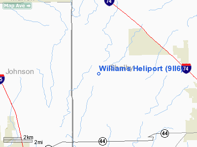
Location & QuickFacts
|
FAA
Information Effective: |
2008-06-05 |
|
Airport
Identifier: |
9II6 |
| Airport
Status: |
Operational |
|
Longitude/Latitude: |
085-55-00.0000W/39-33-53.0000N
-85.916667/39.564722 (Estimated) |
|
Elevation: |
630
ft / 192.02 m (Estimated) |
|
Land: |
0 acres |
| From
nearest city: |
0
nautical miles NW of Boggstown, IN |
|
Location: |
Shelby County, IN |
|
Magnetic Variation: |
03W
(1995) |
Owner & Manager
|
Ownership: |
Privately
owned |
| Owner: |
Neil
D Williams |
|
Address: |
2747 N Sandcreek Road
Boggstown,
IN 46110 |
| Phone
number: |
317-835-1030 |
|
Manager: |
Neil D Williams |
| Address: |
2747
N Sandcreek Road
Boggstown,
IN 46110 |
|
Phone
number: |
317-835-1030 |
Airport
Operations and Facilities
|
Airport
Use: |
Private |
|
Wind indicator: |
Yes |
|
Segmented Circle: |
No |
|
Control
Tower: |
No |
| Lighting
Schedule: |
DUSK-DAWN |
|
Sectional
chart: |
St Louis |
| Region: |
AGL
- Great Lakes |
|
Boundary
ARTCC: |
ZID - Indianapolis |
| Tie-in
FSS: |
HUF
- Terre Haute |
|
FSS on Airport: |
No |
| FSS
Toll Free: |
1-800-WX-BRIEF |
|
Runway Information
Helipad H1
|
Dimension: |
50 x 50 ft /
15.2 x 15.2 m |
| Surface: |
TURF,
|
|
|
Runway H1 |
Runway |
|
Traffic Pattern: |
Left |
Left |
|
Radio Navigation Aids
|
ID |
Type |
Name |
Ch |
Freq |
Var |
Dist |
| HFY |
NDB |
Greenwood |
|
398.00 |
02W |
9.0
nm |
|
BA |
NDB |
Clifs |
|
410.00 |
03W |
15.3 nm |
| UMP |
NDB |
Metropolitan |
|
338.00 |
03W |
23.3
nm |
|
HZP |
NDB |
Zionsville |
|
248.00 |
03W |
27.3 nm |
| HLB |
NDB |
Batesville |
|
254.00 |
02W |
33.2
nm |
|
UWL |
NDB |
New Castle |
|
385.00 |
02W |
33.5 nm |
| OVO |
NDB |
North
Vernon |
|
374.00 |
02W |
34.3
nm |
|
AI |
NDB |
Video |
|
371.00 |
03W |
35.7 nm |
| EQZ |
NDB |
Captain |
|
308.00 |
02W |
42.0
nm |
|
TVX |
NDB |
Greencastle |
|
521.00 |
03W |
42.1 nm |
| BM |
NDB |
Claye |
|
382.00 |
02W |
44.1
nm |
|
BFR |
NDB |
Bedford |
|
344.00 |
02W |
49.9 nm |
| MIE |
VOR/DME |
Muncie |
091X |
114.40 |
03W |
47.1
nm |
|
SHB |
VORTAC |
Shelbyville |
057X |
112.00 |
01E |
5.9 nm |
| VHP |
VORTAC |
Brickyard |
110X |
116.30 |
01E |
25.7
nm |
|
OOM |
VORTAC |
Hoosier |
039X |
110.20 |
02W |
41.1 nm |
| IND |
VOT |
Indianapolis
Intl |
|
109.60 |
|
19.5
nm |
Remarks
- PRVDD
ALL APCH/DEP FM 110 CLKWS TO 130 & 210 TO 310; AREA IS MKD; WIND
INDICATOR IS MAINTAINED; NO NIGHT OPS UNLESS WIND INDICATOR IS LGTD
& BCN IS INSTALLED; FIRE PROTECTION BE PRVDD.
Williams Heliport
Address:
Shelby County, IN
Tel:
317-835-1030
Images
and information placed above are from
http://www.airport-data.com/airport/9II6/
We
thank them for the data!
| General
Info |
| Country |
United
States |
| State |
INDIANA
|
| FAA ID |
9II6 |
| Latitude |
39-33-53.000N
|
| Longitude |
085-55-00.000W
|
| Elevation |
630 feet
|
| Near City |
BOGGSTOWN
|
We don't guarantee the information is fresh and accurate. The data may
be wrong or outdated.
For more up-to-date information please refer to other sources.
|
|


