 |
|
|
|
Location & QuickFacts
|
FAA
Information Effective: |
2008-06-05 |
|
Airport
Identifier: |
IN60 |
| Airport
Status: |
Operational |
|
Longitude/Latitude: |
086-09-36.9630W/40-01-04.1350N
-86.160268/40.017815 (Estimated) |
|
Elevation: |
908
ft / 276.76 m (Estimated) |
|
Land: |
0 acres |
| From
nearest city: |
2
nautical miles SW of Westfield, IN |
|
Location: |
Hamilton County, IN |
|
Magnetic Variation: |
02W
(1985) |
Owner & Manager
|
Ownership: |
Privately
owned |
| Owner: |
Joe
Ferraro |
|
Address: |
211 East 161st St
Westfield,
IN 46074 |
| Phone
number: |
317-896-3829 |
|
Manager: |
Joe Ferraro |
| Address: |
211
East 161st St
Westfield,
IN 46074 |
|
Phone
number: |
317-896-3829 |
Airport
Operations and Facilities
|
Airport
Use: |
Private |
|
Wind indicator: |
Yes |
|
Segmented Circle: |
Yes |
|
Control
Tower: |
No |
| Landing
fee charge: |
No |
|
Sectional
chart: |
St Louis |
| Region: |
AGL
- Great Lakes |
|
Boundary
ARTCC: |
ZAU - Chicago |
| Tie-in
FSS: |
HUF
- Terre Haute |
|
FSS on Airport: |
No |
| FSS
Toll Free: |
1-800-WX-BRIEF
OR LOCAL CALL 244-3316. |
Airport Services
|
Airframe
Repair: |
NONE |
|
Power
Plant Repair: |
NONE |
|
Runway Information
Runway E/W
|
Dimension: |
2500 x 100 ft
/ 762.0 x 30.5 m |
| Surface: |
TURF,
|
|
|
Runway E |
Runway W |
|
Traffic Pattern: |
Right |
Left |
|
Radio Navigation Aids
|
ID |
Type |
Name |
Ch |
Freq |
Var |
Dist |
| HZP |
NDB |
Zionsville |
|
248.00 |
03W |
6.2
nm |
|
UMP |
NDB |
Metropolitan |
|
338.00 |
03W |
7.0 nm |
| HFY |
NDB |
Greenwood |
|
398.00 |
02W |
23.4
nm |
|
FKR |
NDB |
Frankfort |
|
278.00 |
02W |
23.9 nm |
| AI |
NDB |
Video |
|
371.00 |
03W |
30.1
nm |
|
CFJ |
NDB |
Crawfordsville |
|
388.00 |
02W |
34.9 nm |
| TVX |
NDB |
Greencastle |
|
521.00 |
03W |
34.9
nm |
|
UWL |
NDB |
New Castle |
|
385.00 |
02W |
39.6 nm |
| GGP |
NDB |
Logansport |
|
263.00 |
01W |
42.7
nm |
|
BA |
NDB |
Clifs |
|
410.00 |
03W |
44.7 nm |
| IWH |
NDB |
Wabash |
|
329.00 |
03W |
47.8
nm |
|
MCX |
NDB |
White County |
|
377.00 |
03W |
49.9 nm |
| MZZ |
VOR/DME |
Marion |
023X |
108.60 |
03W |
36.1
nm |
|
MIE |
VOR/DME |
Muncie |
091X |
114.40 |
03W |
37.6 nm |
| VHP |
VORTAC |
Brickyard |
110X |
116.30 |
01E |
15.5
nm |
|
SHB |
VORTAC |
Shelbyville |
057X |
112.00 |
01E |
27.9 nm |
| OKK |
VORTAC |
Kokomo |
082X |
113.50 |
00E |
31.0
nm |
|
GUS |
VORTAC |
Grissom |
21Y |
108.45 |
02W |
37.7 nm |
| IND |
VOT |
Indianapolis
Intl |
|
109.60 |
|
18.5
nm |
Remarks
- ALL
OPERATIONS ON SOUTH SIDE OF RWY, WESTFIELD AIRPORT 9600' NORTH.
Based Aircraft
|
Aircraft
based on field: |
6 |
|
Single Engine Airplanes: |
6 |
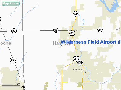
Wilderness Field Airport
Address:
Hamilton County, IN
Tel:
317-896-3829
Images
and information placed above are from
http://www.airport-data.com/airport/IN60/
We
thank them for the data!
| General
Info |
| Country |
United
States |
| State |
INDIANA
|
| FAA ID |
IN60 |
| Latitude |
40-01-04.135N
|
| Longitude |
086-09-36.963W
|
| Elevation |
908 feet
|
| Near City |
WESTFIELD
|
We don't guarantee the information is fresh and accurate. The data may
be wrong or outdated.
For more up-to-date information please refer to other sources.
|
|


