 |
|
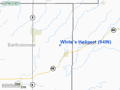
Location & QuickFacts
|
FAA
Information Effective: |
2008-06-05 |
|
Airport
Identifier: |
94IN |
| Airport
Status: |
Operational |
|
Longitude/Latitude: |
085-42-44.9300W/39-16-50.1830N
-85.712481/39.280606 (Estimated) |
|
Elevation: |
771
ft / 235.00 m (Estimated) |
|
Land: |
0 acres |
| From
nearest city: |
1
nautical miles NW of Hartsville, IN |
|
Location: |
Bartholomew County, IN |
|
Magnetic Variation: |
02W
(1985) |
Owner
& Manager
|
Ownership: |
Privately
owned |
|
Owner: |
Lloyd
White |
|
Address: |
Rr 2, Box 305
Hope, IN 47246 |
|
Phone number: |
812-372-9251 |
|
Manager: |
Lloyd White |
|
Address: |
Rr
2, Box 305
Hope, IN 47246 |
|
Phone
number: |
812-372-9251 |
Airport Operations and Facilities
|
Airport
Use: |
Private |
|
Segmented
Circle: |
No |
| Control
Tower: |
No |
|
Landing
fee charge: |
No |
|
Sectional chart: |
St
Louis |
|
Region: |
AGL - Great Lakes |
| Boundary
ARTCC: |
ZID
- Indianapolis |
|
Tie-in FSS: |
HUF - Terre Haute |
| FSS
on Airport: |
No |
|
FSS Toll
Free: |
1-800-WX-BRIEF |
|
Runway Information
Helipad H1
|
Dimension: |
310 x 150 ft
/ 94.5 x 45.7 m |
|
Surface: |
TURF, |
|
|
Runway H1 |
Runway |
| Traffic
Pattern: |
Left |
Left |
|
Radio Navigation Aids
|
ID |
Type |
Name |
Ch |
Freq |
Var |
Dist |
| BA |
NDB |
Clifs |
|
410.00 |
03W |
5.5
nm |
|
OVO |
NDB |
North Vernon |
|
374.00 |
02W |
14.8 nm |
| HLB |
NDB |
Batesville |
|
254.00 |
02W |
21.6
nm |
|
HFY |
NDB |
Greenwood |
|
398.00 |
02W |
27.5 nm |
| EQZ |
NDB |
Captain |
|
308.00 |
02W |
27.7
nm |
|
IMS |
NDB |
Madison |
|
404.00 |
03W |
33.4 nm |
| UWL |
NDB |
New
Castle |
|
385.00 |
02W |
40.4
nm |
|
UMP |
NDB |
Metropolitan |
|
338.00 |
03W |
42.5 nm |
| BFR |
NDB |
Bedford |
|
344.00 |
02W |
43.0
nm |
|
BM |
NDB |
Claye |
|
382.00 |
02W |
43.5 nm |
| OXD |
NDB |
Oxford |
|
282.00 |
04W |
45.4
nm |
|
UR |
NDB |
Burln |
|
321.00 |
04W |
46.0 nm |
| HZP |
NDB |
Zionsville |
|
248.00 |
03W |
46.8
nm |
|
AI |
NDB |
Video |
|
371.00 |
03W |
48.3 nm |
| SHB |
VORTAC |
Shelbyville |
057X |
112.00 |
01E |
21.8
nm |
|
ABB |
VORTAC |
Nabb |
071X |
112.40 |
01E |
41.7 nm |
| OOM |
VORTAC |
Hoosier |
039X |
110.20 |
02W |
42.7
nm |
|
VHP |
VORTAC |
Brickyard |
110X |
116.30 |
01E |
44.2 nm |
| RID |
VORTAC |
Richmond |
043X |
110.60 |
03W |
49.5
nm |
|
CVG |
VORTAC |
Cincinnati |
120X |
117.30 |
04W |
49.7 nm |
| IND |
VOT |
Indianapolis
Intl |
|
109.60 |
|
37.6
nm |
Remarks
- DUE
TO LACK OF OBSTRUCTION FREE INGRESS/EGRESS ROUTES.
White's Heliport
Address:
Bartholomew County, IN
Tel:
812-372-9251
Images
and information placed above are from
http://www.airport-data.com/airport/94IN/
We
thank them for the data!
| General
Info |
| Country |
United
States |
| State |
INDIANA
|
| FAA ID |
94IN |
| Latitude |
39-16-50.183N
|
| Longitude |
085-42-44.930W
|
| Elevation |
771 feet
|
| Near City |
HARTSVILLE
|
We don't guarantee the information is fresh and accurate. The data may
be wrong or outdated.
For more up-to-date information please refer to other sources.
|
|


