 |
|
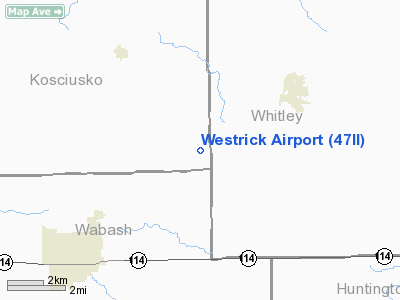
Location & QuickFacts
|
FAA
Information Effective: |
2008-06-05 |
|
Airport
Identifier: |
47II |
| Airport
Status: |
Operational |
|
Longitude/Latitude: |
085-41-25.9420W/41-03-22.1620N
-85.690539/41.056156 (Estimated) |
|
Elevation: |
800
ft / 243.84 m (Estimated) |
|
Land: |
5 acres |
| From
nearest city: |
4
nautical miles NE of Liberty Mills, IN |
|
Location: |
Kosciusko County, IN |
|
Magnetic Variation: |
03W
(1985) |
Owner & Manager
|
Ownership: |
Privately
owned |
| Owner: |
Noelen
A. Westrick |
|
Address: |
Rt 2 Box 80 River Rd
North Manchester, IN 46962 |
|
Phone number: |
219-982-4909 |
|
Address: |
|
Airport
Operations and Facilities
|
Airport
Use: |
Private
PERSONAL USE. |
|
Segmented
Circle: |
No |
| Control
Tower: |
No |
|
Sectional
chart: |
Chicago |
| Region: |
AGL
- Great Lakes |
|
Boundary
ARTCC: |
ZAU - Chicago |
| Tie-in
FSS: |
HUF
- Terre Haute |
|
FSS Toll
Free: |
1-800-WX-BRIEF |
|
Runway Information
Runway 06/24
|
Dimension: |
2400 x 80 ft
/ 731.5 x 24.4 m |
|
Surface: |
TURF, |
|
|
Runway 06 |
Runway 24 |
| Traffic
Pattern: |
Left |
Left |
|
Radio Navigation Aids
|
ID |
Type |
Name |
Ch |
Freq |
Var |
Dist |
| HHG |
NDB |
Huntington |
|
417.00 |
03W |
15.8
nm |
|
IWH |
NDB |
Wabash |
|
329.00 |
03W |
18.2 nm |
| RCR |
NDB |
Rochester |
|
216.00 |
03W |
22.7
nm |
|
CPB |
NDB |
Culver |
|
391.00 |
01W |
32.9 nm |
| GGP |
NDB |
Logansport |
|
263.00 |
01W |
37.4
nm |
|
RWN |
NDB |
Winamac/dcmsnd |
|
335.00 |
00W |
41.5 nm |
| ANQ |
NDB |
Angola |
|
347.00 |
05W |
44.4
nm |
|
IRS |
NDB |
Sturgis |
|
382.00 |
04W |
46.9 nm |
| PLD |
NDB |
Portland |
|
257.00 |
03W |
48.5
nm |
|
OLK |
VOR |
Wolf Lake |
|
110.40 |
03W |
14.4 nm |
| MZZ |
VOR/DME |
Marion |
023X |
108.60 |
03W |
33.8
nm |
|
OXI |
VOR/DME |
Knox |
103X |
115.60 |
00E |
46.2 nm |
| FWA |
VORTAC |
Fort
Wayne |
125X |
117.80 |
00E |
23.3
nm |
|
GSH |
VORTAC |
Goshen |
084X |
113.70 |
00E |
32.0 nm |
| GUS |
VORTAC |
Grissom |
21Y |
108.45 |
02W |
32.4
nm |
|
OKK |
VORTAC |
Kokomo |
082X |
113.50 |
00E |
35.9 nm |
| FWA |
VOT |
Fort
Wayne Baer |
|
111.00 |
|
23.1
nm |
Based Aircraft
|
Aircraft
based on field: |
1 |
|
Single Engine Airplanes: |
1 |
Westrick Airport
Address:
Kosciusko County, IN
Tel:
219-982-4909
Images
and information placed above are from
http://www.airport-data.com/airport/47II/
We
thank them for the data!
| General
Info |
| Country |
United
States |
| State |
INDIANA
|
| FAA ID |
47II |
| Latitude |
41-03-22.162N
|
| Longitude |
085-41-25.942W
|
| Elevation |
800 feet
|
| Near City |
LIBERTY
MILLS |
We don't guarantee the information is fresh and accurate. The data may
be wrong or outdated.
For more up-to-date information please refer to other sources.
|
|


