 |
|
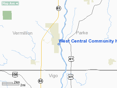
West Central Community Hospital Heliport |
Location & QuickFacts
|
FAA
Information Effective: |
2008-06-05 |
|
Airport
Identifier: |
2II8 |
| Airport
Status: |
Operational |
|
Longitude/Latitude: |
087-23-52.3100W/39-39-08.6500N
-87.397864/39.652403 (Estimated) |
|
Elevation: |
486
ft / 148.13 m (Estimated) |
|
Land: |
1 acres |
| From
nearest city: |
0
nautical miles N of Clinton, IN |
|
Location: |
Vermillion County, IN |
|
Magnetic Variation: |
01W
(1990) |
Owner & Manager
|
Ownership: |
Publicly
owned |
| Owner: |
West
Central Community Hosp |
|
Address: |
801 South Main St
Clinton,
IN 47842 |
| Phone
number: |
317-832-1234 |
|
Manager: |
Terry Hill |
| Address: |
801
South Main St
Clinton,
IN 47842 |
|
Phone
number: |
317-832-1234 |
Airport
Operations and Facilities
|
Airport
Use: |
Private
MEDICAL USE. |
|
Wind indicator: |
Yes |
|
Segmented Circle: |
No |
|
Control
Tower: |
No |
| Lighting
Schedule: |
PHONE
REQ
FOR PERIMETER LGTS CALL 317-832-1234. |
|
Sectional
chart: |
St Louis |
| Region: |
AGL
- Great Lakes |
|
Boundary
ARTCC: |
ZID - Indianapolis |
| Tie-in
FSS: |
HUF
- Terre Haute |
|
FSS Toll
Free: |
1-800-WX-BRIEF |
|
Runway Information
Helipad H1
|
Dimension: |
30 x 30 ft /
9.1 x 9.1 m |
|
Surface: |
CONC, |
|
|
Runway H1 |
Runway |
| Traffic
Pattern: |
Left |
Left |
|
Radio Navigation Aids
|
ID |
Type |
Name |
Ch |
Freq |
Var |
Dist |
| PRG |
NDB |
Paris |
|
341.00 |
01E |
13.1
nm |
|
HU |
NDB |
Yinno |
|
245.00 |
02W |
15.9 nm |
| TVX |
NDB |
Greencastle |
|
521.00 |
03W |
27.6
nm |
|
CFJ |
NDB |
Crawfordsville |
|
388.00 |
02W |
29.8 nm |
| SIV |
NDB |
Sullivan |
|
326.00 |
02W |
32.5
nm |
|
HMJ |
NDB |
Homer |
|
281.00 |
01E |
34.1 nm |
| CZB |
NDB |
Casey |
|
359.00 |
00E |
34.9
nm |
|
MT |
NDB |
Zebre |
|
347.00 |
00E |
38.1 nm |
| PLX |
NDB |
Palestine |
|
391.00 |
00W |
40.0
nm |
|
RSV |
VOR/DME |
Robinson |
021X |
108.40 |
02E |
39.9 nm |
| MTO |
VOR/DME |
Mattoon |
031X |
109.40 |
03E |
42.5
nm |
|
TTH |
VORTAC |
Terre Haute |
100X |
115.30 |
02E |
12.0 nm |
| DNV |
VORTAC |
Danville |
047X |
111.00 |
02E |
39.2
nm |
|
CMI |
VORTAC |
Champaign |
037X |
110.00 |
03E |
46.6 nm |
| OOM |
VORTAC |
Hoosier |
039X |
110.20 |
02W |
47.6
nm |
|
VHP |
VORTAC |
Brickyard |
110X |
116.30 |
01E |
48.6 nm |
Remarks
- PROVIDED
APCH/DEP OPS 050 DEG-070 DEG AND 135 DEG-140 DEG; TAK EOFF/LDG AREA
MKD AND WIRES E. SIDE OF LDG AREA LOWERED OR BURIED; WIND INDICATOR
MAINTAINED; OLD HELIPAD MKNGS OBLITERATED.
West Central Community Hospital Heliport
Address:
Vermillion County, IN
Tel:
317-832-1234
Images
and information placed above are from
http://www.airport-data.com/airport/2II8/
We
thank them for the data!
| General
Info |
| Country |
United
States |
| State |
INDIANA
|
| FAA ID |
2II8 |
| Latitude |
39-39-08.650N
|
| Longitude |
087-23-52.310W
|
| Elevation |
486 feet
|
| Near City |
CLINTON
|
We don't guarantee the information is fresh and accurate. The data may
be wrong or outdated.
For more up-to-date information please refer to other sources.
|
|


