 |
|
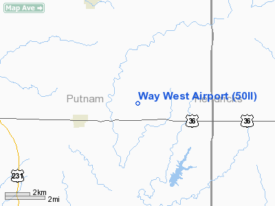
Location & QuickFacts
|
FAA
Information Effective: |
2008-06-05 |
|
Airport
Identifier: |
50II |
| Airport
Status: |
Operational |
|
Longitude/Latitude: |
086-45-23.0240W/39-46-25.1660N
-86.756396/39.773657 (Estimated) |
|
Elevation: |
890
ft / 271.27 m (Estimated) |
|
Land: |
0 acres |
| From
nearest city: |
2
nautical miles SW of Bainbridge, IN |
|
Location: |
Putnam County, IN |
|
Magnetic Variation: |
02W
(1985) |
Owner & Manager
|
Ownership: |
Privately
owned |
| Owner: |
Blaine
W. Merrell |
|
Address: |
101 Way West Airpark
Bainbridge, IN 46105 |
| Phone
number: |
317-522-3241 |
|
Manager: |
Blaine W. Merrell |
| Address: |
101
Way West Airpark
Bainbridge, IN 46105 |
|
Phone
number: |
317-522-3241 |
Airport
Operations and Facilities
|
Airport Use: |
Private |
|
Wind indicator: |
Yes |
|
Segmented Circle: |
No |
|
Control
Tower: |
No |
|
Sectional chart: |
St
Louis |
|
Region: |
AGL - Great Lakes |
|
Boundary ARTCC: |
ZID
- Indianapolis |
|
Tie-in
FSS: |
HUF - Terre Haute |
|
FSS Toll Free: |
1-800-WX-BRIEF |
Airport Communications
|
Runway Information
Runway 09/27
|
Dimension: |
3200 x 80 ft
/ 975.4 x 24.4 m |
|
Surface: |
TURF, |
|
|
Runway 09 |
Runway 27 |
| Traffic
Pattern: |
Left |
Left |
|
Radio Navigation Aids
|
ID |
Type |
Name |
Ch |
Freq |
Var |
Dist |
| TVX |
NDB |
Greencastle |
|
521.00 |
03W |
4.3
nm |
|
CFJ |
NDB |
Crawfordsville |
|
388.00 |
02W |
14.5 nm |
| HZP |
NDB |
Zionsville |
|
248.00 |
03W |
25.4
nm |
|
FKR |
NDB |
Frankfort |
|
278.00 |
02W |
31.2 nm |
| HFY |
NDB |
Greenwood |
|
398.00 |
02W |
31.9
nm |
|
UMP |
NDB |
Metropolitan |
|
338.00 |
03W |
34.0 nm |
| HU |
NDB |
Yinno |
|
245.00 |
02W |
37.7
nm |
|
PRG |
NDB |
Paris |
|
341.00 |
01E |
42.7 nm |
| BM |
NDB |
Claye |
|
382.00 |
02W |
43.7
nm |
|
VHP |
VORTAC |
Brickyard |
110X |
116.30 |
01E |
18.1 nm |
| TTH |
VORTAC |
Terre
Haute |
100X |
115.30 |
02E |
28.5
nm |
|
OOM |
VORTAC |
Hoosier |
039X |
110.20 |
02W |
38.4 nm |
| SHB |
VORTAC |
Shelbyville |
057X |
112.00 |
01E |
43.9
nm |
|
DNV |
VORTAC |
Danville |
047X |
111.00 |
02E |
48.3 nm |
| BVT |
VORTAC |
Boiler |
098X |
115.10 |
01E |
49.2
nm |
|
IND |
VOT |
Indianapolis Intl |
|
109.60 |
|
22.1 nm |
Based Aircraft
|
Aircraft
based on field: |
1 |
|
Single Engine Airplanes: |
1 |
Way West Airport
Address:
Putnam County, IN
Tel:
317-522-3241
Images
and information placed above are from
http://www.airport-data.com/airport/50II/
We
thank them for the data!
| General
Info |
| Country |
United
States |
| State |
INDIANA
|
| FAA ID |
50II |
| Latitude |
39-46-25.166N
|
| Longitude |
086-45-23.024W
|
| Elevation |
890 feet
|
| Near City |
BAINBRIDGE
|
We don't guarantee the information is fresh and accurate. The data may
be wrong or outdated.
For more up-to-date information please refer to other sources.
|
|


