 |
|
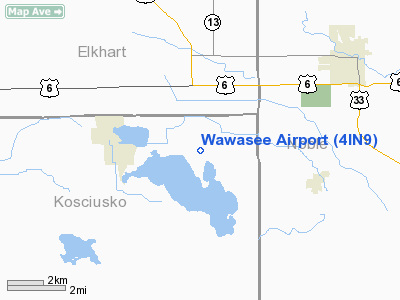
Location & QuickFacts
|
FAA
Information Effective: |
2008-06-05 |
|
Airport
Identifier: |
4IN9 |
| Airport
Status: |
Operational |
|
Longitude/Latitude: |
085-41-29.9550W/41-25-08.1720N
-85.691654/41.418937 (Estimated) |
|
Elevation: |
880
ft / 268.22 m (Surveyed) |
|
Land: |
47 acres |
| From
nearest city: |
3
nautical miles E of Syracuse, IN |
|
Location: |
Kosciusko County, IN |
|
Magnetic Variation: |
03W
(1985) |
Owner & Manager
|
Ownership: |
Privately
owned |
| Owner: |
Stephen
Hay |
|
Address: |
116 East Main St
Syracuse,
IN 46567 |
| Phone
number: |
219-457-3639 |
|
Manager: |
Richard Summe |
| Address: |
11790
East State Road 334
Zionsville, IN 46077 |
|
Phone
number: |
219-457-3639 |
Airport
Operations and Facilities
|
Airport Use: |
Private |
|
Wind indicator: |
Yes |
|
Segmented Circle: |
No |
|
Control
Tower: |
No |
|
Landing fee charge: |
No |
|
Sectional
chart: |
Chicago |
|
Region: |
AGL
- Great Lakes |
|
Boundary
ARTCC: |
ZAU - Chicago |
|
Tie-in FSS: |
HUF
- Terre Haute |
|
FSS on
Airport: |
No |
|
FSS Toll Free: |
1-800-WX-BRIEF |
Airport
Services
|
Bottled
Oxygen: |
NONE |
| Bulk
Oxygen: |
NONE |
|
Runway Information
Runway 07/25
|
Dimension: |
2150 x 60 ft
/ 655.3 x 18.3 m |
| Surface: |
TURF,
|
|
|
Runway 07 |
Runway 25 |
|
Traffic Pattern: |
Left |
Left |
| Markings: |
None,
|
None,
|
|
Displaced
threshold: |
300.00 ft |
300.00 ft |
| Runway
End Identifier: |
No |
No |
|
Centerline
Lights: |
No |
No |
| Touchdown
Lights: |
No |
No |
|
Obstruction: |
15 ft road, 22.0 ft from runway, 1:1 slope
to clear
APCH RATIO 20:1 AT DSPLCD THR. |
15 ft road, 14.0 ft from runway, 1:1 slope
to clear
APCH RATIO 20:1 AT DSPLCD THR. |
|
Radio Navigation Aids
|
ID |
Type |
Name |
Ch |
Freq |
Var |
Dist |
| IRS |
NDB |
Sturgis |
|
382.00 |
04W |
26.4
nm |
|
ANQ |
NDB |
Angola |
|
347.00 |
05W |
30.3 nm |
| RCR |
NDB |
Rochester |
|
216.00 |
03W |
31.0
nm |
|
HAI |
NDB |
Three Rivers |
|
407.00 |
02W |
32.7 nm |
| CPB |
NDB |
Culver |
|
391.00 |
01W |
33.6
nm |
|
HHG |
NDB |
Huntington |
|
417.00 |
03W |
35.4 nm |
| IWH |
NDB |
Wabash |
|
329.00 |
03W |
39.7
nm |
|
RWN |
NDB |
Winamac/dcmsnd |
|
335.00 |
00W |
45.6 nm |
| IUL |
NDB |
La
Porte |
|
356.00 |
03W |
48.9
nm |
|
OLK |
VOR |
Wolf Lake |
|
110.40 |
03W |
13.6 nm |
| OXI |
VOR/DME |
Knox |
103X |
115.60 |
00E |
43.6
nm |
|
ELX |
VOR/DME |
Keeler |
113X |
116.60 |
00E |
47.7 nm |
| AZO |
VOR/DME |
Kalamazoo |
027X |
109.00 |
01W |
49.6
nm |
|
GSH |
VORTAC |
Goshen |
084X |
113.70 |
00E |
16.4 nm |
| FWA |
VORTAC |
Fort
Wayne |
125X |
117.80 |
00E |
34.9
nm |
|
GIJ |
VORTAC |
Gipper |
101X |
115.40 |
00E |
35.2 nm |
| FWA |
VOT |
Fort
Wayne Baer |
|
111.00 |
|
34.8
nm |
Remarks
- HANGAR
RENTAL AVAILABLE.
- 8
INCH RR TIES AT RY ENDS TO DISCOURAGE AUTO TRAFFIC.
- RWY
NOT PLOWED IN WINTER.
Based Aircraft
|
Aircraft
based on field: |
5 |
|
Single Engine Airplanes: |
3 |
| Ultralights: |
2 |
Wawasee Airport
Address:
Kosciusko County, IN
Tel:
219-457-3639
Images
and information placed above are from
http://www.airport-data.com/airport/4IN9/
We
thank them for the data!
| General
Info |
| Country |
United
States |
| State |
INDIANA
|
| FAA ID |
4IN9 |
| Latitude |
41-25-08.172N
|
| Longitude |
085-41-29.955W
|
| Elevation |
880 feet
|
| Near City |
SYRACUSE
|
We don't guarantee the information is fresh and accurate. The data may
be wrong or outdated.
For more up-to-date information please refer to other sources.
|
|


