|
|
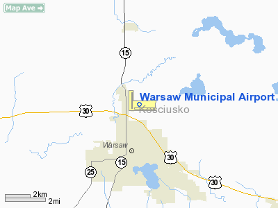
| Warsaw Municipal Airport |
| IATA: none â ICAO: KASW â FAA LID: ASW |
| Summary |
| Airport type |
Public |
| Owner |
Warsaw Board of Aviation Commissioners |
| Serves |
Warsaw, Indiana |
| Elevation AMSL |
850 ft / 259 m |
| Coordinates |
41°16â²29â³N 085°50â²24â³W / 41.27472°N 85.84°W / 41.27472; -85.84 |
| Runways |
| Direction |
Length |
Surface |
| ft |
m |
| 9/27 |
6,000 |
1,829 |
Asphalt |
| 18/36 |
4,020 |
1,225 |
Asphalt |
| Statistics (2006) |
| Aircraft operations |
24,186 |
| Based aircraft |
53 |
| Source: Federal Aviation Administration |
Warsaw Municipal Airport (ICAO: KASW, FAA LID: ASW) is a public-use airport located two miles (3 km) north of the central business district of Warsaw, a city in Kosciusko County, Indiana, United States. It is owned by the Warsaw Board of Aviation Commissioners.
Although most U.S. airports use the same three-letter location identifier for the FAA and IATA, Warsaw Municipal Airport is assigned ASW by the FAA but has no designation from the IATA (which assigned ASW to Aswan International Airport in Aswan, Egypt).
Facilities and aircraft
Warsaw Municipal Airport covers an area of 557 acres (225 ha) which contains two asphalt paved runways: 9/27 measuring 6,000 x 100 ft (1,829 x 30 m) and 18/36 measuring 4,020 x 75 ft (1,225 x 23 m).
For the 12-month period ending December 31, 2006, the airport had 24,186 aircraft operations, an average of 66 per day: 95% general aviation and 5% air taxi. At that time there were 53 aircraft based at this airport: 70% single-engine, 4% multi-engine, 19% jet and 8% ultralight.
The above content comes from Wikipedia and is published under free licenses – click here to read more.
|
 |
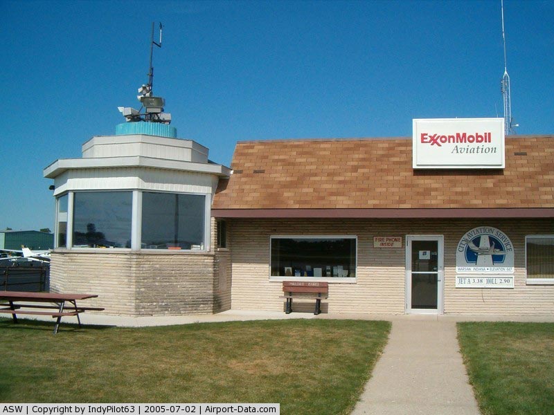
(Click on the photo to enlarge) |
|
 |
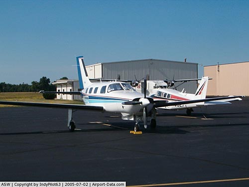
(Click on the photo to enlarge) |
|
 |
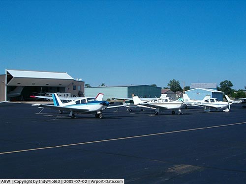
(Click on the photo to enlarge) |
Location & QuickFacts
|
FAA
Information Effective: |
2008-06-05 |
|
Airport
Identifier: |
ASW |
| Airport
Status: |
Operational |
|
Longitude/Latitude: |
085-50-24.2000W/41-16-28.9200N
-85.840056/41.274700 (Estimated) |
|
Elevation: |
850
ft / 259.08 m (Estimated) |
|
Land: |
557 acres |
| From
nearest city: |
2
nautical miles N of Warsaw, IN |
|
Location: |
Kosciusko County, IN |
|
Magnetic Variation: |
03W
(1985) |
Owner
& Manager
|
Ownership: |
Publicly
owned |
|
Owner: |
Warsaw
Boac |
|
Address: |
3000 Airport Dr
Warsaw,
IN 46582 |
|
Phone number: |
574-269-1337 |
|
Manager: |
David Beall |
|
Address: |
3000
Airport Dr
Warsaw,
IN 46582 |
|
Phone
number: |
574-269-1337 |
Airport Operations and Facilities
|
Airport
Use: |
Open
to public |
|
Wind indicator: |
Yes |
|
Segmented Circle: |
Yes |
|
Control
Tower: |
No |
| Lighting
Schedule: |
DUSK-DAWN
ACTVT MIRL RY 18/36; HIRL RY 09/27 PRESET ON LOW INTST TO
INCR INTST & ACTVT REIL RYS 09 & 27 - CTAF.
VASI RY
18 & PAPI RY 09 & 27 ON 24 HRS. |
|
Beacon Color: |
Clear-Green (lighted land airport) |
| Landing
fee charge: |
No |
|
Sectional
chart: |
Chicago |
| Region: |
AGL
- Great Lakes |
|
Boundary
ARTCC: |
ZAU - Chicago |
| Tie-in
FSS: |
HUF
- Terre Haute |
|
FSS on Airport: |
No |
| FSS
Toll Free: |
1-800-WX-BRIEF |
|
NOTAMs Facility: |
ASW (NOTAM-d service avaliable) |
|
Federal Agreements: |
NGY |
Airport
Communications
|
CTAF: |
122.700 |
|
Unicom: |
122.700
|
Airport Services
|
Fuel
available: |
100LLA |
|
Airframe
Repair: |
MAJOR |
|
Power
Plant Repair: |
MAJOR |
|
Runway Information
Runway 09/27
|
Dimension: |
6000 x 100 ft
/ 1828.8 x 30.5 m |
|
Surface: |
ASPH, Good Condition |
| Surface
Treatment: |
Saw-cut or plastic Grooved |
|
Weight Limit: |
Single wheel: 46000 lbs.
Dual wheel: 60000 lbs. |
| Edge
Lights: |
High |
|
|
Runway 09 |
Runway 27 |
|
Longitude: |
085-50-46.4400W |
085-49-27.8800W |
| Latitude: |
41-16-20.6700N |
41-16-21.8900N |
|
Elevation: |
838.00 ft |
850.00 ft |
| Alignment: |
89 |
127 |
|
ILS Type: |
SDF |
ILS/DME |
| Traffic
Pattern: |
Left |
Left |
|
Markings: |
Non-precision instrument, Fair Condition |
Precision instrument, Fair Condition |
| Crossing
Height: |
24.00
ft |
54.00
ft |
|
Displaced
threshold: |
0.00 ft |
900.00 ft |
| VASI: |
2-light
PAPI on left side |
4-light
PAPI on left side |
|
Visual Glide
Angle: |
3.00° |
3.00° |
| Runway
End Identifier: |
Yes |
Yes |
|
Obstruction: |
41 ft pole, 1835.0 ft from runway, 200 ft left
of centerline, 39:1 slope to clear |
166 ft tower, 4892.0 ft from runway, 1050 ft
right of centerline, 28:1 slope to clear
CLOSEST ESTD INTCP OF TALLEST TWR.
APCH SLOPE 34:1 TO DSPLCD THLD.
RY 27 6 FT FENCE 1045 FT FM RY END, 15 FT RD 1070 FT FM RY
END. |
| Decleard
distances: |
Take
off run available 5100.00 ft
Take off distance available 5100.00 ft
Actual stop distance available 5100.00 ft
Landing distance available 5100.00 ft |
Take
off run available 6000.00 ft
Take off distance available 6000.00 ft
Actual stop distance available 6000.00 ft
Landing distance available 5100.00 ft |
|
Runway 18/36
|
Dimension: |
4020 x 75 ft
/ 1225.3 x 22.9 m |
| Surface: |
ASPH,
Fair Condition |
|
Weight Limit: |
Single wheel: 15000 lbs. |
| Edge
Lights: |
Medium |
|
|
Runway 18 |
Runway 36 |
|
Longitude: |
085-50-50.1880W |
085-50-49.4360W |
| Latitude: |
41-17-00.2050N |
41-16-20.4860N |
|
Elevation: |
840.00 ft |
837.00 ft |
| Alignment: |
127 |
127 |
|
Traffic Pattern: |
Left |
Left |
| Markings: |
Non-precision
instrument, Fair Condition |
Non-precision
instrument, Fair Condition |
|
Crossing Height: |
24.00 ft |
0.00 ft |
| VASI: |
2-box
on left side |
|
|
Visual Glide
Angle: |
3.50° |
0.00° |
|
Obstruction: |
15
ft road, 495.0 ft from runway, 19:1 slope to clear |
15
ft road, 740.0 ft from runway, 36:1 slope to clear |
|
Radio Navigation Aids
|
ID |
Type |
Name |
Ch |
Freq |
Var |
Dist |
| RCR |
NDB |
Rochester |
|
216.00 |
03W |
20.2
nm |
|
CPB |
NDB |
Culver |
|
391.00 |
01W |
24.9 nm |
| HHG |
NDB |
Huntington |
|
417.00 |
03W |
30.4
nm |
|
IWH |
NDB |
Wabash |
|
329.00 |
03W |
30.8 nm |
| RWN |
NDB |
Winamac/dcmsnd |
|
335.00 |
00W |
36.2
nm |
|
IRS |
NDB |
Sturgis |
|
382.00 |
04W |
37.2 nm |
| ANQ |
NDB |
Angola |
|
347.00 |
05W |
40.4
nm |
|
GGP |
NDB |
Logansport |
|
263.00 |
01W |
41.7 nm |
| HAI |
NDB |
Three
Rivers |
|
407.00 |
02W |
42.6
nm |
|
IUL |
NDB |
La Porte |
|
356.00 |
03W |
44.1 nm |
| VP |
NDB |
Sedly |
|
212.00 |
02W |
48.0
nm |
|
OLK |
VOR |
Wolf Lake |
|
110.40 |
03W |
15.6 nm |
| OXI |
VOR/DME |
Knox |
103X |
115.60 |
00E |
36.7
nm |
|
MZZ |
VOR/DME |
Marion |
023X |
108.60 |
03W |
47.5 nm |
| GSH |
VORTAC |
Goshen |
084X |
113.70 |
00E |
17.3
nm |
|
FWA |
VORTAC |
Fort Wayne |
125X |
117.80 |
00E |
34.5 nm |
| GIJ |
VORTAC |
Gipper |
101X |
115.40 |
00E |
36.7
nm |
|
GUS |
VORTAC |
Grissom |
21Y |
108.45 |
02W |
40.4 nm |
| OKK |
VORTAC |
Kokomo |
082X |
113.50 |
00E |
46.0
nm |
|
FWA |
VOT |
Fort Wayne Baer |
|
111.00 |
|
34.4 nm |
Remarks
- DEER
& BIRDS ON & INVOF ARPT.
Based Aircraft
|
Aircraft
based on field: |
53 |
|
Single Engine Airplanes: |
37 |
| Multi
Engine Airplanes: |
2 |
|
Jet Engine Airplanes: |
10 |
| Ultralights: |
4 |
Operational Statistics
Time
Period: 2006-01-01 - 2006-12-31
|
Aircraft
Operations: |
67/Day |
| Air
Taxi: |
5.0% |
|
General Aviation
Local: |
65.0% |
| General
Aviation Itinerant: |
30.0% |
Warsaw Municipal Airport
Address:
Kosciusko County, IN
Tel:
574-269-1337
Images
and information placed above are from
http://www.airport-data.com/airport/ASW/
We
thank them for the data!
| General
Info |
| Country |
United
States |
| State |
INDIANA
|
| FAA ID |
ASW |
| Latitude |
41-16-28.920N
|
| Longitude |
085-50-24.200W
|
| Elevation |
850 feet
|
| Near City |
WARSAW
|
We don't guarantee the information is fresh and accurate. The data may
be wrong or outdated.
For more up-to-date information please refer to other sources.
|
|