 |
|
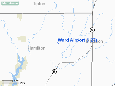
Location & QuickFacts
|
FAA
Information Effective: |
2008-06-05 |
|
Airport
Identifier: |
II27 |
| Airport
Status: |
Operational |
|
Longitude/Latitude: |
085-56-26.9370W/40-10-00.1360N
-85.940816/40.166704 (Estimated) |
|
Elevation: |
830
ft / 252.98 m (Estimated) |
|
Land: |
0 acres |
| From
nearest city: |
4
nautical miles E of Arcadia, IN |
|
Location: |
Hamilton County, IN |
|
Magnetic Variation: |
02W
(1985) |
Owner
& Manager
|
Ownership: |
Privately
owned |
|
Owner: |
25890
St Rd 213 |
|
Address: |
Rr 2, Box 11
Arcadia, CA 46030 |
|
Phone number: |
317-984-3887 |
|
Address: |
|
Airport Operations and Facilities
|
Airport
Use: |
Private |
|
Segmented
Circle: |
No |
| Control
Tower: |
No |
|
Landing
fee charge: |
No |
|
Sectional chart: |
Chicago |
|
Region: |
AGL - Great Lakes |
| Boundary
ARTCC: |
ZAU
- Chicago |
|
Tie-in FSS: |
HUF - Terre Haute |
| FSS
Toll Free: |
1-800-WX-BRIEF |
|
Runway Information
Runway N/S
|
Dimension: |
1800 x 100 ft
/ 548.6 x 30.5 m |
| Surface: |
TURF,
|
|
|
Runway N |
Runway S |
|
Traffic Pattern: |
Left |
Left |
|
Radio Navigation Aids
|
ID |
Type |
Name |
Ch |
Freq |
Var |
Dist |
| UMP |
NDB |
Metropolitan |
|
338.00 |
03W |
14.7
nm |
|
HZP |
NDB |
Zionsville |
|
248.00 |
03W |
19.7 nm |
| AI |
NDB |
Video |
|
371.00 |
03W |
20.6
nm |
|
FKR |
NDB |
Frankfort |
|
278.00 |
02W |
29.2 nm |
| HFY |
NDB |
Greenwood |
|
398.00 |
02W |
32.8
nm |
|
UWL |
NDB |
New Castle |
|
385.00 |
02W |
33.4 nm |
| IWH |
NDB |
Wabash |
|
329.00 |
03W |
36.5
nm |
|
GGP |
NDB |
Logansport |
|
263.00 |
01W |
38.1 nm |
| CFJ |
NDB |
Crawfordsville |
|
388.00 |
02W |
46.2
nm |
|
HHG |
NDB |
Huntington |
|
417.00 |
03W |
46.8 nm |
| PLD |
NDB |
Portland |
|
257.00 |
03W |
47.1
nm |
|
TVX |
NDB |
Greencastle |
|
521.00 |
03W |
48.3 nm |
| MCX |
NDB |
White
County |
|
377.00 |
03W |
49.8
nm |
|
MZZ |
VOR/DME |
Marion |
023X |
108.60 |
03W |
23.0 nm |
| MIE |
VOR/DME |
Muncie |
091X |
114.40 |
03W |
25.5
nm |
|
OKK |
VORTAC |
Kokomo |
082X |
113.50 |
00E |
22.4 nm |
| VHP |
VORTAC |
Brickyard |
110X |
116.30 |
01E |
28.9
nm |
|
GUS |
VORTAC |
Grissom |
21Y |
108.45 |
02W |
30.3 nm |
| SHB |
VORTAC |
Shelbyville |
057X |
112.00 |
01E |
32.6
nm |
|
IND |
VOT |
Indianapolis Intl |
|
109.60 |
|
30.9 nm |
Remarks
- FILED
FOR RECORD PURPOSES ONLY.
Based Aircraft
|
Aircraft
based on field: |
1 |
|
Single Engine Airplanes: |
1 |
Ward Airport
Address:
Hamilton County, IN
Tel:
317-984-3887
Images
and information placed above are from
http://www.airport-data.com/airport/II27/
We
thank them for the data!
| General
Info |
| Country |
United
States |
| State |
INDIANA
|
| FAA ID |
II27 |
| Latitude |
40-10-00.136N
|
| Longitude |
085-56-26.937W
|
| Elevation |
830 feet
|
| Near City |
ARCADIA
|
We don't guarantee the information is fresh and accurate. The data may
be wrong or outdated.
For more up-to-date information please refer to other sources.
|
|


