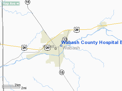
Wabash County Hospital Emergency Heliport |
 |
|
Location & QuickFacts
|
FAA
Information Effective: |
2008-06-05 |
|
Airport
Identifier: |
62II |
| Airport
Status: |
Operational |
|
Longitude/Latitude: |
085-48-56.9470W/40-48-22.1550N
-85.815819/40.806154 (Estimated) |
|
Elevation: |
779
ft / 237.44 m (Estimated) |
|
Land: |
0 acres |
| From
nearest city: |
0
nautical miles N of Wabash, IN |
|
Location: |
Wabash County, IN |
|
Magnetic Variation: |
03W
(1990) |
Owner & Manager
|
Ownership: |
Privately
owned |
| Owner: |
Wabash
County Hospital |
|
Address: |
710 North East Street
Wabash,
IN 46992 |
|
Phone number: |
219-569-2229
EXT 229. |
|
Manager: |
Myron Ridgeway |
|
Address: |
|
|
Phone
number: |
219-563-3131
EXT 222 |
Airport Operations and Facilities
|
Airport
Use: |
Private
MEDICAL USE. |
|
Wind indicator: |
Yes |
|
Segmented Circle: |
No |
|
Control
Tower: |
No |
| Lighting
Schedule: |
RDO
REQ
FOR HEL BCN & PERIMETER LGTS REQUEST ON FREQ 155.340. |
|
Beacon Color: |
Clear-Green-Yellow (heliport) |
|
Sectional chart: |
Chicago |
|
Region: |
AGL - Great Lakes |
| Boundary
ARTCC: |
ZAU
- Chicago |
|
Tie-in FSS: |
HUF - Terre Haute |
| FSS
Toll Free: |
1-800-WX-BRIEF |
|
Runway Information
Helipad H1
|
Dimension: |
67 x 67 ft /
20.4 x 20.4 m |
| Surface: |
CONC,
|
|
|
Runway H1 |
Runway |
|
Traffic Pattern: |
Left |
Left |
|
Radio Navigation Aids
|
ID |
Type |
Name |
Ch |
Freq |
Var |
Dist |
| IWH |
NDB |
Wabash |
|
329.00 |
03W |
2.7
nm |
|
HHG |
NDB |
Huntington |
|
417.00 |
03W |
16.3 nm |
| RCR |
NDB |
Rochester |
|
216.00 |
03W |
23.0
nm |
|
GGP |
NDB |
Logansport |
|
263.00 |
01W |
26.1 nm |
| CPB |
NDB |
Culver |
|
391.00 |
01W |
35.7
nm |
|
RWN |
NDB |
Winamac/dcmsnd |
|
335.00 |
00W |
39.8 nm |
| MCX |
NDB |
White
County |
|
377.00 |
03W |
43.5
nm |
|
PLD |
NDB |
Portland |
|
257.00 |
03W |
43.5 nm |
| AI |
NDB |
Video |
|
371.00 |
03W |
46.4
nm |
|
FKR |
NDB |
Frankfort |
|
278.00 |
02W |
46.9 nm |
| OLK |
VOR |
Wolf
Lake |
|
110.40 |
03W |
30.2
nm |
|
MZZ |
VOR/DME |
Marion |
023X |
108.60 |
03W |
19.8 nm |
| MIE |
VOR/DME |
Muncie |
091X |
114.40 |
03W |
39.3
nm |
|
OXI |
VOR/DME |
Knox |
103X |
115.60 |
00E |
48.9 nm |
| GUS |
VORTAC |
Grissom |
21Y |
108.45 |
02W |
18.1
nm |
|
OKK |
VORTAC |
Kokomo |
082X |
113.50 |
00E |
20.0 nm |
| FWA |
VORTAC |
Fort
Wayne |
125X |
117.80 |
00E |
30.4
nm |
|
GSH |
VORTAC |
Goshen |
084X |
113.70 |
00E |
44.3 nm |
| FWA |
VOT |
Fort
Wayne Baer |
|
111.00 |
|
30.2
nm |
Remarks
- PRVDD
APCH/DEP OPS 125-180 & FM 315-350 DEGS; TKOF/LNDG CONST TO BE LEVEL;
TREE TO NW TRIMMED MKRS INSTLDON PLINE TO SE; A NON-OBSTG WIND INDICATOR
IS MAINTD ADJACEMT TO TKOF/LNDG AREA; UNAUTHORIZED PERSONS ARE RSTRD
FM ACCESS TO TKOF/LNDG AREA DURG HEL LGT OPS USING A NON-OBSTG SAFETY
BARRIER.
Wabash County Hospital Emergency Heliport
Address:
Wabash County, IN
Tel:
219-569-2229,
219-563-3131
Images
and information placed above are from
http://www.airport-data.com/airport/62II/
We
thank them for the data!
| General
Info |
| Country |
United
States |
| State |
INDIANA
|
| FAA ID |
62II |
| Latitude |
40-48-22.155N
|
| Longitude |
085-48-56.947W
|
| Elevation |
779 feet
|
| Near City |
WABASH
|
We don't guarantee the information is fresh and accurate. The data may
be wrong or outdated.
For more up-to-date information please refer to other sources.
|


