 |
|
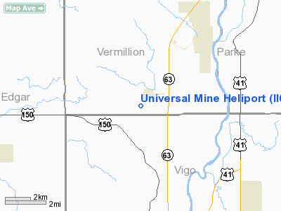
Location & QuickFacts
|
FAA
Information Effective: |
2008-06-05 |
|
Airport
Identifier: |
II64 |
| Airport
Status: |
Operational |
|
Longitude/Latitude: |
087-27-43.0720W/39-36-50.1300N
-87.461964/39.613925 (Estimated) |
|
Elevation: |
550
ft / 167.64 m (Estimated) |
|
Land: |
0 acres |
| From
nearest city: |
1
nautical miles SW of Universal, IN |
|
Location: |
Vermillion County, IN |
|
Magnetic Variation: |
01W
(1985) |
Owner & Manager
|
Ownership: |
Privately
owned |
| Owner: |
Peabody
Coal Co - Univ Mine |
|
Address: |
Po Box 145
Universal,
IN 47884 |
|
Phone number: |
317-832-3594 |
|
Manager: |
Robert Petit |
|
Address: |
Po
Box 145
Universal,
IN 47884 |
|
Phone
number: |
317-832-3594 |
Airport Operations and Facilities
|
Airport
Use: |
Private |
|
Wind indicator: |
Yes |
|
Segmented Circle: |
No |
|
Control
Tower: |
No |
|
Sectional chart: |
St
Louis |
|
Region: |
AGL - Great Lakes |
| Boundary
ARTCC: |
ZID
- Indianapolis |
|
Tie-in FSS: |
HUF - Terre Haute |
| FSS
Toll Free: |
1-800-WX-BRIEF |
|
Runway Information
Helipad H1
|
Dimension: |
12 x 12 ft /
3.7 x 3.7 m |
| Surface: |
CONC,
|
|
|
Runway H1 |
Runway |
|
Traffic Pattern: |
Left |
Left |
|
Radio Navigation Aids
|
ID |
Type |
Name |
Ch |
Freq |
Var |
Dist |
| PRG |
NDB |
Paris |
|
341.00 |
01E |
11.1
nm |
|
HU |
NDB |
Yinno |
|
245.00 |
02W |
13.9 nm |
| SIV |
NDB |
Sullivan |
|
326.00 |
02W |
30.1
nm |
|
TVX |
NDB |
Greencastle |
|
521.00 |
03W |
30.9 nm |
| CZB |
NDB |
Casey |
|
359.00 |
00E |
31.2
nm |
|
CFJ |
NDB |
Crawfordsville |
|
388.00 |
02W |
33.5 nm |
| HMJ |
NDB |
Homer |
|
281.00 |
01E |
33.6
nm |
|
MT |
NDB |
Zebre |
|
347.00 |
00E |
34.6 nm |
| PLX |
NDB |
Palestine |
|
391.00 |
00W |
37.0
nm |
|
RSV |
VOR/DME |
Robinson |
021X |
108.40 |
02E |
36.9 nm |
| MTO |
VOR/DME |
Mattoon |
031X |
109.40 |
03E |
39.1
nm |
|
TTH |
VORTAC |
Terre Haute |
100X |
115.30 |
02E |
12.4 nm |
| DNV |
VORTAC |
Danville |
047X |
111.00 |
02E |
41.1
nm |
|
CMI |
VORTAC |
Champaign |
037X |
110.00 |
03E |
45.3 nm |
| OOM |
VORTAC |
Hoosier |
039X |
110.20 |
02W |
48.5
nm |
Remarks
- PRVDD
ALL APP/DEP FM 100 TO 210; AREA IS MARKED AND 30' POLE S OF PAD IS LOWERED
OR OBST LGTD; WIND INDICATOR IS MAINTAINED.
Universal Mine Heliport
Address:
Vermillion County, IN
Tel:
317-832-3594
Images
and information placed above are from
http://www.airport-data.com/airport/II64/
We
thank them for the data!
| General
Info |
| Country |
United
States |
| State |
INDIANA
|
| FAA ID |
II64 |
| Latitude |
39-36-50.130N
|
| Longitude |
087-27-43.072W
|
| Elevation |
550 feet
|
| Near City |
UNIVERSAL
|
We don't guarantee the information is fresh and accurate. The data may
be wrong or outdated.
For more up-to-date information please refer to other sources.
|
|


