 |
|
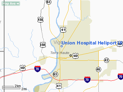
Location & QuickFacts
|
FAA
Information Effective: |
2008-06-05 |
|
Airport
Identifier: |
60II |
| Airport
Status: |
Operational |
|
Longitude/Latitude: |
087-24-37.0730W/39-29-10.1310N
-87.410298/39.486148 (Estimated) |
|
Elevation: |
480
ft / 146.30 m (Estimated) |
|
Land: |
0 acres |
| From
nearest city: |
0
nautical miles N of Terre Haute, IN |
|
Location: |
Vigo County, IN |
|
Magnetic Variation: |
01W
(1985) |
Owner & Manager
|
Ownership: |
Privately
owned |
| Owner: |
Frank
Hoffman |
|
Address: |
1606 N 7th St
Terre
Haute, IN 47804 |
|
Phone number: |
812-238-7665 |
|
Address: |
|
Airport
Operations and Facilities
|
Airport
Use: |
Private
MEDICAL USE. |
|
Wind indicator: |
Yes |
|
Segmented Circle: |
No |
|
Control
Tower: |
No |
|
Sectional chart: |
St
Louis |
|
Region: |
AGL - Great Lakes |
| Boundary
ARTCC: |
ZID
- Indianapolis |
|
Tie-in FSS: |
HUF - Terre Haute |
| FSS
Toll Free: |
1-800-WX-BRIEF |
|
Runway Information
Helipad H1
|
Dimension: |
36 x 36 ft /
11.0 x 11.0 m |
| Surface: |
CONC,
|
|
|
Runway H1 |
Runway |
|
Traffic Pattern: |
Left |
Left |
|
Radio Navigation Aids
|
ID |
Type |
Name |
Ch |
Freq |
Var |
Dist |
| HU |
NDB |
Yinno |
|
245.00 |
02W |
5.9
nm |
|
PRG |
NDB |
Paris |
|
341.00 |
01E |
17.7 nm |
| SIV |
NDB |
Sullivan |
|
326.00 |
02W |
22.5
nm |
|
CZB |
NDB |
Casey |
|
359.00 |
00E |
29.6 nm |
| PLX |
NDB |
Palestine |
|
391.00 |
00W |
30.4
nm |
|
TVX |
NDB |
Greencastle |
|
521.00 |
03W |
31.2 nm |
| MT |
NDB |
Zebre |
|
347.00 |
00E |
35.5
nm |
|
CFJ |
NDB |
Crawfordsville |
|
388.00 |
02W |
37.5 nm |
| HMJ |
NDB |
Homer |
|
281.00 |
01E |
41.0
nm |
|
BM |
NDB |
Claye |
|
382.00 |
02W |
45.7 nm |
| OEA |
NDB |
Vincennes |
|
251.00 |
00E |
48.2
nm |
|
DCY |
NDB |
Washington |
|
212.00 |
03W |
49.2 nm |
| RSV |
VOR/DME |
Robinson |
021X |
108.40 |
02E |
30.2
nm |
|
MTO |
VOR/DME |
Mattoon |
031X |
109.40 |
03E |
40.6 nm |
| LWV |
VOR/DME |
Lawrenceville |
025X |
108.80 |
01W |
44.0
nm |
|
TTH |
VORTAC |
Terre Haute |
100X |
115.30 |
02E |
7.5 nm |
| OOM |
VORTAC |
Hoosier |
039X |
110.20 |
02W |
42.4
nm |
|
DNV |
VORTAC |
Danville |
047X |
111.00 |
02E |
49.0 nm |
Remarks
- PROVIDED
APCH/DEP OPERATIONS ARE CONDUCTED FROM 020 TO 090 DEG; AREA IS MKD;
WIND INDICATOR MAINTAINED; BASKETBALL COURT & LIGHT ARE REMOVED.
Union Hospital Heliport
Address:
Vigo County, IN
Tel:
812-238-7665
Images
and information placed above are from
http://www.airport-data.com/airport/60II/
We
thank them for the data!
| General
Info |
| Country |
United
States |
| State |
INDIANA
|
| FAA ID |
60II |
| Latitude |
39-29-10.131N
|
| Longitude |
087-24-37.073W
|
| Elevation |
480 feet
|
| Near City |
TERRE
HAUTE |
We don't guarantee the information is fresh and accurate. The data may
be wrong or outdated.
For more up-to-date information please refer to other sources.
|
|


