 |
|
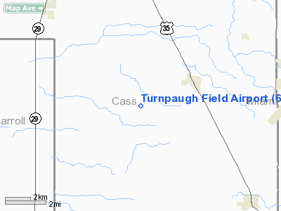
Location & QuickFacts
|
FAA
Information Effective: |
2008-06-05 |
|
Airport
Identifier: |
6II0 |
| Airport
Status: |
Operational |
|
Longitude/Latitude: |
086-17-33.9800W/40-38-43.1300N
-86.292772/40.645314 (Estimated) |
|
Elevation: |
757
ft / 230.73 m (Estimated) |
|
Land: |
0 acres |
| From
nearest city: |
2
nautical miles SW of Walton, IN |
|
Location: |
Cass County, IN |
|
Magnetic Variation: |
02W
(1990) |
Owner
& Manager
|
Ownership: |
Privately
owned |
|
Owner: |
David
Turnpaugh |
|
Address: |
Rr 1; Box 42
Walton, IN 46994 |
|
Phone number: |
219-626-3295 |
|
Manager: |
David Turnpaugh |
|
Address: |
Rr
1; Box 42
Walton, IN 46994 |
|
Phone
number: |
219-626-3295 |
Airport Operations and Facilities
|
Airport
Use: |
Private |
|
Segmented
Circle: |
No |
| Control
Tower: |
No |
|
Sectional
chart: |
St Louis |
| Region: |
AGL
- Great Lakes |
|
Boundary
ARTCC: |
ZAU - Chicago |
| Tie-in
FSS: |
HUF
- Terre Haute |
|
FSS Toll
Free: |
1-800-WX-BRIEF |
|
Runway Information
Runway 18/36
|
Dimension: |
2700 x 100 ft
/ 823.0 x 30.5 m |
|
Surface: |
TURF, |
|
|
Runway 18 |
Runway 36 |
| Traffic
Pattern: |
Left |
Left |
|
Displaced
threshold: |
500.00 ft |
150.00 ft |
|
Obstruction: |
25
ft pline |
|
|
Radio Navigation Aids
|
ID |
Type |
Name |
Ch |
Freq |
Var |
Dist |
| GGP |
NDB |
Logansport |
|
263.00 |
01W |
5.3
nm |
|
MCX |
NDB |
White County |
|
377.00 |
03W |
21.8 nm |
| IWH |
NDB |
Wabash |
|
329.00 |
03W |
23.7
nm |
|
RCR |
NDB |
Rochester |
|
216.00 |
03W |
25.7 nm |
| FKR |
NDB |
Frankfort |
|
278.00 |
02W |
25.7
nm |
|
RWN |
NDB |
Winamac/dcmsnd |
|
335.00 |
00W |
30.5 nm |
| CPB |
NDB |
Culver |
|
391.00 |
01W |
34.6
nm |
|
HHG |
NDB |
Huntington |
|
417.00 |
03W |
39.8 nm |
| HZP |
NDB |
Zionsville |
|
248.00 |
03W |
42.5
nm |
|
UMP |
NDB |
Metropolitan |
|
338.00 |
03W |
44.0 nm |
| RZL |
NDB |
Rensselaer |
|
362.00 |
02W |
44.4
nm |
|
CFJ |
NDB |
Crawfordsville |
|
388.00 |
02W |
49.1 nm |
| AI |
NDB |
Video |
|
371.00 |
03W |
49.8
nm |
|
MZZ |
VOR/DME |
Marion |
023X |
108.60 |
03W |
29.5 nm |
| OXI |
VOR/DME |
Knox |
103X |
115.60 |
00E |
43.8
nm |
|
MIE |
VOR/DME |
Muncie |
091X |
114.40 |
03W |
47.9 nm |
| GUS |
VORTAC |
Grissom |
21Y |
108.45 |
02W |
6.4
nm |
|
OKK |
VORTAC |
Kokomo |
082X |
113.50 |
00E |
12.8 nm |
| BVT |
VORTAC |
Boiler |
098X |
115.10 |
01E |
35.8
nm |
Remarks
- PRVDD
OBSTN IN RY APCH SLOPE ARE REMOVED/LOWERED OR RY THR IS DSPLCD &
MKD TO PRVD A 20:1 APCH OVER OBSTN AREA 125 FT ON EITHER SIDE OF RY
CNTRLN & 200 FT RY END BE CLEAR OF OBSTN.
Turnpaugh Field Airport
Address:
Cass County, IN
Tel:
219-626-3295
Images
and information placed above are from
http://www.airport-data.com/airport/6II0/
We
thank them for the data!
| General
Info |
| Country |
United
States |
| State |
INDIANA
|
| FAA ID |
6II0 |
| Latitude |
40-38-43.130N
|
| Longitude |
086-17-33.980W
|
| Elevation |
757 feet
|
| Near City |
WALTON
|
We don't guarantee the information is fresh and accurate. The data may
be wrong or outdated.
For more up-to-date information please refer to other sources.
|
|


