|
|
|
 |
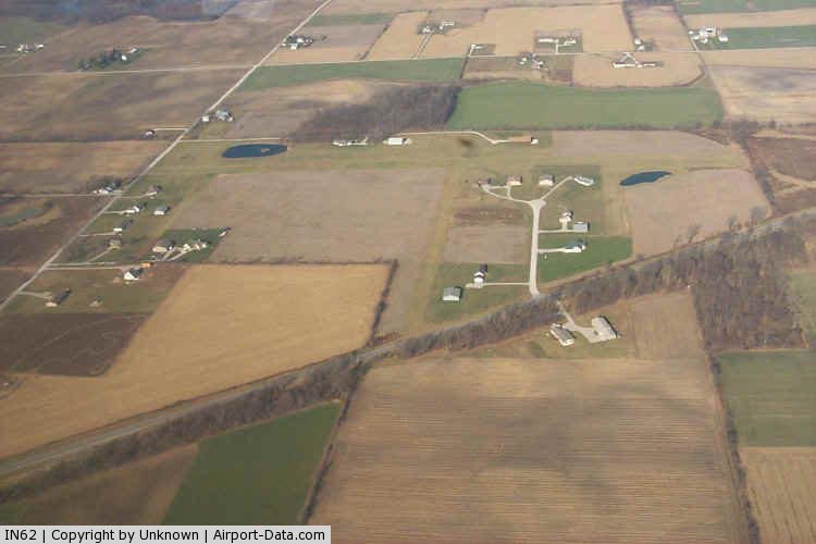
(Click on the photo to enlarge) |
|
 |
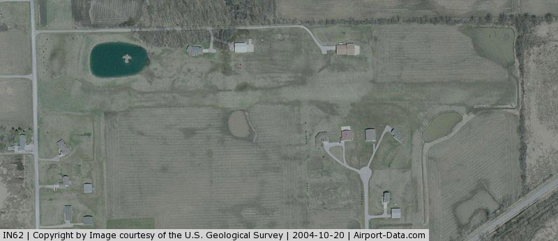
(Click on the photo to enlarge) |
Location & QuickFacts
|
FAA
Information Effective: |
2008-06-05 |
|
Airport
Identifier: |
IN62 |
| Airport
Status: |
Operational |
|
Longitude/Latitude: |
085-17-50.9130W/41-14-41.1720N
-85.297476/41.244770 (Estimated) |
|
Elevation: |
905
ft / 275.84 m (Estimated) |
|
Land: |
0 acres |
| From
nearest city: |
1
nautical miles NE of Churubusco, IN |
|
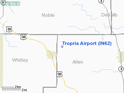
Location: |
Allen County, IN |
|
Magnetic Variation: |
03W
(1985) |
Owner & Manager
|
Ownership: |
Privately
owned |
| Owner: |
Marcus
Brewer |
|
Address: |
17522 Mc Duffee Road
Churubusco, IN 46723 |
| Phone
number: |
219-693-3980 |
|
Manager: |
Marcus Brewer |
| Address: |
17522
Mc Duffee Road
Churubusco, IN 46723 |
|
Phone
number: |
219-422-4801 |
Airport
Operations and Facilities
|
Airport
Use: |
Private |
|
Wind indicator: |
Yes |
|
Segmented Circle: |
No |
|
Control
Tower: |
No |
|
Sectional chart: |
Chicago |
|
Region: |
AGL - Great Lakes |
| Boundary
ARTCC: |
ZAU
- Chicago |
|
Tie-in FSS: |
HUF - Terre Haute |
| FSS
Toll Free: |
1-800-WX-BRIEF |
|
Runway Information
Runway 09/27
|
Dimension: |
2600 x 100 ft
/ 792.5 x 30.5 m |
| Surface: |
TURF,
|
|
|
Runway 09 |
Runway 27 |
|
Traffic Pattern: |
Left |
Left |
| Displaced
threshold: |
100.00
ft |
0.00
ft |
|
Radio Navigation Aids
|
ID |
Type |
Name |
Ch |
Freq |
Var |
Dist |
| HHG |
NDB |
Huntington |
|
417.00 |
03W |
24.6
nm |
|
ANQ |
NDB |
Angola |
|
347.00 |
05W |
25.6 nm |
| IRS |
NDB |
Sturgis |
|
382.00 |
04W |
34.7
nm |
|
IWH |
NDB |
Wabash |
|
329.00 |
03W |
36.8 nm |
| VFU |
NDB |
Stanley |
|
411.00 |
05W |
38.6
nm |
|
DFI |
NDB |
Defiance |
|
246.00 |
05W |
39.7 nm |
| BYN |
NDB |
Bryan |
|
260.00 |
04W |
40.1
nm |
|
RCR |
NDB |
Rochester |
|
216.00 |
03W |
41.8 nm |
| HAI |
NDB |
Three
Rivers |
|
407.00 |
02W |
44.9
nm |
|
CPB |
NDB |
Culver |
|
391.00 |
01W |
49.2 nm |
| PLD |
NDB |
Portland |
|
257.00 |
03W |
49.6
nm |
|
OLK |
VOR |
Wolf Lake |
|
110.40 |
03W |
9.0 nm |
| MZZ |
VOR/DME |
Marion |
023X |
108.60 |
03W |
48.4
nm |
|
FWA |
VORTAC |
Fort Wayne |
125X |
117.80 |
00E |
16.7 nm |
| GSH |
VORTAC |
Goshen |
084X |
113.70 |
00E |
37.0
nm |
|
FWA |
VOT |
Fort Wayne Baer |
|
111.00 |
|
16.7 nm |
Remarks
- PRVDD
THERE IS ADEUQATE CTL OF PEOPLE OR VEHICLES USING THE BUILDINGS.
Based Aircraft
|
Aircraft
based on field: |
6 |
|
Single Engine Airplanes: |
6 |
Tropria Airport
Address:
Allen County, IN
Tel:
219-693-3980,
219-422-4801
Images
and information placed above are from
http://www.airport-data.com/airport/IN62/
We
thank them for the data!
| General
Info |
| Country |
United
States |
| State |
INDIANA
|
| FAA ID |
IN62 |
| Latitude |
41-14-41.172N
|
| Longitude |
085-17-50.913W
|
| Elevation |
905 feet
|
| Near City |
CHURUBUSCO
|
We don't guarantee the information is fresh and accurate. The data may
be wrong or outdated.
For more up-to-date information please refer to other sources.
|
|