 |
|
|
|
|
|
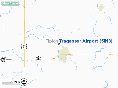
Location & QuickFacts
|
FAA
Information Effective: |
2008-06-05 |
|
Airport
Identifier: |
5IN3 |
| Airport
Status: |
Operational |
|
Longitude/Latitude: |
086-03-00.9540W/40-18-01.1350N
-86.050265/40.300315 (Estimated) |
|
Elevation: |
875
ft / 266.70 m (Estimated) |
|
Land: |
0 acres |
| From
nearest city: |
1
nautical miles NW of Tipton, IN |
|
Location: |
Tipton County, IN |
|
Magnetic Variation: |
02W
(1985) |
Owner
& Manager
|
Ownership: |
Privately
owned |
|
Owner: |
A
A Tragesser |
|
Address: |
327 Oak Street
Tipton,
IN 46072 |
|
Phone number: |
317-675-6966 |
|
Manager: |
Thomas Tragesser |
|
Address: |
Rr
Box 322
Tipton, IN 46072 |
|
Phone
number: |
317-675-4924 |
Airport Operations and Facilities
|
Airport
Use: |
Private |
|
Wind indicator: |
Yes |
|
Segmented Circle: |
No |
|
Control
Tower: |
No |
| Lighting
Schedule: |
PHONE
REQ
FOR RWY LGTS CALL 317-675-6966. |
|
Landing
fee charge: |
No |
|
Sectional chart: |
Chicago |
|
Region: |
AGL - Great Lakes |
|
Traffic Pattern Alt: |
800
ft |
|
Boundary
ARTCC: |
ZAU - Chicago |
|
Tie-in FSS: |
HUF
- Terre Haute |
|
FSS on
Airport: |
No |
|
FSS Toll Free: |
1-800-WX-BRIEF |
Airport
Services
|
Airframe
Repair: |
NONE |
|
Power
Plant Repair: |
NONE |
|
Bottled
Oxygen: |
NONE |
| Bulk
Oxygen: |
NONE |
|
Runway Information
Runway 18/36
|
Dimension: |
2270 x 50 ft
/ 691.9 x 15.2 m |
| Surface: |
TURF,
|
|
Edge Lights: |
Low |
|
|
Runway 18 |
Runway 36 |
| Traffic
Pattern: |
Left |
Left |
|
Runway End
Identifier: |
No |
No |
| Centerline
Lights: |
No |
No |
|
Touchdown
Lights: |
No |
No |
|
Radio Navigation Aids
|
ID |
Type |
Name |
Ch |
Freq |
Var |
Dist |
| UMP |
NDB |
Metropolitan |
|
338.00 |
03W |
21.8
nm |
|
HZP |
NDB |
Zionsville |
|
248.00 |
03W |
23.5 nm |
| FKR |
NDB |
Frankfort |
|
278.00 |
02W |
23.6
nm |
|
AI |
NDB |
Video |
|
371.00 |
03W |
28.4 nm |
| GGP |
NDB |
Logansport |
|
263.00 |
01W |
28.7
nm |
|
IWH |
NDB |
Wabash |
|
329.00 |
03W |
30.1 nm |
| HFY |
NDB |
Greenwood |
|
398.00 |
02W |
40.2
nm |
|
MCX |
NDB |
White County |
|
377.00 |
03W |
40.8 nm |
| UWL |
NDB |
New
Castle |
|
385.00 |
02W |
42.1
nm |
|
HHG |
NDB |
Huntington |
|
417.00 |
03W |
42.8 nm |
| CFJ |
NDB |
Crawfordsville |
|
388.00 |
02W |
44.2
nm |
|
RCR |
NDB |
Rochester |
|
216.00 |
03W |
46.4 nm |
| TVX |
NDB |
Greencastle |
|
521.00 |
03W |
49.5
nm |
|
PLD |
NDB |
Portland |
|
257.00 |
03W |
49.7 nm |
| MZZ |
VOR/DME |
Marion |
023X |
108.60 |
03W |
20.6
nm |
|
MIE |
VOR/DME |
Muncie |
091X |
114.40 |
03W |
30.3 nm |
| OKK |
VORTAC |
Kokomo |
082X |
113.50 |
00E |
13.7
nm |
|
GUS |
VORTAC |
Grissom |
21Y |
108.45 |
02W |
21.2 nm |
| VHP |
VORTAC |
Brickyard |
110X |
116.30 |
01E |
32.6
nm |
|
SHB |
VORTAC |
Shelbyville |
057X |
112.00 |
01E |
41.5 nm |
| BVT |
VORTAC |
Boiler |
098X |
115.10 |
01E |
49.1
nm |
|
IND |
VOT |
Indianapolis Intl |
|
109.60 |
|
36.2 nm |
Remarks
- PLINE
PARALLELS RWY ON WEST SIDE.
- EXISTED
PRIOR TO 1959.
Based Aircraft
|
Aircraft
based on field: |
2 |
|
Single Engine Airplanes: |
2 |
Operational Statistics
|
Aircraft
Operations: |
21/Month |
|
General Aviation
Local: |
80.0% |
| General
Aviation Itinerant: |
20.0% |
Tragesser Airport
Address:
Tipton County, IN
Tel:
317-675-6966,
317-675-4924
Images
and information placed above are from
http://www.airport-data.com/airport/5IN3/
We
thank them for the data!
| General
Info |
| Country |
United
States |
| State |
INDIANA
|
| FAA ID |
5IN3 |
| Latitude |
40-18-01.135N
|
| Longitude |
086-03-00.954W
|
| Elevation |
875 feet
|
| Near City |
TIPTON
|
We don't guarantee the information is fresh and accurate. The data may
be wrong or outdated.
For more up-to-date information please refer to other sources.
|
|


