 |
|
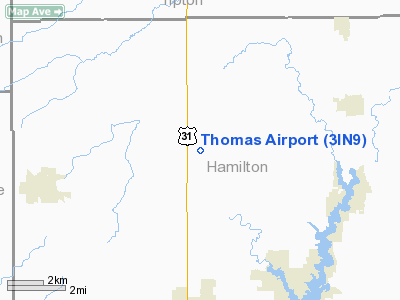
Location & QuickFacts
|
FAA
Information Effective: |
2008-06-05 |
|
Airport
Identifier: |
3IN9 |
| Airport
Status: |
Operational |
|
Longitude/Latitude: |
086-07-09.0000W/40-09-05.0000N
-86.119167/40.151389 (Estimated) |
|
Elevation: |
890
ft / 271.27 m (Estimated) |
|
Land: |
0 acres |
| From
nearest city: |
6
nautical miles NW of Cicero, IN |
|
Location: |
Hamilton County, IN |
|
Magnetic Variation: |
03W
(1995) |
Owner & Manager
|
Ownership: |
Privately
owned |
| Owner: |
Michael
L Thomas |
|
Address: |
2868 E 246 Th St
Cicero,
IN 46034 |
| Phone
number: |
317-773-0384 |
|
Manager: |
Michael L Thomas |
| Address: |
2868
E 246 Th St
Cicero,
IN 46034 |
|
Phone
number: |
317-773-0384 |
Airport
Operations and Facilities
|
Airport
Use: |
Private |
|
Segmented
Circle: |
No |
| Control
Tower: |
No |
|
Sectional
chart: |
Chicago |
| Region: |
AGL
- Great Lakes |
|
Boundary
ARTCC: |
ZAU - Chicago |
| Tie-in
FSS: |
HUF
- Terre Haute |
|
FSS Toll
Free: |
1-800-WX-BRIEF |
|
Runway Information
Runway N/S
|
Dimension: |
2250 x 75 ft
/ 685.8 x 22.9 m |
|
Surface: |
TURF, |
|
|
Runway N |
Runway S |
| Traffic
Pattern: |
Left |
Left |
|
Obstruction: |
|
5 ft fence |
|
Radio Navigation Aids
|
ID |
Type |
Name |
Ch |
Freq |
Var |
Dist |
| UMP |
NDB |
Metropolitan |
|
338.00 |
03W |
13.2
nm |
|
HZP |
NDB |
Zionsville |
|
248.00 |
03W |
14.1 nm |
| FKR |
NDB |
Frankfort |
|
278.00 |
02W |
21.6
nm |
|
AI |
NDB |
Video |
|
371.00 |
03W |
28.4 nm |
| HFY |
NDB |
Greenwood |
|
398.00 |
02W |
31.2
nm |
|
GGP |
NDB |
Logansport |
|
263.00 |
01W |
35.5 nm |
| CFJ |
NDB |
Crawfordsville |
|
388.00 |
02W |
38.0
nm |
|
IWH |
NDB |
Wabash |
|
329.00 |
03W |
39.6 nm |
| UWL |
NDB |
New
Castle |
|
385.00 |
02W |
40.3
nm |
|
TVX |
NDB |
Greencastle |
|
521.00 |
03W |
41.1 nm |
| MCX |
NDB |
White
County |
|
377.00 |
03W |
44.7
nm |
|
MZZ |
VOR/DME |
Marion |
023X |
108.60 |
03W |
28.8 nm |
| MIE |
VOR/DME |
Muncie |
091X |
114.40 |
03W |
33.7
nm |
|
OKK |
VORTAC |
Kokomo |
082X |
113.50 |
00E |
22.8 nm |
| VHP |
VORTAC |
Brickyard |
110X |
116.30 |
01E |
23.2
nm |
|
GUS |
VORTAC |
Grissom |
21Y |
108.45 |
02W |
29.7 nm |
| SHB |
VORTAC |
Shelbyville |
057X |
112.00 |
01E |
34.0
nm |
|
BVT |
VORTAC |
Boiler |
098X |
115.10 |
01E |
49.9 nm |
| IND |
VOT |
Indianapolis
Intl |
|
109.60 |
|
26.8
nm |
Remarks
- PRVDD
CLEAR OBSTACLE FREE ZONE & CLEAR RWY SFC AREA.
Thomas Airport
Address:
Hamilton County, IN
Tel:
317-773-0384
Images
and information placed above are from
http://www.airport-data.com/airport/3IN9/
We
thank them for the data!
| General
Info |
| Country |
United
States |
| State |
INDIANA
|
| FAA ID |
3IN9 |
| Latitude |
40-09-05.000N
|
| Longitude |
086-07-09.000W
|
| Elevation |
890 feet
|
| Near City |
CICERO
|
We don't guarantee the information is fresh and accurate. The data may
be wrong or outdated.
For more up-to-date information please refer to other sources.
|
|


