 |
|
|
|
|
|
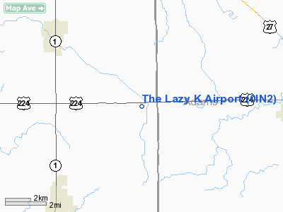
Location & QuickFacts
|
FAA
Information Effective: |
2008-06-05 |
|
Airport
Identifier: |
0IN2 |
| Airport
Status: |
Operational |
|
Longitude/Latitude: |
085-05-09.8890W/40-49-40.1690N
-85.086080/40.827825 (Estimated) |
|
Elevation: |
835
ft / 254.51 m (Estimated) |
|
Land: |
0 acres |
| From
nearest city: |
1
nautical miles E of Tocsin, IN |
|
Location: |
Wells County, IN |
|
Magnetic Variation: |
03W
(1985) |
Owner
& Manager
|
Ownership: |
Privately
owned |
|
Owner: |
Helen
Kunkel |
|
Address: |
3350 E. 200 S.
Bluffton, IN 46714 |
|
Phone number: |
219-597-7345 |
|
Manager: |
Terry Hoffmeier |
|
Address: |
7176
E. Us 224
Craigville, IN 46731 |
Airport Operations and Facilities
|
Airport
Use: |
Private |
| Wind
indicator: |
Yes |
|
Segmented
Circle: |
No |
| Control
Tower: |
No |
|
Lighting
Schedule: |
PHONE REQ
FOR RWY LGTS PHONE 219-597-7345. |
|
Landing fee charge: |
No |
|
Sectional
chart: |
Chicago |
|
Region: |
AGL
- Great Lakes |
|
Boundary
ARTCC: |
ZAU - Chicago |
|
Tie-in FSS: |
HUF
- Terre Haute |
|
FSS on
Airport: |
No |
|
FSS Toll Free: |
1-800-WX-BRIEF |
Airport Communications
Airport Services
|
Fuel
available: |
100 80 |
|
Airframe
Repair: |
MINOR |
|
Power
Plant Repair: |
MINOR |
|
Runway Information
Runway 09/27
|
Dimension: |
2600 x 60 ft
/ 792.5 x 18.3 m |
| Surface: |
TURF,
|
|
|
Runway 09 |
Runway 27 |
|
Traffic Pattern: |
Left |
Left |
|
Runway 18/36
|
Dimension: |
2900 x 60 ft
/ 883.9 x 18.3 m |
|
Surface: |
TURF, |
| Edge
Lights: |
Low |
|
|
Runway 18 |
Runway 36 |
|
Traffic Pattern: |
Left |
Left |
|
Radio Navigation Aids
|
ID |
Type |
Name |
Ch |
Freq |
Var |
Dist |
| HHG |
NDB |
Huntington |
|
417.00 |
03W |
17.3
nm |
|
VFU |
NDB |
Stanley |
|
411.00 |
05W |
21.6 nm |
| PLD |
NDB |
Portland |
|
257.00 |
03W |
23.0
nm |
|
CQA |
NDB |
Lakefield |
|
205.00 |
04W |
31.6 nm |
| IWH |
NDB |
Wabash |
|
329.00 |
03W |
32.6
nm |
|
DFI |
NDB |
Defiance |
|
246.00 |
05W |
42.7 nm |
| VES |
NDB |
Versailles |
|
356.00 |
04W |
45.4
nm |
|
BYN |
NDB |
Bryan |
|
260.00 |
04W |
48.2 nm |
| ANQ |
NDB |
Angola |
|
347.00 |
05W |
48.8
nm |
|
LYL |
NDB |
Lima |
|
362.00 |
04W |
48.9 nm |
| AI |
NDB |
Video |
|
371.00 |
03W |
49.5
nm |
|
OLK |
VOR |
Wolf Lake |
|
110.40 |
03W |
31.3 nm |
| MZZ |
VOR/DME |
Marion |
023X |
108.60 |
03W |
33.7
nm |
|
MIE |
VOR/DME |
Muncie |
091X |
114.40 |
03W |
38.2 nm |
| FWA |
VORTAC |
Fort
Wayne |
125X |
117.80 |
00E |
10.2
nm |
|
OKK |
VORTAC |
Kokomo |
082X |
113.50 |
00E |
47.8 nm |
| GUS |
VORTAC |
Grissom |
21Y |
108.45 |
02W |
49.8
nm |
|
FWA |
VOT |
Fort Wayne Baer |
|
111.00 |
|
10.2 nm |
Remarks
- PARACHUTE
SCHOOL ON FLD. JUMPING DAILY 0700-DUSK.
Based Aircraft
|
Aircraft
based on field: |
10 |
|
Single Engine Airplanes: |
9 |
| Multi
Engine Airplanes: |
1 |
The Lazy K Airport
Address:
Wells County, IN
Tel:
219-597-7345
Images
and information placed above are from
http://www.airport-data.com/airport/0IN2/
We
thank them for the data!
| General
Info |
| Country |
United
States |
| State |
INDIANA
|
| FAA ID |
0IN2 |
| Latitude |
40-49-40.169N
|
| Longitude |
085-05-09.889W
|
| Elevation |
835 feet
|
| Near City |
TOCSIN
|
We don't guarantee the information is fresh and accurate. The data may
be wrong or outdated.
For more up-to-date information please refer to other sources.
|
|


