 |
|
Location & QuickFacts
|
FAA
Information Effective: |
2008-06-05 |
|
Airport
Identifier: |
7IN9 |
| Airport
Status: |
Operational |
|
Longitude/Latitude: |
085-24-38.0000W/40-02-15.0000N
-85.410556/40.037500 (Estimated) |
|
Elevation: |
1070
ft / 326.14 m (Estimated) |
|
Land: |
0 acres |
| From
nearest city: |
10
nautical miles SW of Springport, IN |
|
Location: |
Henry County, IN |
|
Magnetic Variation: |
() |
Owner
& Manager
|
Ownership: |
Privately
owned |
|
Owner: |
Garry
Wilson |
|
Address: |
7406 North 100 West
Springport, IN 47386 |
|
Phone number: |
756-755-3444 |
|
Manager: |
Garry Wilson |
|
Address: |
7406
North 100 West
Springport, IN 47386 |
|
Phone
number: |
756-755-3444 |
Airport Operations and Facilities
|
Airport
Use: |
Private |
|
Segmented
Circle: |
No |
| Control
Tower: |
No |
|
Sectional
chart: |
St Louis |
| Region: |
AGL
- Great Lakes |
|
Boundary
ARTCC: |
ZID - Indianapolis |
| Tie-in
FSS: |
HUF
- Terre Haute |
|
FSS Toll
Free: |
1-800-WX-BRIEF |
|
Runway Information
Runway 18/36
|
Dimension: |
2100 x 75 ft
/ 640.1 x 22.9 m |
|
Surface: |
TURF, |
|
|
Runway 18 |
Runway 36 |
| Traffic
Pattern: |
Left |
Left |
|
Radio Navigation Aids
|
ID |
Type |
Name |
Ch |
Freq |
Var |
Dist |
| AI |
NDB |
Video |
|
371.00 |
03W |
5.0
nm |
|
UWL |
NDB |
New Castle |
|
385.00 |
02W |
10.4 nm |
| UMP |
NDB |
Metropolitan |
|
338.00 |
03W |
30.1
nm |
|
PLD |
NDB |
Portland |
|
257.00 |
03W |
31.8 nm |
| HZP |
NDB |
Zionsville |
|
248.00 |
03W |
39.1
nm |
|
HFY |
NDB |
Greenwood |
|
398.00 |
02W |
39.7 nm |
| HLB |
NDB |
Batesville |
|
254.00 |
02W |
41.9
nm |
|
VES |
NDB |
Versailles |
|
356.00 |
04W |
42.0 nm |
| OXD |
NDB |
Oxford |
|
282.00 |
04W |
43.1
nm |
|
BA |
NDB |
Clifs |
|
410.00 |
03W |
47.0 nm |
| IWH |
NDB |
Wabash |
|
329.00 |
03W |
47.1
nm |
|
CQA |
NDB |
Lakefield |
|
205.00 |
04W |
47.1 nm |
| HHG |
NDB |
Huntington |
|
417.00 |
03W |
49.2
nm |
|
MIE |
VOR/DME |
Muncie |
091X |
114.40 |
03W |
12.0 nm |
| MZZ |
VOR/DME |
Marion |
023X |
108.60 |
03W |
30.0
nm |
|
DQN |
VOR/DME |
Dayton |
092X |
114.50 |
01W |
46.7 nm |
| SHB |
VORTAC |
Shelbyville |
057X |
112.00 |
01E |
30.9
nm |
|
RID |
VORTAC |
Richmond |
043X |
110.60 |
03W |
31.4 nm |
| OKK |
VORTAC |
Kokomo |
082X |
113.50 |
00E |
41.8
nm |
|
VHP |
VORTAC |
Brickyard |
110X |
116.30 |
01E |
46.1 nm |
| GUS |
VORTAC |
Grissom |
21Y |
108.45 |
02W |
49.9
nm |
|
IND |
VOT |
Indianapolis Intl |
|
109.60 |
|
44.4 nm |
Remarks
- 20
FT TREES 230 FT EAST OF RY.
- PRVDD
CLEAR 20:1 APCHS AND CLEAR OBSTACLE FREE ZONE.
Based Aircraft
|
Aircraft
based on field: |
1 |
|
Single Engine Airplanes: |
1 |
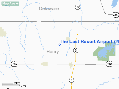
The Last Resort Airport
Address:
Henry County, IN
Tel:
756-755-3444
Images
and information placed above are from
http://www.airport-data.com/airport/7IN9/
We
thank them for the data!
We don't guarantee the information is fresh and accurate. The data may
be wrong or outdated.
For more up-to-date information please refer to other sources.
|
|


