 |
|
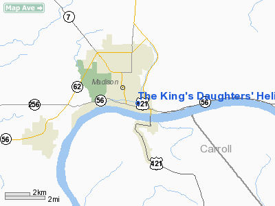
The King's Daughters' Heliport |
|
|
Location & QuickFacts
|
FAA
Information Effective: |
2008-06-05 |
|
Airport
Identifier: |
21II |
| Airport
Status: |
Operational |
|
Longitude/Latitude: |
085-22-53.8470W/38-44-21.2150N
-85.381624/38.739226 (Estimated) |
|
Elevation: |
531
ft / 161.85 m (Surveyed) |
|
Land: |
0 acres |
| From
nearest city: |
0
nautical miles N of Madison, IN |
|
Location: |
Jefferson County, IN |
|
Magnetic Variation: |
02W
(1985) |
Owner & Manager
|
Ownership: |
Privately
owned |
| Owner: |
The
King's Daughters' Hosp |
|
Address: |
One King's Daughters' Dr
Madison, IN 47250 |
| Phone
number: |
812-265-5211 |
|
Manager: |
Michael C. Hanson |
| Address: |
One
Kings Daughters Dr
Madison, IN 47250 |
|
Phone
number: |
812-265-0171 |
Airport
Operations and Facilities
|
Airport
Use: |
Private |
|
Wind indicator: |
Yes |
|
Segmented Circle: |
No |
|
Control
Tower: |
No |
| Lighting
Schedule: |
RDO-CTL
ACTVT ROTG BCN & PERIMETER LGTS - 123.050. |
|
Beacon
Color: |
Clear-Green-Yellow (heliport) |
|
Sectional chart: |
St
Louis |
|
Region: |
AGL - Great Lakes |
|
Boundary ARTCC: |
ZID
- Indianapolis |
|
Tie-in
FSS: |
HUF - Terre Haute |
|
FSS Toll Free: |
1-800-WX-BRIEF |
Airport Communications
|
Runway Information
Helipad H1
|
Dimension: |
30 x 30 ft /
9.1 x 9.1 m |
|
Surface: |
CONC, |
|
|
Runway H1 |
Runway |
| Traffic
Pattern: |
Left |
Left |
|
Radio Navigation Aids
|
ID |
Type |
Name |
Ch |
Freq |
Var |
Dist |
| IMS |
NDB |
Madison |
|
404.00 |
03W |
3.9
nm |
|
OVO |
NDB |
North Vernon |
|
374.00 |
02W |
21.3 nm |
| EQZ |
NDB |
Captain |
|
308.00 |
02W |
28.8
nm |
|
UR |
NDB |
Burln |
|
321.00 |
04W |
33.9 nm |
| HLB |
NDB |
Batesville |
|
254.00 |
02W |
37.2
nm |
|
BA |
NDB |
Clifs |
|
410.00 |
03W |
40.5 nm |
| FEU |
NDB |
Arnold |
|
521.00 |
03W |
41.1
nm |
|
BFR |
NDB |
Bedford |
|
344.00 |
02W |
49.8 nm |
| FFT |
VOR |
Frankfort |
|
109.40 |
03W |
40.2
nm |
|
BQM |
VOR/DME |
Bowman |
059X |
112.20 |
01W |
33.4 nm |
| ABB |
VORTAC |
Nabb |
071X |
112.40 |
01E |
15.0
nm |
|
CVG |
VORTAC |
Cincinnati |
120X |
117.30 |
04W |
35.8 nm |
| IIU |
VORTAC |
Louisville |
095X |
114.80 |
01E |
39.3
nm |
|
SDF |
VOT |
Louisville Standifd |
|
111.00 |
|
37.6 nm |
Remarks
- PRVDD
OPNS ARE CONDUCTED TO/FM 270 DEGS; AREA IS MKD ; UNAUTHORIZED PERSONS
RESTRAINED FM AREA; CERTAIN OBSTRUCTIONS ARE REMOVED & OTHERS MKD.
The King's Daughters' Heliport
Address:
Jefferson County, IN
Tel:
812-265-5211,
812-265-0171
Images
and information placed above are from
http://www.airport-data.com/airport/21II/
We
thank them for the data!
| General
Info |
| Country |
United
States |
| State |
INDIANA
|
| FAA ID |
21II |
| Latitude |
38-44-21.215N
|
| Longitude |
085-22-53.847W
|
| Elevation |
531 feet
|
| Near City |
MADISON
|
We don't guarantee the information is fresh and accurate. The data may
be wrong or outdated.
For more up-to-date information please refer to other sources.
|
|


