 |
|
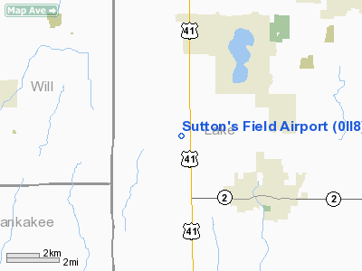
Location & QuickFacts
|
FAA
Information Effective: |
2008-06-05 |
|
Airport
Identifier: |
0II8 |
| Airport
Status: |
Operational |
|
Longitude/Latitude: |
087-28-33.1290W/41-19-29.1260N
-87.475869/41.324757 (Estimated) |
|
Elevation: |
740
ft / 225.55 m (Estimated) |
|
Land: |
5 acres |
| From
nearest city: |
3
nautical miles NW of Lowell, IN |
|
Location: |
Lake County, IN |
|
Magnetic Variation: |
01W
(1990) |
Owner & Manager
|
Ownership: |
Privately
owned |
| Owner: |
Mr.
David E. Sutton |
|
Address: |
12304 W. 165th Ave.
Lowell,
IN 46356 |
| Phone
number: |
219-696-8726 |
|
Manager: |
Mr. David E. Sutton |
| Address: |
12304
W. 165th Ave.
Lowell,
IN 46356 |
|
Phone
number: |
219-696-8726 |
Airport
Operations and Facilities
|
Airport
Use: |
Private |
|
Wind indicator: |
Yes |
|
Segmented Circle: |
No |
|
Control
Tower: |
No |
|
Sectional chart: |
Chicago |
|
Region: |
AGL - Great Lakes |
| Boundary
ARTCC: |
ZAU
- Chicago |
|
Tie-in FSS: |
HUF - Terre Haute |
| FSS
on Airport: |
No |
|
FSS Toll
Free: |
1-800-WX-BRIEF |
|
Runway Information
Runway 01/19
|
Dimension: |
1400 x 100 ft
/ 426.7 x 30.5 m |
|
Surface: |
TURF, Good Condition |
|
|
Runway 01 |
Runway 19 |
| Traffic
Pattern: |
Left |
Left |
|
Obstruction: |
110 ft pline, 2390.0 ft from runway |
|
|
Radio Navigation Aids
|
ID |
Type |
Name |
Ch |
Freq |
Var |
Dist |
| RZL |
NDB |
Rensselaer |
|
362.00 |
02W |
26.3
nm |
|
MX |
NDB |
Kedzi |
|
248.00 |
01W |
26.8 nm |
| VP |
NDB |
Sedly |
|
212.00 |
02W |
28.0
nm |
|
HK |
NDB |
Ermin |
|
332.00 |
01W |
28.7 nm |
| IUL |
NDB |
La
Porte |
|
356.00 |
03W |
33.4
nm |
|
MGC |
NDB |
Michigan City |
|
203.00 |
01W |
37.5 nm |
| RWN |
NDB |
Winamac/dcmsnd |
|
335.00 |
00W |
41.8
nm |
|
ME |
NDB |
Deana |
|
350.00 |
00E |
45.9 nm |
| MCX |
NDB |
White
County |
|
377.00 |
03W |
49.1
nm |
|
CPB |
NDB |
Culver |
|
391.00 |
01W |
49.7 nm |
| IKK |
VOR/DME |
Kankakee |
053X |
111.60 |
00E |
22.6
nm |
|
OXI |
VOR/DME |
Knox |
103X |
115.60 |
00E |
37.3 nm |
| ORD |
VOR/DME |
Chicago
O'hare |
086X |
113.90 |
02E |
44.3
nm |
|
CGT |
VORTAC |
Chicago Heights |
089X |
114.20 |
02E |
11.9 nm |
| EON |
VORTAC |
Peotone |
079X |
113.20 |
02E |
14.6
nm |
|
JOT |
VORTAC |
Joliet |
070X |
112.30 |
02E |
40.2 nm |
| BVT |
VORTAC |
Boiler |
098X |
115.10 |
01E |
49.8
nm |
|
MDW |
VOT |
Chicago Midway |
|
111.00 |
|
30.4 nm |
| ORD |
VOT |
Chicago
O'hare Intl |
|
112.00 |
|
44.0
nm |
Remarks
- PROVIDING
OBSTRUCTIONS IN RY APCH SLOPE REMOVED/LOWERED TO PROVIDE MINIMUM 20:1
APCH CLNC OVER OBSTRUCTIONS; 125' EITHER SIDE OF RY CNTRLN CLEAR OF
ALL OBSTRUCTIONS.
Based Aircraft
|
Aircraft
based on field: |
2 |
|
Single Engine Airplanes: |
1 |
| Multi
Engine Airplanes: |
1 |
Sutton's Field Airport
Address:
Lake County, IN
Tel:
219-696-8726
Images
and information placed above are from
http://www.airport-data.com/airport/0II8/
We
thank them for the data!
| General
Info |
| Country |
United
States |
| State |
INDIANA
|
| FAA ID |
0II8 |
| Latitude |
41-19-29.126N
|
| Longitude |
087-28-33.129W
|
| Elevation |
740 feet
|
| Near City |
LOWELL
|
We don't guarantee the information is fresh and accurate. The data may
be wrong or outdated.
For more up-to-date information please refer to other sources.
|
|


